August 31, 2017
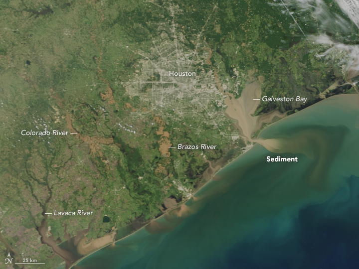
On August 31, 2017, the Moderate Resolution Imaging Spectroradiometer (MODIS) on NASA’s Terra satellite captured this image of the Texas coast and the Houston metropolitan area. Note the brown rivers and bays, full of flood water from Hurricane Harvey. Along the coast, muddy, sediment-laden waters from inland pour into a Gulf of Mexico that also was churned up by the relentless storm.
NASA Earth Observatory image by Jesse Allen, using data from the Land Atmosphere Near real-time Capability for EOS (LANCE). Caption by Michael Carlowicz.
Rivers and bays are loaded with sediment and mud following the catastrophic storm.
Land Water Severe Storms Human Presence
Tropical Storm Harvey rapidly intensified into a category four hurricane in the Gulf of Mexico in August 2017. It made landfall in Texas and dumped record-setting amounts of rain for six days, leading to devastating floods.
Terra gives a broad view of the scale of the devastating flooding.
This photo-like image of the Texas and Louisiana coasts shows the impact of Hurricane Ike’s powerful storm surge on coastal wetlands. Hurricane Ike came ashore bringing with it a wall of water that stretched from Galveston, Texas, across all of coastal Louisiana.