The Earth Observatory has published its last Image of the Day on this website. Please join us on our new home at science.nasa.gov/earth/earth-observatory.
When the hot, humid air from a jet engine mixes with colder, drier air in the surrounding environment, condensation trails, or “contrails,” streak the sky. If the air through which the airplane is flying is already close to being saturated with water vapor, the condensation trail will last longer than it will if the air is dry. A contrail that lingers can spread out into a layer of cirrus (thin, wispy clouds).
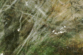
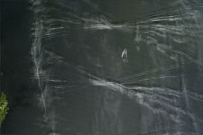
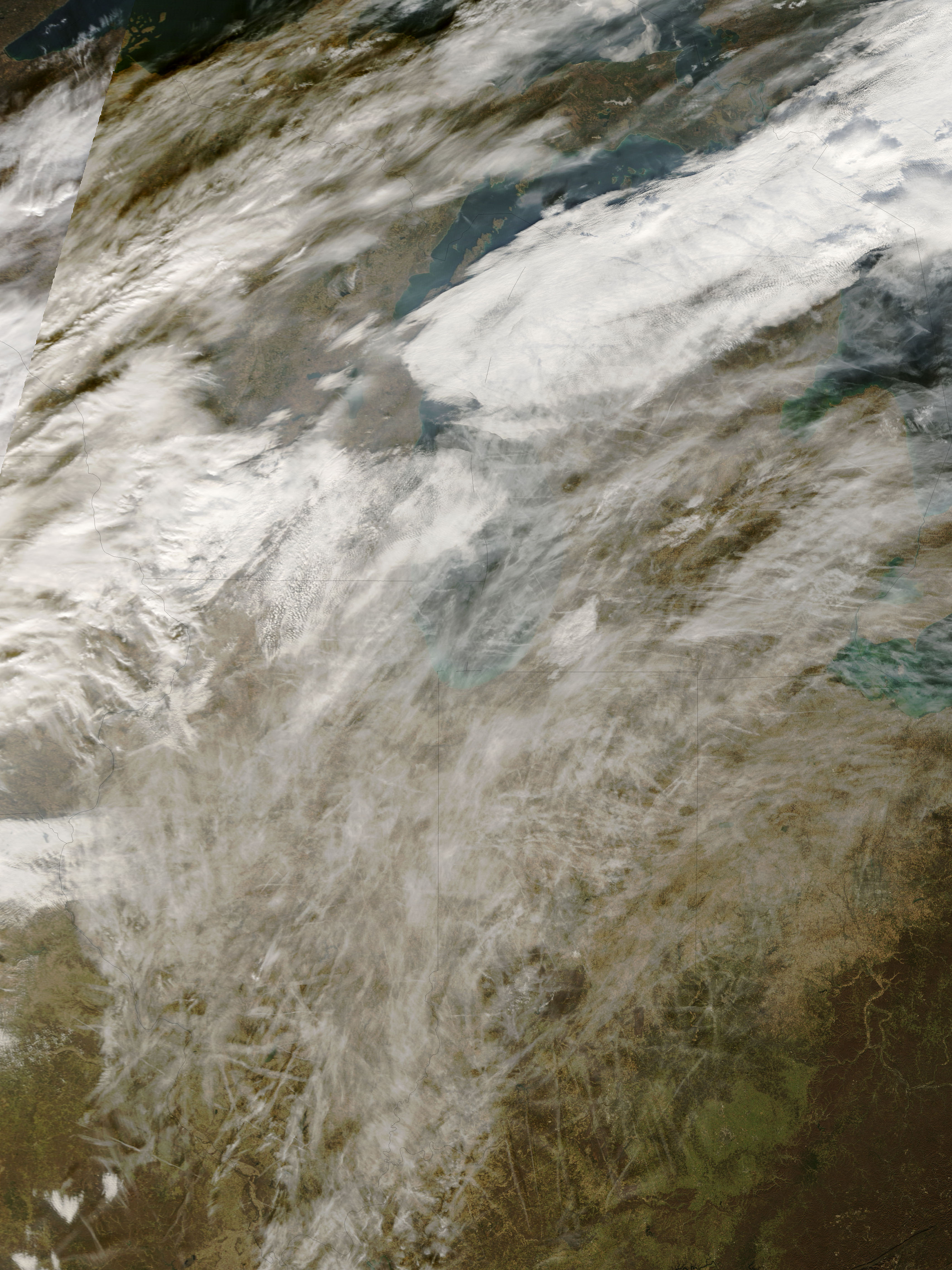
When this image from the Moderate Resolution Imaging Spectroradiometer (MODIS) on NASA’s Terra satellite was captured on November 25, 2006, scores of contrails streaked the sky over the Midwest, including western Kentucky, Ohio, Indiana, Illinois, Michigan, and Missouri. The mingled contrails create a thick cloud over the top part of the scene (though not all the clouds in the region are necessarily contrails), while to the south, more distinct individual tracks are visible.
They might seem to be too transient to have a significant effect on the atmosphere, but, in fact, contrails can influence the climate by increasing the cloud cover in heavy air-traffic regions. Clouds can have contradictory influences on the climate, depending on their extent, thickness, and altitude, among many factors. Clouds can cool the climate by blocking incoming sunlight, and they can also warm the climate by absorbing energy radiated from the Earth’s surface. Thin cirrus clouds have more of a warming influence; their thinness makes them not very good at intercepting incoming solar radiation, but they do absorb outgoing radiation that would otherwise escape to space.
In 2004, NASA scientists discovered that contrail-generated cirrus clouds could be responsible for much of the warming of surface temperatures over the United States from 1975-1994. The streaky clouds were not found to be the culprit in other parts of the globe where temperatures also warmed. The scientists said that the discrepancy indicates that warming from contrails is in addition to warming produced by increasing concentrations of greenhouse gases.
The high-resolution image provided above has a spatial resolution of 250 meters per pixel. The MODIS Rapid Response System provides daily images of the region in additional resolutions and formats.
NASA image courtesy the MODIS Rapid Response Team, Goddard Space Flight Center