The Earth Observatory has published its last Image of the Day on this website. Please join us on our new home at science.nasa.gov/earth/earth-observatory.
September heralds a shift away from the warm, lazy days of summer to the cooler, shorter days of autumn in the Northern Hemisphere. It is the time that kids return to school and adults get back to work. For polar scientists, it is time to pack for a new research season in the south. In Antarctica, September marks the return of the Sun for longer and longer periods each day, allowing the Moderate Resolution Imaging Spectroradiometer (MODIS) to get its first peek at the frozen continent in visible light (as opposed to only infrared) after the darkness of winter.
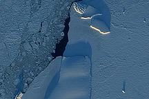
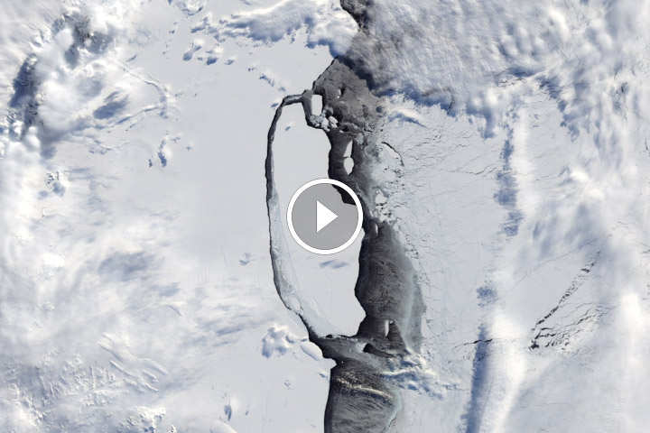
When the light broke over Antarctica in 2004, it revealed four massive icebergs blockading McMurdo Sound. The icebergs posed a significant challenge to those charged with charting a course through the sound to McMurdo Station, the U.S. research hub in Antarctica. Sitting along the shore of McMurdo Sound, the station’s supplies come from ships that have cut a long path through the sea ice.
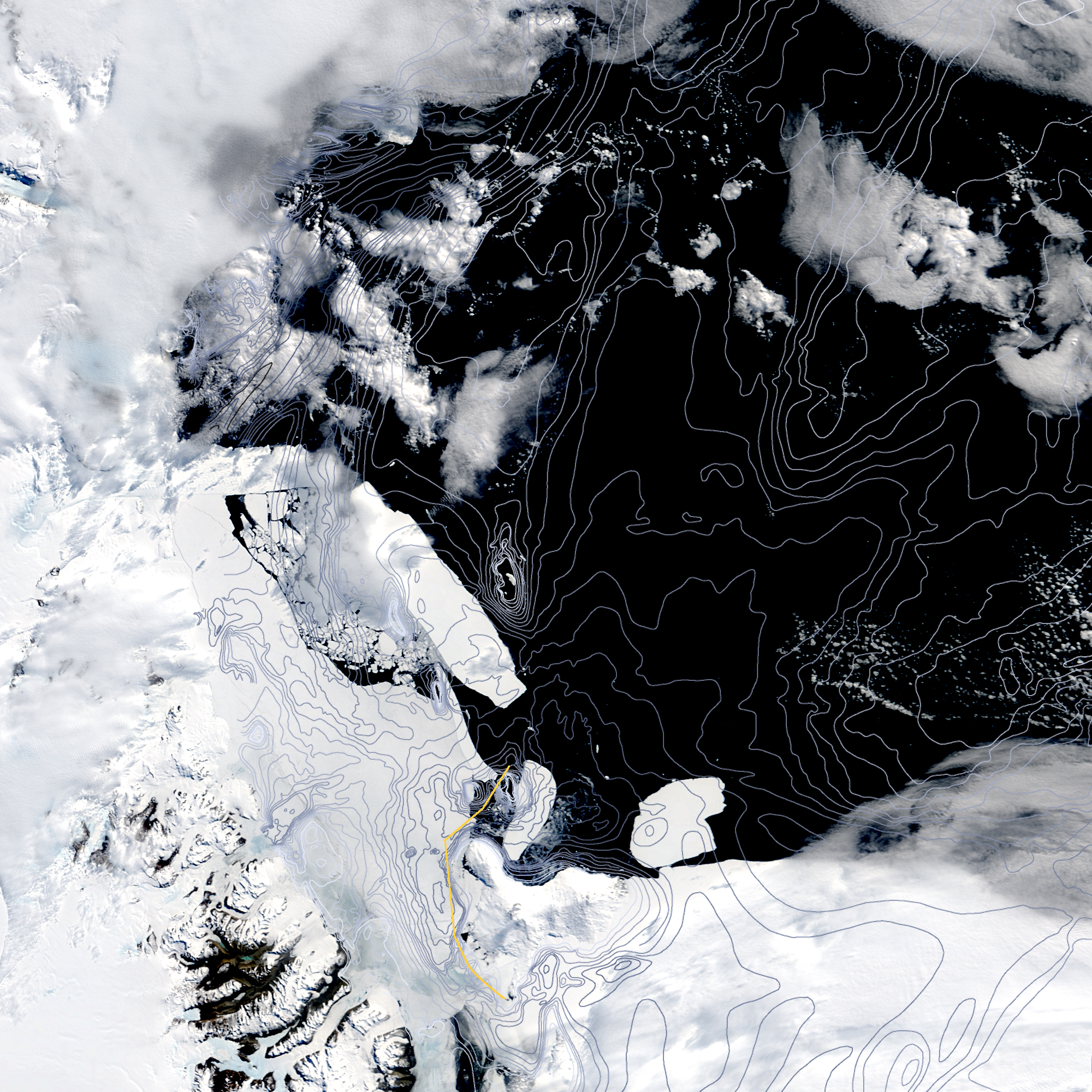
Faced with the worry that the icebergs might shift and close off the shipping channel, planners from the U.S. Antarctic Program watched the icebergs closely using daily satellite imagery provided by the MODIS Rapid Response Team at NASA Goddard Space Flight Center. They placed bathymetry data over the images to outline the contours of the sea floor around the C-16 and B-15K icebergs, the two bergs closest to the shipping channel. Since the icebergs were most likely to move along the deep channels, the bathymetry helped planners predict where the icebergs might drift and where it would be safest to cut the shipping channel through the ice.
The image shown here was taken on January 27, 2005. Daily imagery of McMurdo Sound, including the latest imagery from September 2005, are available from the MODIS Rapid Response Team. As the light begins to reveal conditions in September 2005, the images show that the largest of the icebergs has shifted away from the sound. This should make planning an easier task for the 2005-2006 season.
To read more about the use of MODIS imagery to supply U.S. research stations in Antarctica, see “Operation Antarctica” on the Earth Observatory.
Image by Jesse Allen, Earth Observatory, based on data from Jeff Schmaltz (MODIS Rapid Response Team), Jessica Walker (Raytheon Polar Services) and Fred Davey (Institute of Geophysical & Nuclear Sciences Ltd).