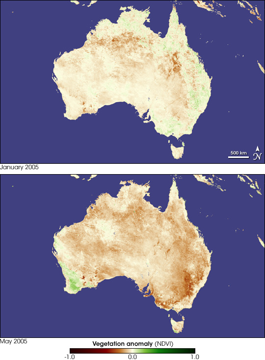
Widespread drought is settling over Australia as the country moves into its winter months. The drought is an extension of the drought that started in 2002 and is being called the third worst in Australia's history. The lack of rain delayed planting early in the season, and that has led the Australian Bureau of Agriculture and Resource Economics (ABARE) to predict a 17 percent drop in winter crop production if rain doesn't fall soon. In New South Wales, in the southeast corner of the country, production may fall by as much as 55 percent, says ABARE.
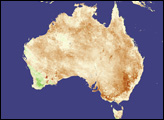
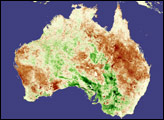
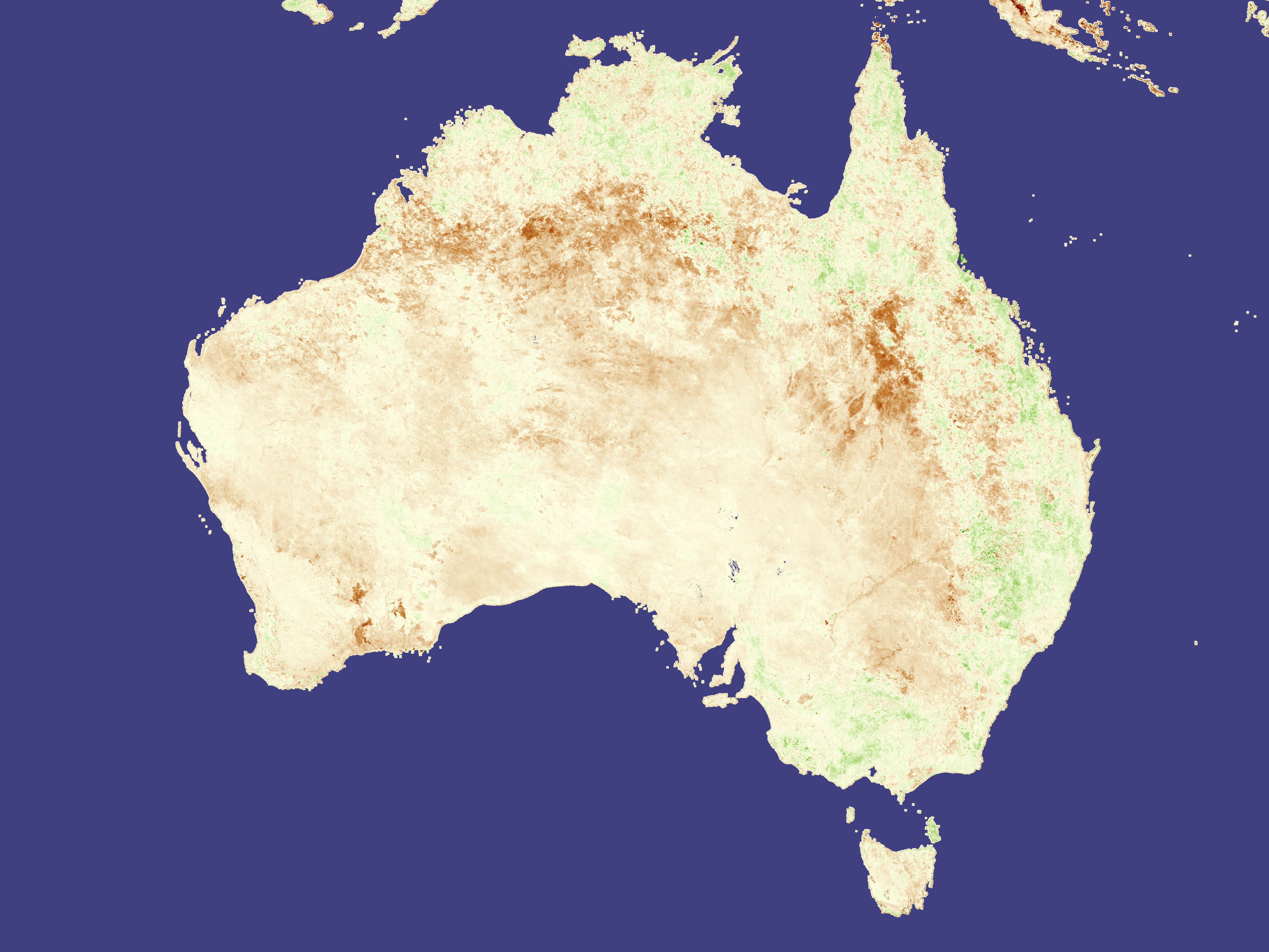
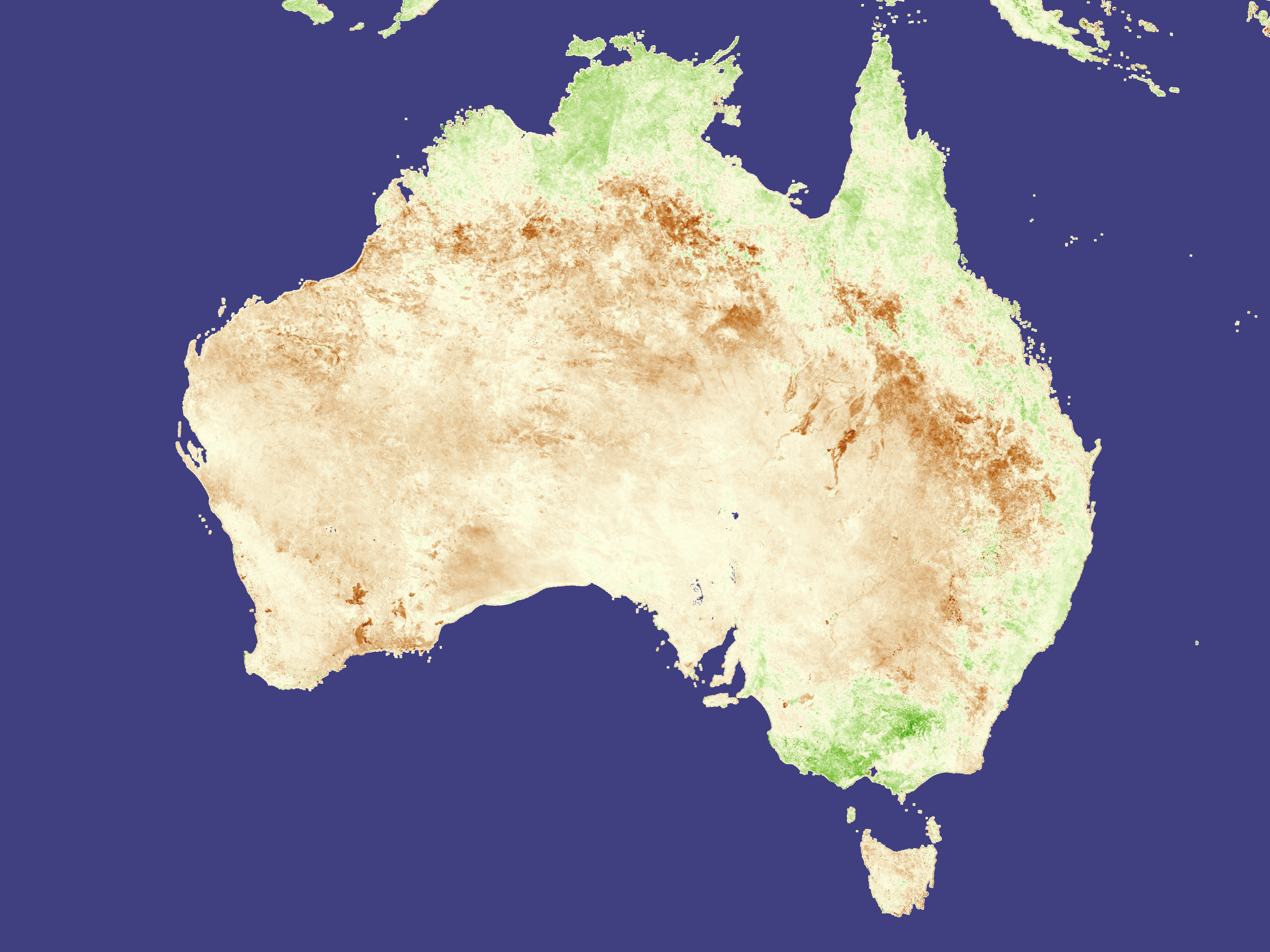
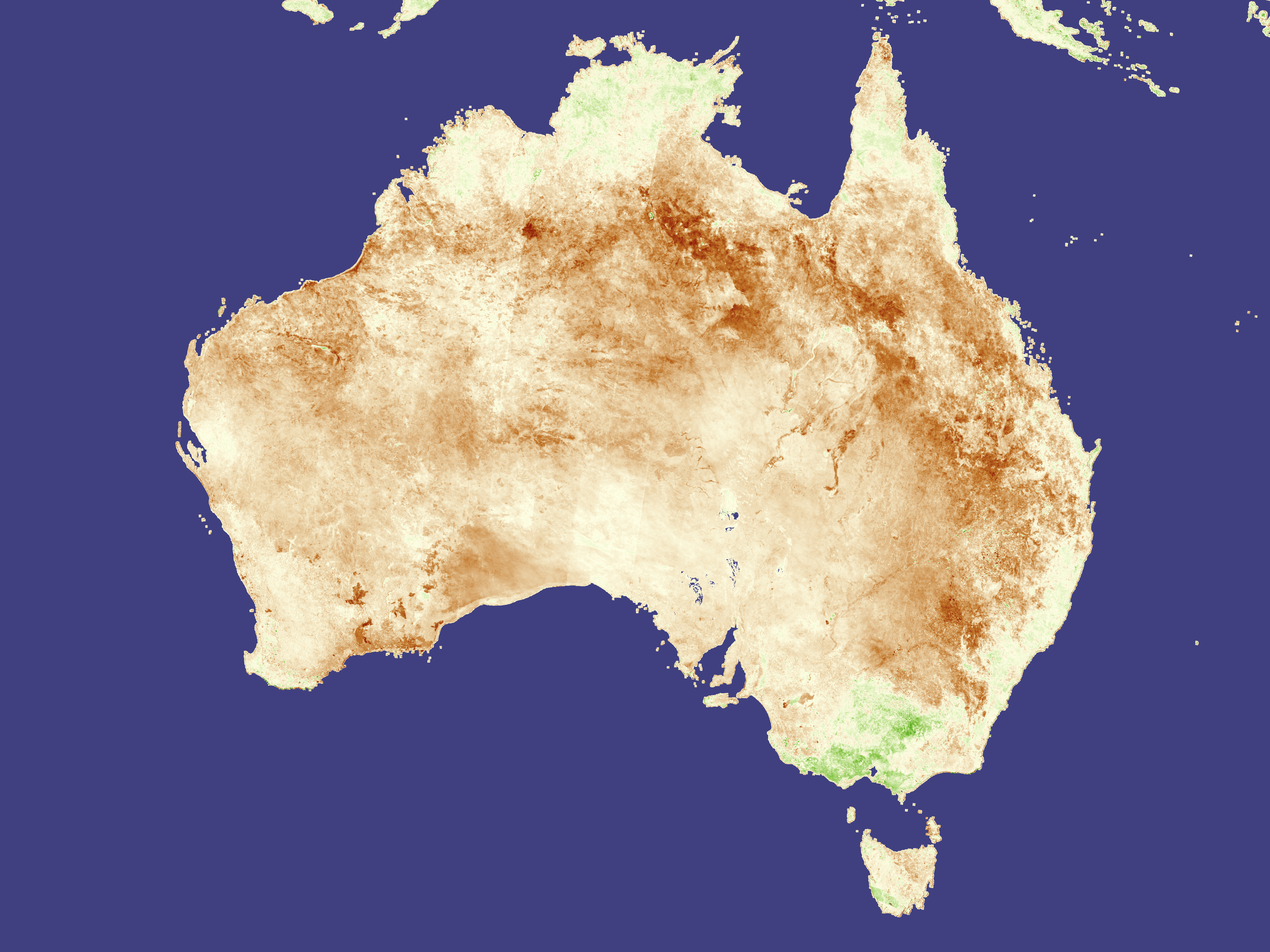
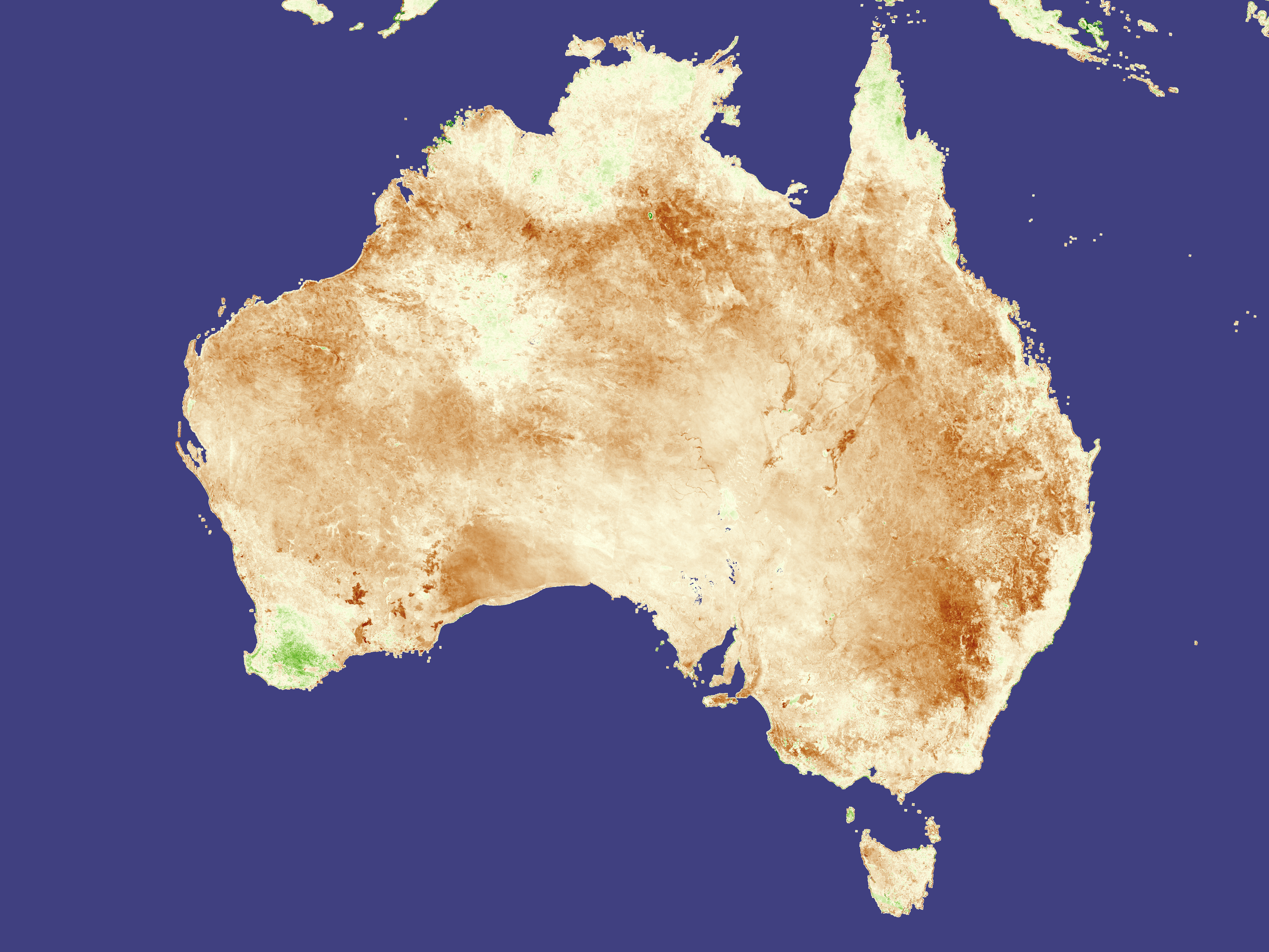
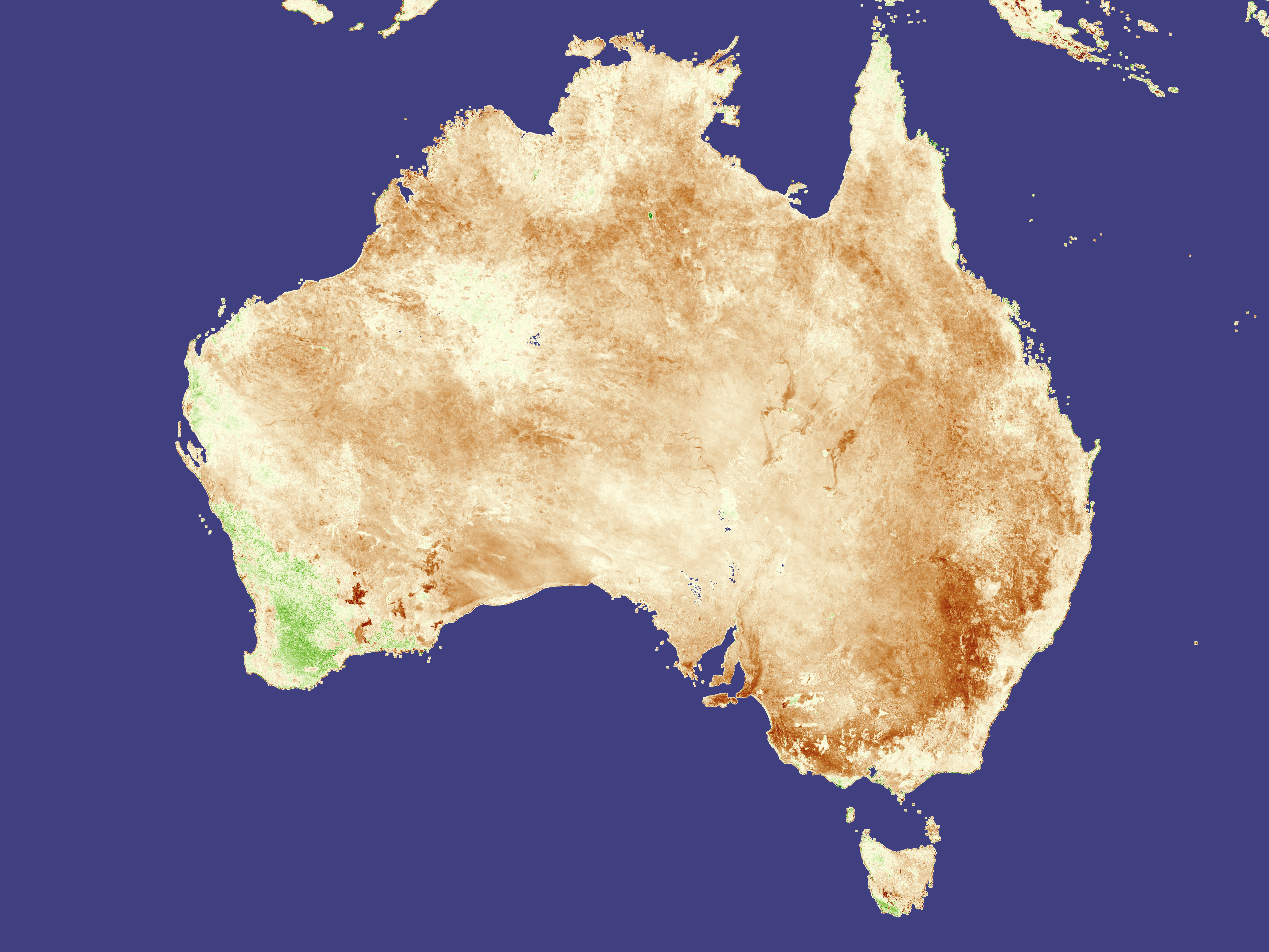
The impact of the long drought on vegetation is clearly visible in these vegetation anomaly images. Where vegetation, both crops and native plants, is less dense than average, the images are brown. Regions that are more densely vegetated than average are green. Between January, top, and May, bottom, vegetation has become progressively drier than average as drought has spread across the country. The animation above shows the drought's development over the five-month period.
Covered with a streak of dark brown, the southeast corner of the country is most severely affected in the lower image. Most of this land falls in New South Wales, where as much as 91 percent of the state is drought declared. The patch of green in the southwest corner of the country is in Western Australia, where ABARE reports crops are off to a good start.
These images are a composite of data collected by the SPOT Vegetation satellite and were generated at NASA Goddard Space Flight Center by the GIMMS Group under analysis agreement with the USDA Foreign Agricultural Service.
NASA images created by Jesse Allen, Earth Observatory, using data obtained courtesy of USDA FAS and processed by Jennifer Small and Assaf Anyamba, NASA GIMMS Group at Goddard Space Flight Center.


