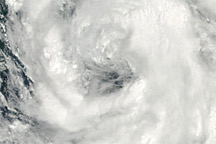
As of 15:00 UTC on August 8, 2011 (midnight on August 9 in Seoul), Muifa had made landfall over North Korea. The Navy’s Joint Typhoon Warning Center (JTWC) reported that Muifa was located about 190 nautical miles (350 kilometers) north-northwest of Seoul, South Korea.
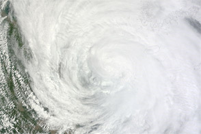
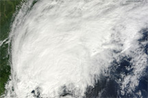
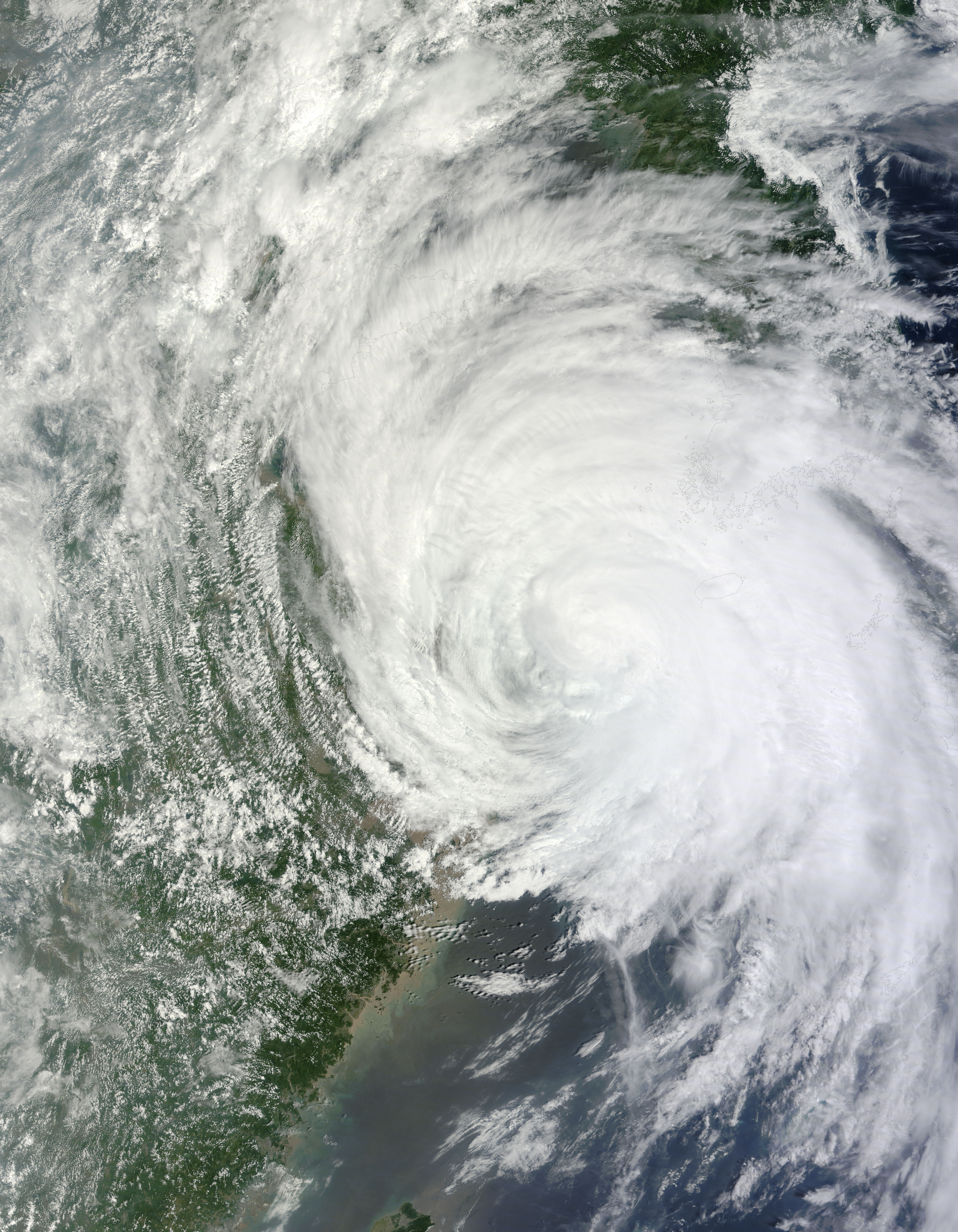
The Moderate Resolution Imaging Spectroradiometer (MODIS) on NASA’s Terra satellite captured this natural-color image of Tropical Storm Muifa at 2:50 UTC (11:50 in Seoul) on August 7, 2011. Muifa’s clouds stretch from the eastern coast of China past the southern tip of the Korean Peninsula. The storm lacks a distinct eye, but retains the spiral shape characteristic of strong storms.
On August 7, the JTWC reported that Muifa had maximum sustained winds of 55 knots (100 kilometers per hour) with gusts up to 70 knots (130 kilometers per hour). At that time, the storm was centered roughly 230 nautical miles (425 kilometers) southwest of Seoul. The following day, after Muifa had moved northwest of the city and made landfall over North Korea, wind speeds had dropped, to 40 knots (75 kilometers per hour) with higher gusts. The storm was expected to dissipate over the next two days.
Despite lower wind speeds, Muifa caused significant damage in South Korea, hurting crops, and temporarily knocking out power to tens of thousands of residents, Korea JoongAng Daily reported. The storm was blamed for three deaths and one missing person. Meanwhile, Xinhuanet reported, Chinese authorities evacuated more than 360,000 residents in Shandong Province ahead of Muifa’s expected landfall.
NASA image courtesy Jeff Schmaltz, MODIS Rapid Response Team at NASA GSFC. Caption by Michon Scott.