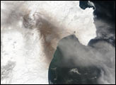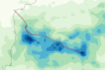
Cyclone 01S hovered just off the west coast of India this past week slowly drifting parallel to the coastline without coming ashore. It began as a weak depression that formed on the 4th of May 2004 about 200 km east of the southwest coast of India in the Laccadive Sea. The system strengthened into a tropical storm the next day on the 5th with winds estimated at 35 knots (40 mph) by the Joint Typhoon Warning Center. On the 7th and 8th, the stormed reached its peak intensity of just 45 knots (52 mph) before weakening back into a depression on the 10th. The storm was responsible for 5 deaths in India from heavy rains.
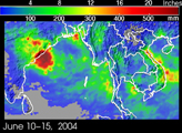
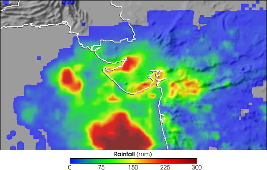
The Tropical Rainfall Measuring Mission TRMM-based, near-real time Multi-satellite Precipitation Analysis (MPA) at the NASA Goddard Space Flight Center monitors rainfall over the global tropics. The last image gives MPA rainfall totals for the period 3-11 May 2004 associated with the passage of the cyclone. The highest amounts on the order of 300 mm (12 inches) fell over water (dark red areas). However, some coastal areas in the state of Gujarat did receive up to 225 mm (9 inches) locally (red areas) with several areas receiving between 75 and 150 mm (3 and 6 inches) (green areas).
Image produced by Hal Pierce (SSAI/NASA GSFC) and caption by Steve Lang (SSAI/NASA GSFC).