The Earth Observatory has published its last Image of the Day on this website. Please join us on our new home at science.nasa.gov/earth/earth-observatory.
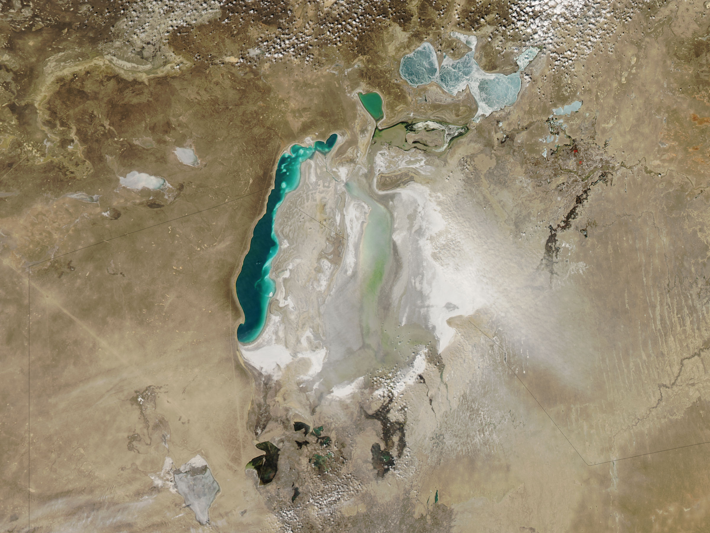
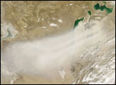
Dust plumes rose from desiccated lakebed sediments of the Aral Sea in late March 2010. The Moderate Resolution Imaging Spectroradiometer (MODIS) on NASA’s Aqua satellite captured this true-color image on March 26, 2010. A pale beige plume of dust blows from the sediments of the South Aral Sea toward the southeast, along the Kazakhstan-Uzbekistan border. Northeast of the plume, two red outlines indicate hotspots associated with fires.
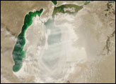
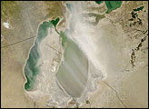
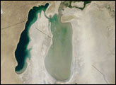
Once counted among the world’s largest inland lakes, the Aral Sea shrank dramatically in the second half of the twentieth century after the Soviet Union tapped the rivers feeding the sea for irrigation projects. The Aral Sea’s decline continued in the twenty-first century. As water levels fell, the sea separated into the North Aral Sea and the South Aral Sea, and the southern portion further divided into eastern and western lobes.
A dam helped restore the North Aral Sea, but the same project led to continued decline of the South Aral Sea. (The mottled appearance of the North Aral Sea in this image probably results from a coating of lingering winter ice.) By the time MODIS observed this dust storm, the eastern lobe of the Southern Aral Sea had all but disappeared.
The retreat of this water body left behind large expanses of dry lakebed sediments prone to forming dust plumes. In addition, local sediments had become a repository for salt, fertilizers, and pesticides frequently used in irrigated farming. The increased frequency of dust storms combined with the chemicals contained in the lakebed sediments have raised concerns about the impact of Aral Sea dust storms on human health in the region.
NASA image by Jeff Schmaltz, MODIS Rapid Response Team at NASA GSFC. Caption by Michon Scott.