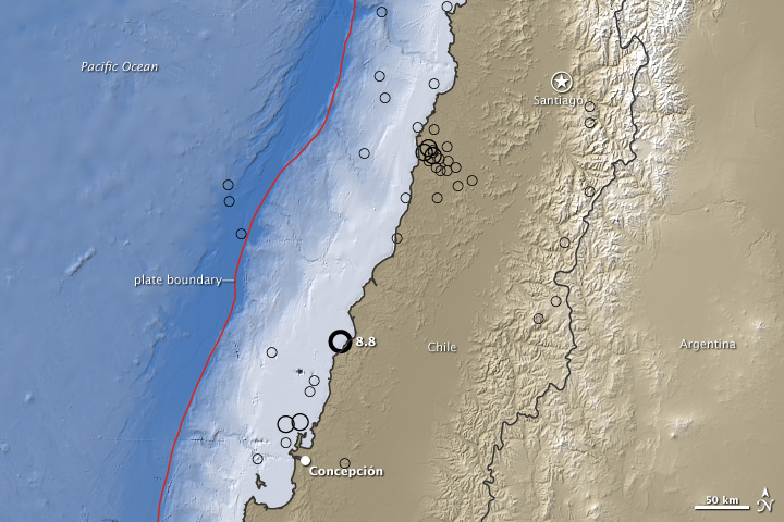


In the weeks following the 8.8-magnitude earthquake that struck Chile on February 27, several aftershocks large enough to qualify as significant quakes rattled the country. A 6.9-magnitude quake on March 11 produced a small tsunami that reached Valparaíso, about 100 kilometers northwest of Santiago. According to the U.S. Geological Survey, the large aftershocks almost certainly occurred in response to tensions being redistributed to different parts of the fault following the February 27 quake.
This map of topography and water depth along the Chilean coast includes black circles that indicate quakes with a magnitude of 5.0 or larger that occurred between March 5 and 12, 2010. (The epicenter of the 8.8-magnitude quake is shown for reference.) Lighter colors indicate higher elevation on land and shallower depth in the water. The boundary where the Nazca and South America Plates converge is marked by a red line. The topography is based on radar data collected during the Shuttle Radar Topography Mission, which flew onboard Space Shuttle Endeavour in mid-February 2002.
NASA Earth Observatory image created by Jesse Allen, using earthquake and plate tectonics data from the USGS Earthquake Hazard Program, elevation data from the Shuttle Radar Topography Mission (SRTM) provided by the University of Maryland’s Global Land Cover Facility, and ocean bathymetry data from the British Oceanographic Data Center’s Global Bathmetric Chart of the Oceans (GEBCO). Caption by Rebecca Lindsey.