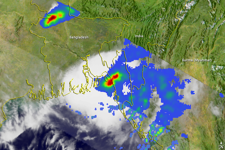


Tropical Cyclone Bijli came ashore over eastern Bangladesh on April 17, 2009. The storm caused little damage, according to news reports, but did dump heavy rain on Bangladesh and neighboring Burma (Myanmar). This image, made with data captured by the Tropical Rainfall Measuring Mission (TRMM) satellite on April 17, shows the rainfall associated with the storm.
As much as 50 millimeters of rain fell per hour in the regions where rainfall was heaviest, shown in red. Outside the area of concentrated heavy rain, the rainfall was relatively light, as shown by the wide field of blue. The measurements shown in this image are from a variety of sensors on the TRMM satellite. Rain rates in the center of the swath (lighter area) are from the TRMM Precipitation Radar, the first precipitation radar in space, and those in the outer part of the swath are from the TRMM Microwave Imager. The rain rates were overlaid on infrared data from the TRMM Visible Infrared Scanner.
Designed to measure rainfall from space, the Tropical Rainfall Measuring Mission satellite has been in service for over 11 years and continues to provide valuable images and information on tropical cyclones around the tropics using a combination of passive microwave and active radar sensors.
Image produced by Hal Pierce (SSAI/NASA GSFC). Caption by Holli Riebeek.