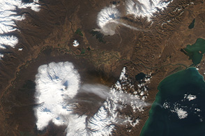
At the northwestern margin of the Pacific Ocean, the tectonic plate underlying the ocean is slowly grinding beneath the leading edge of the tectonic plate bearing the Asian continent. The tremendous heat and pressure of this slow-motion collision melts rock far below the surface. The magma fuels more than a dozen active volcanoes on Russia’s Kamchatka Peninsula.
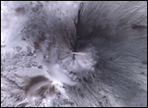
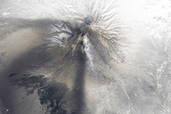
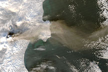
This image from the Advanced Spaceborne Thermal Emission and Reflection Radiometer (ASTER) on NASA’s Terra satellite shows an eruption of one of the Kamchatka volcanoes, Klyuchevskaya, on December 8, 2008. The image is made from near-infrared, red, and green light reflected by the surface and detected by ASTER.
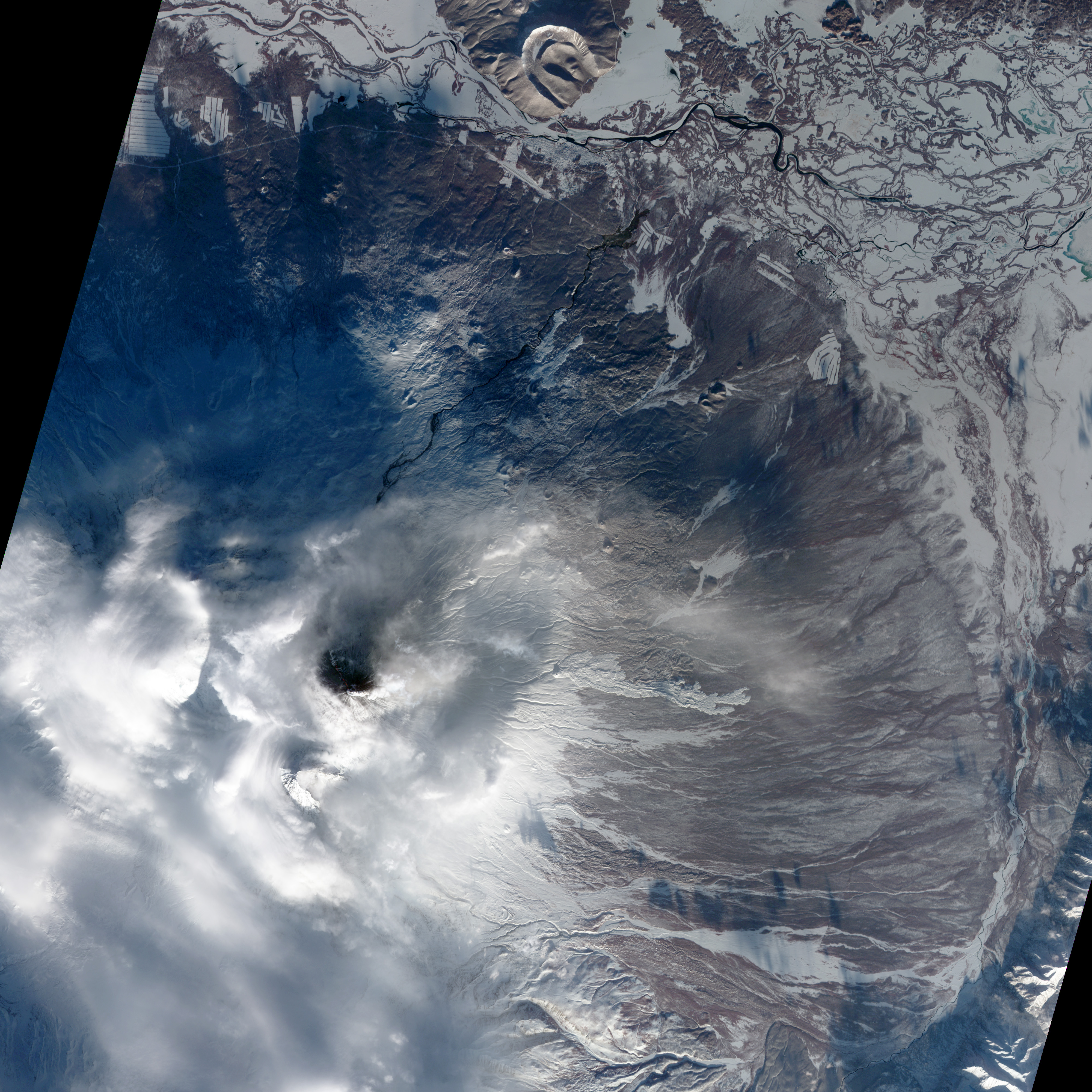
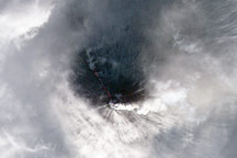
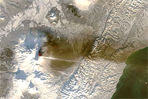
Clouds fringe the snow-covered mountain, but an opening at the summit reveals a ribbon of lava flowing down the northwestern flank. A white plume trailing to the east is probably steam, perhaps mixed with ash. The dark color of the summit may mean that snow has been blanketed with rock fragments, ash, and other volcanic debris, or that heat from the eruption has melted the snow. (The MODIS sensor on the Terra satellite captured a wider-area view of the plume the next day.)
Although the Kamchatka Peninsula is not populated, eruptions there generate hazardous volcanic ash plumes that spread into the heavily traveled airspace of the Northern Pacific. Because of the potential hazard they pose to airplanes, even remote volcanoes such as those on Kamchatka need to be monitored.
According to volcanologist Michael Ramsay of the Department of Geology and Planetary Sciences at the University of Pittsburgh, satellites are an integral part of volcano monitoring systems. Weather satellites make observations as frequently as every 15-30 minutes, but they don’t see a lot of detail at the surface. They may detect nothing more than one or two hot pixels in a large image. Scientists follow up on the “thermal alert” with a view from a higher-resolution sensor like ASTER, which makes repeat observations of an area less frequently than a weather satellite, but sees greater detail at the surface.
To hear Michael Ramsay explain more about how satellites are used for monitoring volcanoes, you can listen to a Clear Voices for Science podcast produced for the radio program “EarthSky.”
NASA image created by Jesse Allen, using data provided courtesy of NASA/GSFC/METI/ERSDAC/JAROS, and U.S./Japan ASTER Science Team. Caption by Rebecca Lindsey.
The Klyuchevskaya Volcano on Russia’s Kamchatka Peninsula released a plume of ash in early December 2008.
alert message