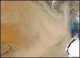
browse image of orbit 17489
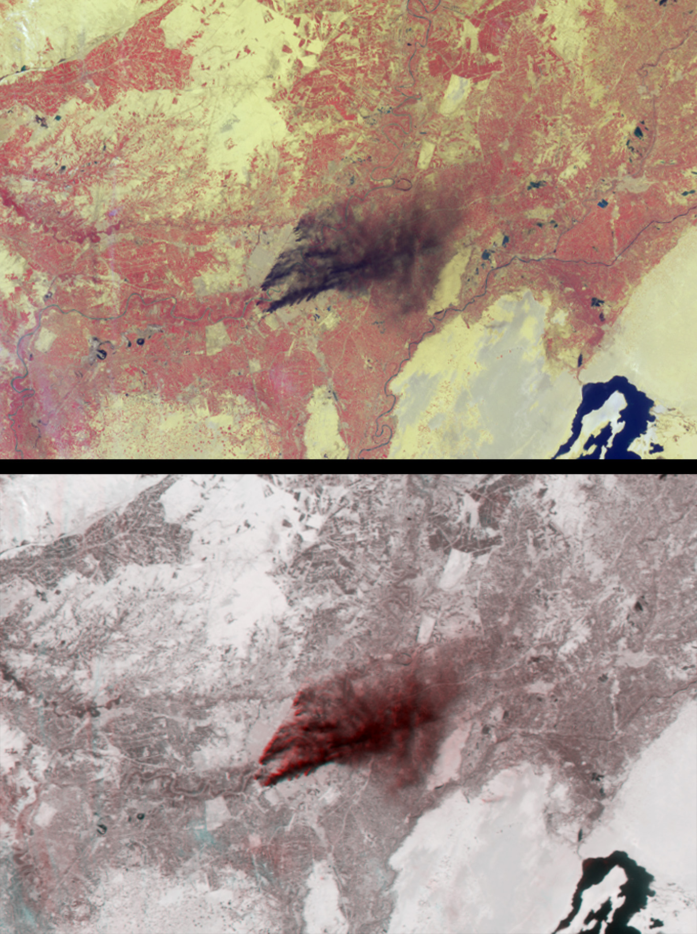
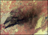
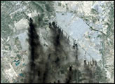
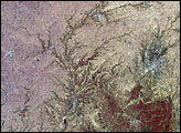
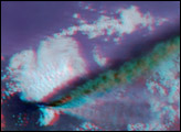
Dark smoke from oil fires extend for about 60 kilometers south of Iraq’s capital city of Baghdad in these images acquired by the Multi-angle Imaging SpectroRadiometer (MISR) on April 2, 2003. The thick, almost black smoke is apparent near image center and contains chemical and particulate components hazardous to human health and the environment.
The top panel is from MISR’s vertical-viewing (nadir) camera. Vegetated areas appear red here because this display is constructed using near-infrared, red and blue band data, displayed as red, green and blue, respectively, to produce a false-color image. The bottom panel is a combination of two camera views of the same area and is a 3-D stereo anaglyph in which red band nadir camera data are displayed as red, and red band data from the 60-degree backward-viewing camera are displayed as green and blue. Both panels are oriented with north to the left in order to facilitate stereo viewing. Viewing the 3-D anaglyph with red/blue glasses (with the red filter placed over the left eye and the blue filter over the right) makes it possible to see the rising smoke against the surface terrain. This technique helps to distinguish features in the atmosphere from those on the surface. In addition to the smoke, several high, thin cirrus clouds (barely visible in the nadir view) are readily observed using the stereo image.
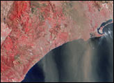
The Multi-angle Imaging SpectroRadiometer observes the daylit Earth continuously and every 9 days views the entire globe between 82 degrees north and 82 degrees south latitude. The MISR Browse Image Viewer provides access to low-resolution true-color versions of these images. These data products were generated from a portion of the imagery acquired during Terra orbit 17489. The panels cover an area of about 187 kilometers x 123 kilometers.
Image courtesy NASA/GSFC/LaRC/JPL, MISR Team. Text by Clare Averill (Acro Service Corporation/JPL)


