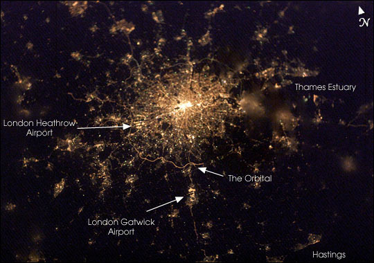


This nighttime view of the British capital offers unique insight into the city’s urban density and infrastructure as highlighted by electrical lighting. Interpreting the brightest areas as the most populated, the population density drops off rapidly from the bright urban center until it reaches the vicinity of the Orbital, an encircling roadway. Beyond lie isolated bright areas marking the numerous smaller cities and towns of the region and as far southeast as Hastings on the coast. Note London’s two major airports, Heathrow and Gatwick, and the particularly bright, sinuous stretch of the Orbital to the south of the city.
The crew of the International Space Station acquired this image shortly after 7:22 p.m. local time on the evening of February 4, 2003. Either thin, low clouds or perhaps fog is evident in the fuzzy character of patterns for some of the surrounding smaller cities while that of the warmer urban center is still clear and sharp.
Astronaut photograph ISS006-E-22939 was taken with digital camera and is provided by the Earth Sciences and Image Analysis Laboratory at Johnson Space Center. Higher resolution images and other views taken by astronauts and cosmonauts can be viewed at the NASA-JSC Gateway to Astronaut Photography of Earth.