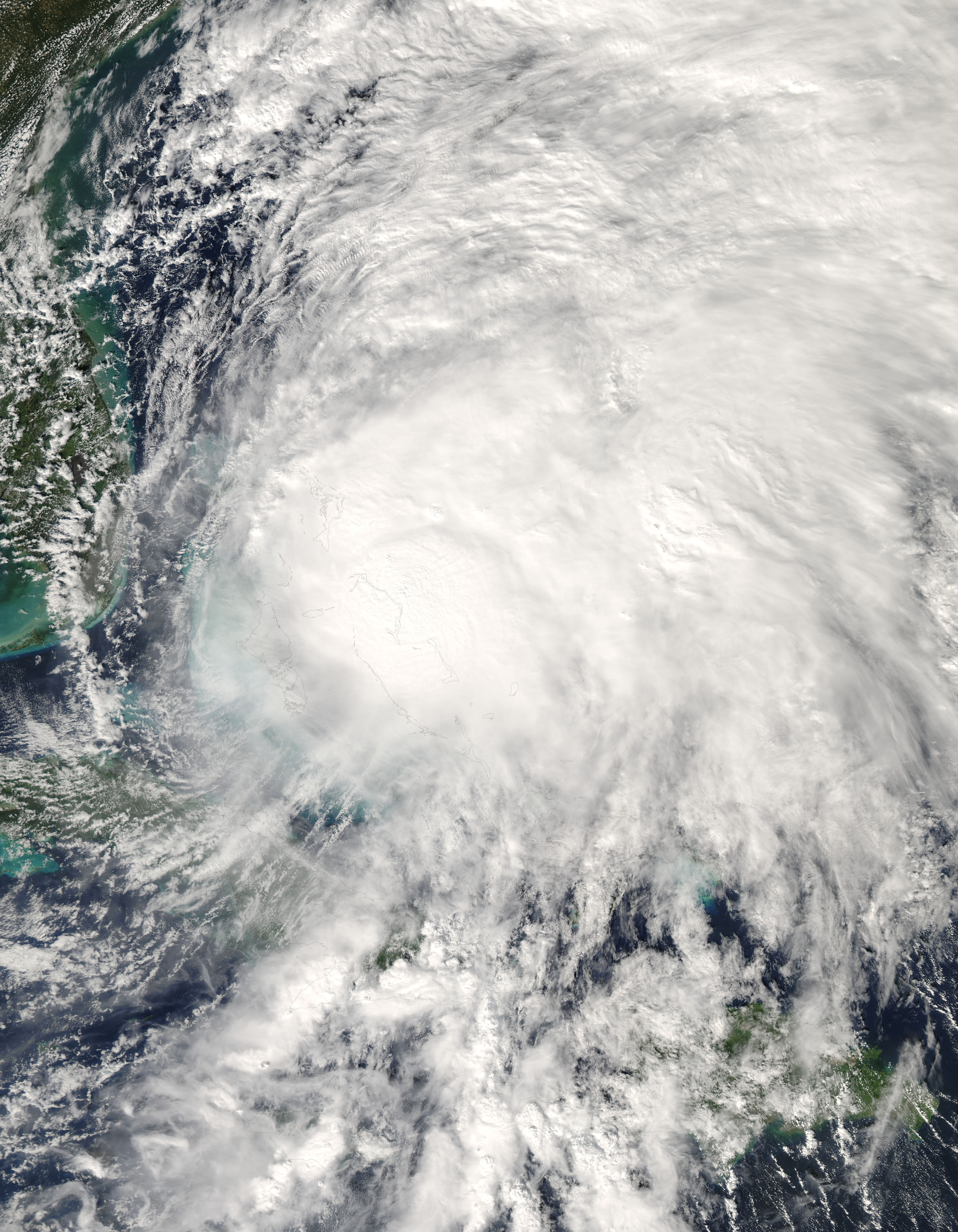
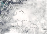
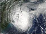
The Moderate Resolution Imaging Spectroradiometer (MODIS) on NASA’s Aqua satellite captured this photo-like image of Tropical Storm Noel as the storm passed over the Bahamas Islands on November 1, 2007, at 2:15 p.m., local time. At that time, Noel had sustained winds of 95 kilometers per hour (65 miles per hour) and was moving northeast at 23 km/hr (14 mph), said the National Hurricane Center. The storm later intensified into a Category 1 hurricane and tracked north along the east coast of the United States.
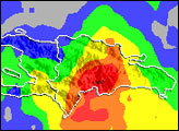
Noel spreads messily across hundreds of kilometers in this image. The center of the storm, a tightly concentrated mass of clouds, sits nearly directly over the Bahamas, while clusters of thunderstorms stretch north and east from the center. In its rampage across the Caribbean, Noel caused at least 115 deaths, primarily in the Dominican Republic and Haiti, reported the Associated Press on November 2. Though the storm was relatively weak, it moved slowly over the two nations, dumping as much as 550 millimeters (21 inches) of rain. (View a satellite-based rainfall map.) The heavy rain caused deadly flooding and mudslides.
The large image provided above is at MODIS’ maximum resolution of 250 meters per pixel. The image is available in additional resolutions from the MODIS Rapid Response System.
Image courtesy Jeff Schmaltz, MODIS Rapid Response Team at NASA GSFC


