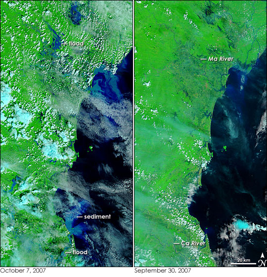
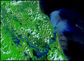
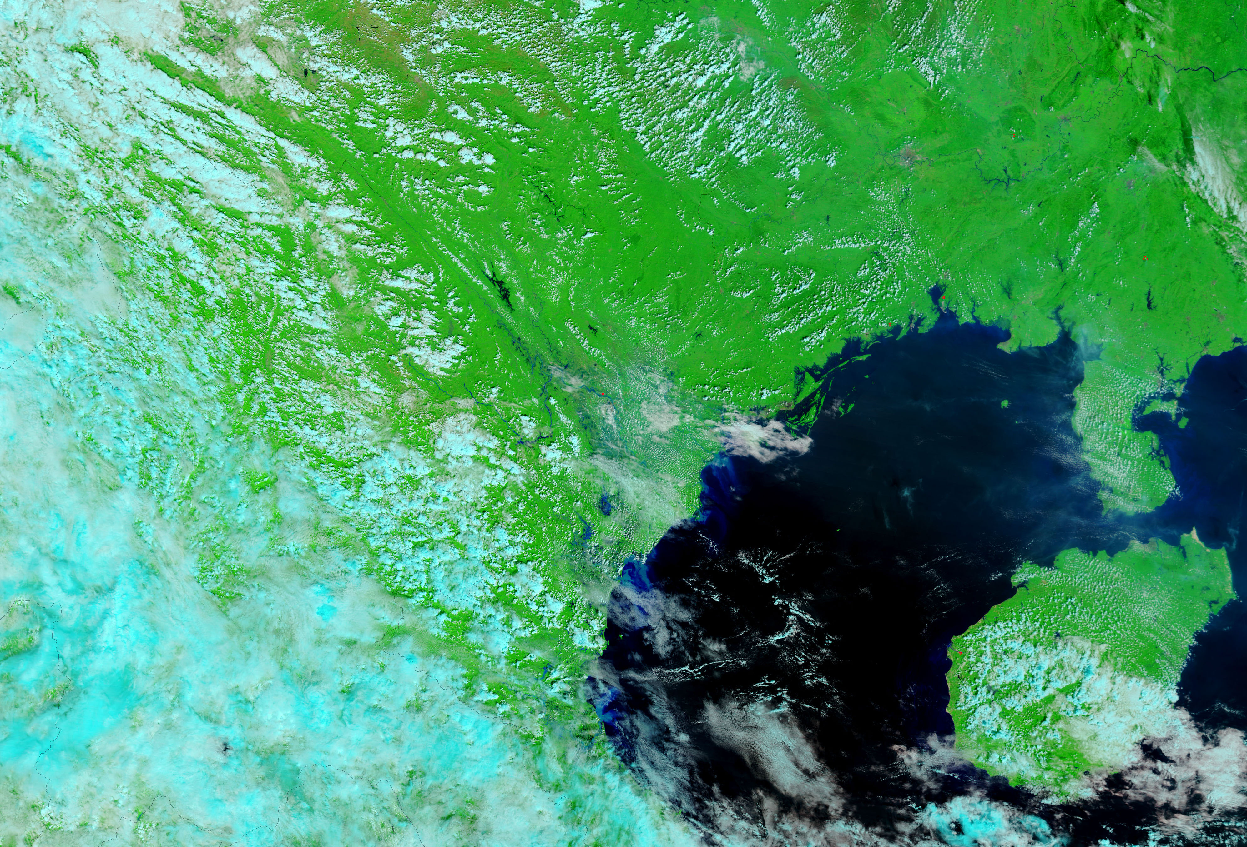
Typhoon Lekima unleashed heavy rains on central and northern Vietnam when the storm came ashore on October 3, 2007. The resulting floods and landslides killed at least 77 people and caused more than $130 million in damage, reported Reuters on October 8. These images show coastal northern Vietnam near the Ma and Ca Rivers, where flooding was most severe. The Moderate Resolution Imaging Spectroradiometer (MODIS) on NASA’s Terra satellite captured the left image on October 7, five days after the storm initially came ashore. The right image was taken on September 30, a few days before Lekima struck.
Though scattered clouds (light blue and white in this type of image) obscure the view of the ground, extensive flooding is still visible around the two rivers in the October 7 image. Both images were made with infrared and visible light in a combination that highlights the presence of water on the ground. Water is typically black in these images, but dirt in the water scatters light, turning the water blue. In the lower half of the left image, the Ca River is swollen and pale blue. The overflowing river is sweeping mud from the surrounding landscape. Some of the mud may also be from run-off and landslides. A burst of bright blue blooms from the river’s mouth where the mud-laden water enters the southern Gulf of Tonkin. A second, much larger plume is coming from the area around the mouth of the Ma River towards to the top of the image. In this case, the floods are not confined to the river itself, but appear to be spread across the land around the river. Spots of pale blue beyond the river channel may be either sediment-filled water or water-soaked earth.
Though the floods themselves are slightly harder to see, the photo-like version of the image shows how much mud the floods are depositing in the Gulf of Tonkin. Daily images of northern Vietnam are available from the MODIS Rapid Response System in both false color, as shown here, and photo-like true color.
NASA images courtesy the MODIS Rapid Response Team at NASA GSFC.


