large images:
Shaded Relief (4.9 MB JPEG)
Anaglyph (830 KB JPEG)
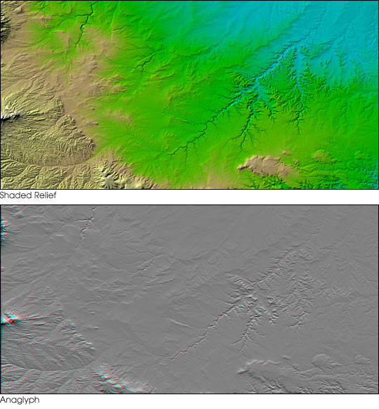
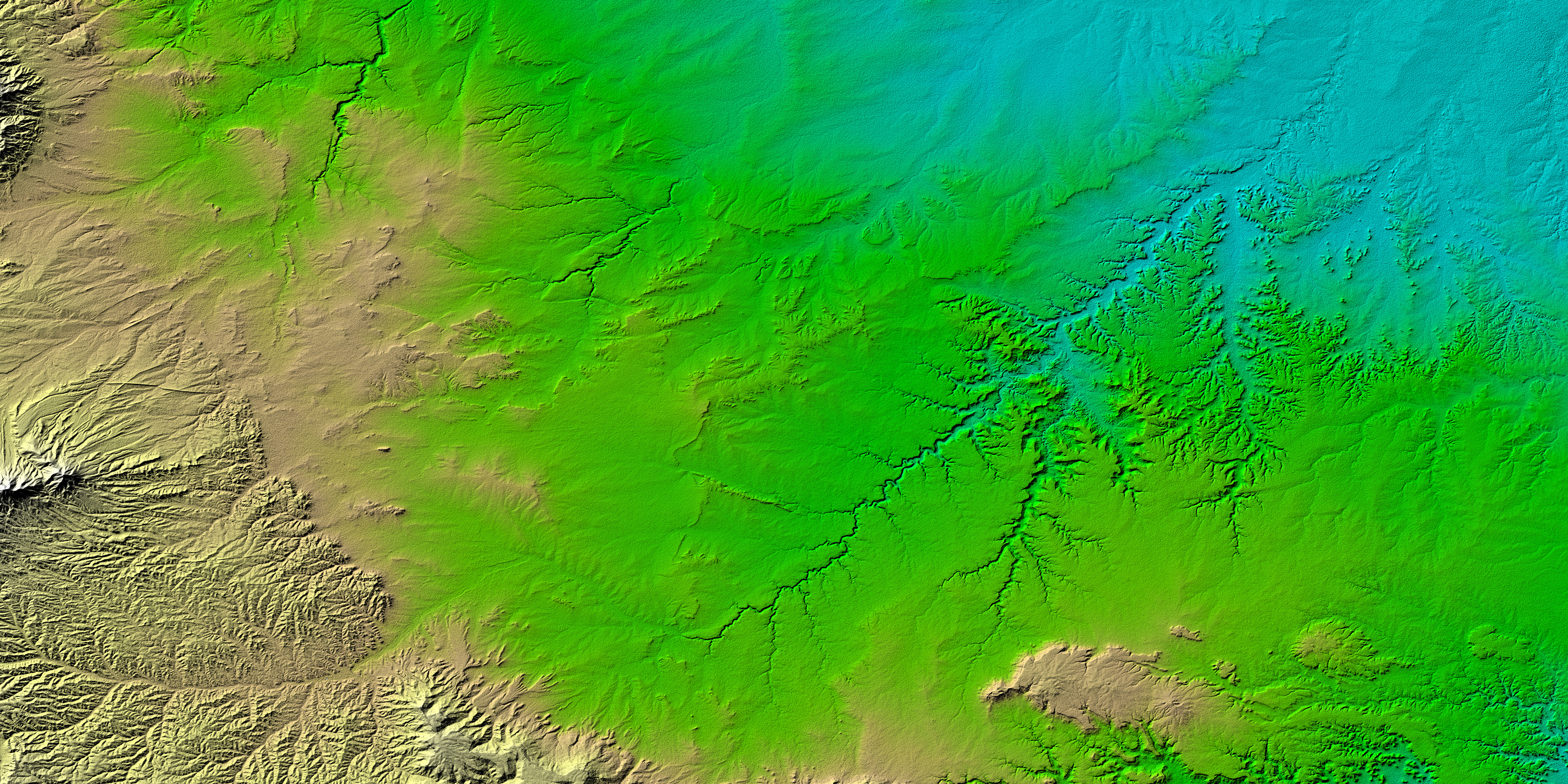
Erosional features are prominent in this view of southern Colorado taken by the Shuttle Radar Topography Mission (SRTM). The area covers about 20,000 square kilometers and is located about 50 kilometers south of Pueblo, Colorado. The prominent mountains near the left edge of the image are the Spanish Peaks, remnants of a 20-million-year-old volcano. Rising 2,100 meters (7,000 feet) above the plains to the east, these igneous rock formations with intrusions of eroded sedimentary rock historically served as guiding landmarks for travelers on the Mountain Branch of the Santa Fe Trail.
Near the center of the image is the Piñon Canyon Maneuver Site, a training area for soldiers of the U.S. Army from nearby Fort Carson. The site supports a diverse ecosystem with large numbers of big and small game, fisheries, non-game wildlife, forest, rangeland, and mineral resources. It is bounded on the east by the dramatic topography of the Purgatoire River Canyon, a 100-meter (328-foot) deep scenic red canyon with flowing streams, sandstone formations, and exposed geologic processes.
Two visualization methods were combined to produce the top image: shading and color coding of topographic height. The shade image was derived by computing topographic slope in the northwest-southeast direction. Southern slopes appear bright and northern slopes appear dark. Color coding is directly related to topographic height, with blue and green at the lower elevations, rising through yellow and brown to white at the highest elevations.
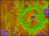
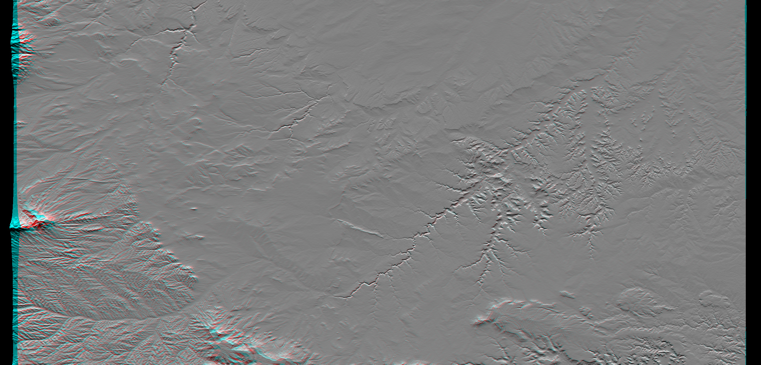
The anaglyph (bottom) was produced by first shading a preliminary SRTM elevation model. The stereoscopic effect was then created by generating two differing perspectives, one for each eye. When viewed through special glasses, the result is a vertically exaggerated view of the Earth’s surface in its full three dimensions. Anaglyph glasses cover the left eye with a red filter and cover the right eye with a blue filter.
Size: 177.8 x 111.3 kilometers ( 110.5 x 69.2 miles)
Location: 37.5 deg. North lat., 104 deg. West lon.
Orientation: North toward the top
Image Data: Shaded and colored SRTM elevation model
Original Data Resolution: SRTM 1 arcsecond (30 meters or 99 feet)
Date Acquired: February 2000
Image courtesy SRTM Team at the NASA Jet Propulsion Laboratory, the National Imagery and Mapping Agency (NIMA), and the German and Italian space agencies


