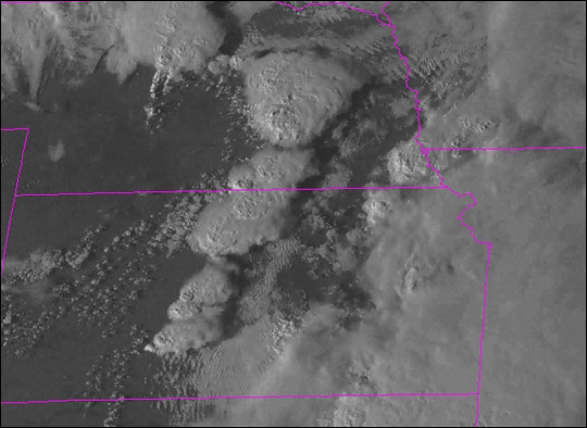


GOES-12 Animation (2.7 MB)
On October 9, 2001, the Storm Prediction Center issued a "Moderate Risk" warning for severe storms to occur over portions of the Central and Southern Great Plains region of the United States. This warning prompted Colorado State University's Cooperative Institute for Research in the Atmosphere (CIRA) to initiate super rapid scan operations of the GOES-12 satellite to collect images over the region at 1-minute intervals. Residents of Oklahoma, Nebraska and Kansas didn't know it at the time, but they would be hit by a series of tornadoes sweeping through portions of those states later that day.
The National Weather Service received 23 reported tornado sightings for the region. This animation, produced from GOES-12 data, shows a series of storm cells as they formed and moved northward. Initially, there was a strong flow of upper air currents from west central Texas toward Oklahoma. However, there was also a wind minimum over Nebraska moving slowing eastward, and there was a low-pressure system in southwestern Nebraska. A dryline (a sharp boundary line of dry air) extended southward from the low-pressure system into west Texas. Storm cells formed along the dryline and quickly became severe in Oklahoma.
Thankfully, no fatalities were reported in the wake of the storms. There were some injuries reported and at least 150 homes were destroyed. For more images and more details on this storm, visit the CIRA/NOAA Web site.
Image courtesy CIRA/NOAA