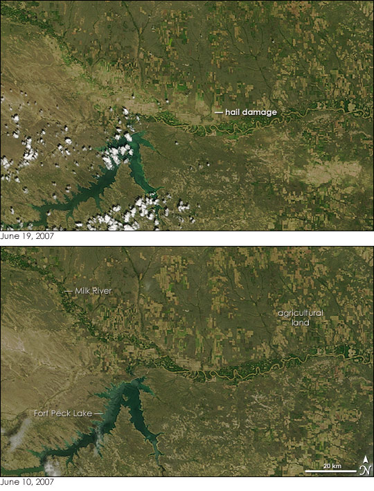
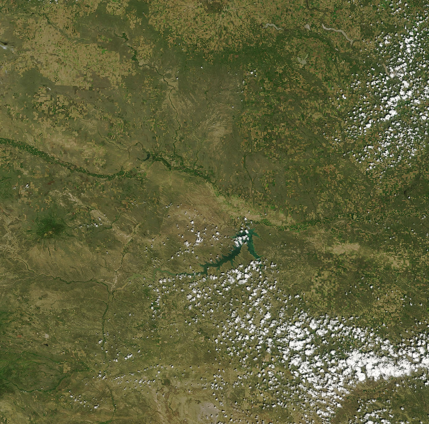
On June 16, 2007, an intense thunderstorm rolled across the eastern plains of Montana. The storm pelted the region with hailstones up to eight centimeters (three inches) in diameter. The Moderate Resolution Imaging Spectroradiometer (MODIS) on NASA’s Terra satellite captured the top image on June 19, three days after the storm passed. The storm’s path is evident in the image. The hail stripped leaves off plants, turning the dark green checkerboard farms, pale green natural vegetation, and bright green riverside plants into a strip of tan earth that runs diagonally across the image. The damage is most evident north of Fort Peck Lake, where the hail destroyed the bright green vegetation that lined the Milk River.
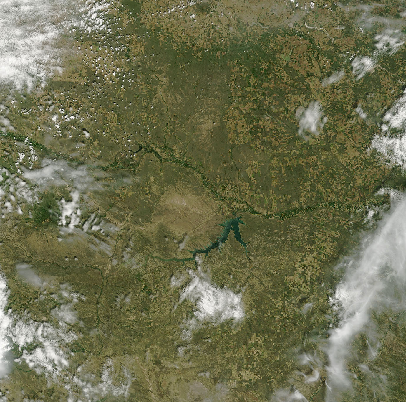
As the tan and green squares show, this is farm country. The storm ruined wheat and alfalfa crops, said the Warning Coordination Meteorologist at the National Weather Service forecast office in Glasgow, Montana, a small city along the Milk in the upper left corner of the image. The lower image, taken by Terra MODIS on June 10, shows vegetation conditions before the storm struck.
NASA image courtesy Liam Gumley, Space Science and Engineering Center at the University of Wisconsin-Madison, using data provided by NASA Goddard Space Flight Center. Caption information courtesy Liam Gumley and the National Weather Service forecast office in Glasgow, Montana.
alert message


