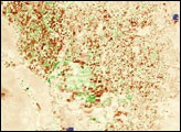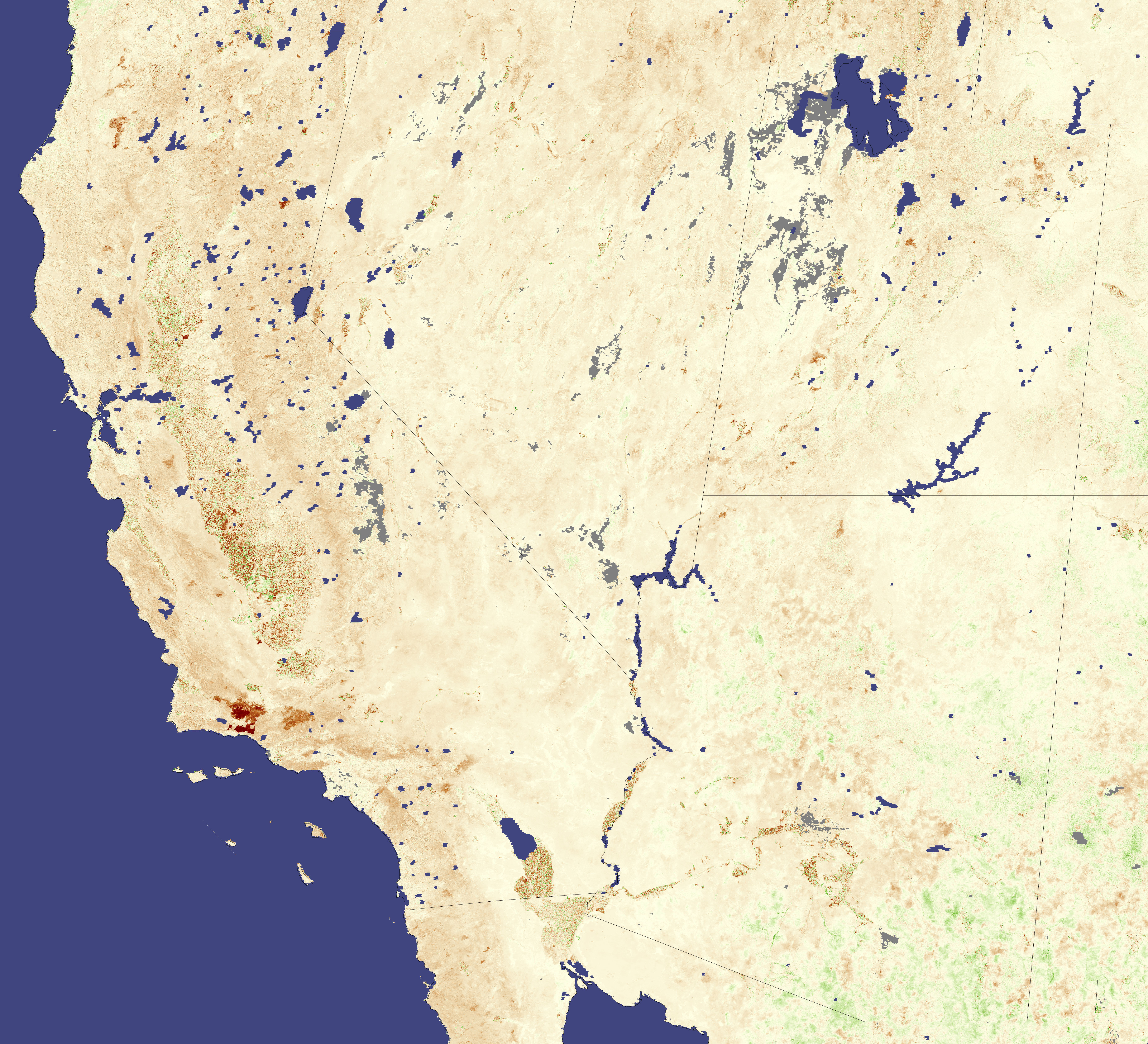
Like the rest of southern California, the southern San Joaquin Valley was in drought in August 2007, according to the U.S. Drought Monitor. Irrigated crops in the intensely farmed valley contrast sharply with the surrounding natural vegetation in this vegetation anomaly image. The Moderate Resolution Imaging Spectroradiometer (MODIS) on NASA’s Terra satellite collected the data used to make this image between August 13 and August 28, 2007. Vegetation conditions were then compared to average conditions observed during the same period from 2000 to 2006. Areas that were more lush or densely vegetated than average are green, while less-densely vegetated areas are brown. Lakes and reservoirs are masked out with blue.
The pattern that emerges in this image reveals as much about land use at it does about drought. Grids of green and dark brown define the southern San Joaquin Valley’s agricultural areas. Green reveals where irrigated crops were growing. Brown squares are more difficult to interpret. They could be fields that are fallow or that have already been harvested. A different, less leafy or later-developing crop could be growing where a leafy crop may have been in previous years. Or, the brown squares could be non-irrigated fields where crops are growing poorly because of drought. More than likely, a combination of all of these factors contributed to the dense concentration of brown in the valley. Outside the valley, the landscape is covered with natural vegetation, which is less healthy than normal in the dry conditions, as indicated by its general brown color.
NASA image created by Jesse Allen, Earth Observatory, using data provided by Inbal Reshef, Global Agricultural Monitoring Project.