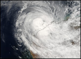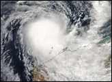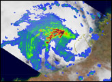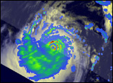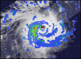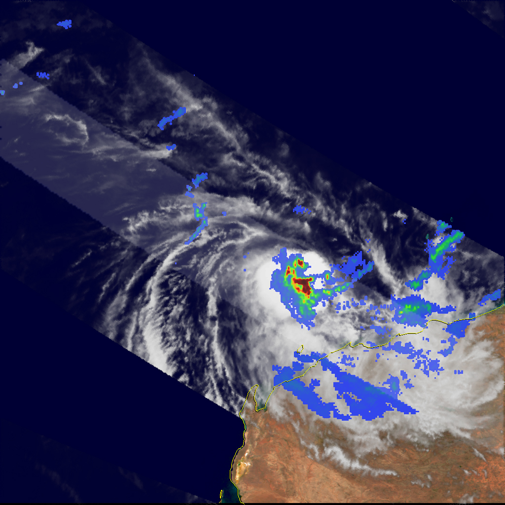
The Tropical Rainfall Measuring Mission (TRMM) flew directly over Tropical Cyclone Hubert as the storm was building off Australia’s northwestern coast on April 6, 2006. Hubert is one of the seasonal storms that form between December and April in the region between Australia’s northwestern coast and the western islands of the Indonesian chain. In a typical year, the cyclone season winds down in April when the Asian Monsoon developing in the north shifts storm formation away from the Australian coastline. The 2006 Australian cyclone season has seen just slightly more than the typical number of storms, including the unusually powerful Cyclone Glenda, which swept over northwestern Australia in late March.
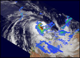
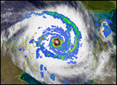
The TRMM satellite brought its full suite of instruments to bear on Tropical Cyclone Hubert. The outer regions of the storm were observed by the Visible and Infrared Scanner instrument, showing the extent and structure of clouds in the building storm. Superimposed on top of the clouds (wide outer swath) is the rain intensity, as detected by passive microwave energy using the TRMM Microwave Radiometer. The innermost swath shows the rain intensity as measured by the TRMM Precipitation Radar (PR). Reds indicated the heaviest rain regions, with the PR instrument able to peer into the clouds to discern the structure and intensity of the storm. The spiral structure of the rain bands, with the most intense rainfall in the storm center, is not at all obvious to other instruments, where the absence of a clear eye structure disguises the underlying storm form. TRMM’s unique abilities provide insight into pressing questions in meteorological research, particularly in critical areas such as how storm systems form and intensify.
TRMM observed Hubert at 10:47 a.m. local time (02:47 UTC) on April 6, 2006. At the time of this observation, Hubert was strong enough to be classified as a cyclone, but not particularly intense. Cyclone Hubert had a basic spiral form, but lacked the well-developed eye and tight-wound shape of a powerful storm. The PR observations show that the spiral structure and eye formation existed within the storm even though it was not evident in the cloud tops. Sustained, peak winds in the storm system were roughly 100 kilometers per hour (65 miles per hour) around the time the image was captured.
The Tropical Rainfall Measurement Mission is shared between NASA and the Japanese space agency, JAXA. More detailed images of hurricane rain structure can be found on the TRMM website.
NASA image courtesy of Hal Pierce, SSAI/Goddard Space Flight Center