Virunga National Park in Africa’s Great Rift Valley teems not only with a rich array of plant and animal life but also with a chain of towering volcanoes. Two of these—the gently sloping Nyamulagira and its steep-sloped neighbor Nyiragongo—account for 40 percent of Africa’s historic volcanic eruptions. Diverging tectonic plates in East Africa allow magma to rise to the surface and fuel the volcanic activity.
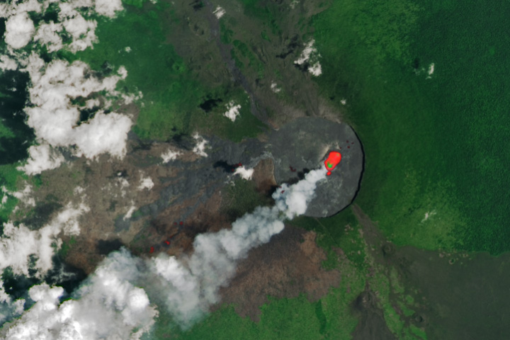
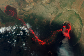
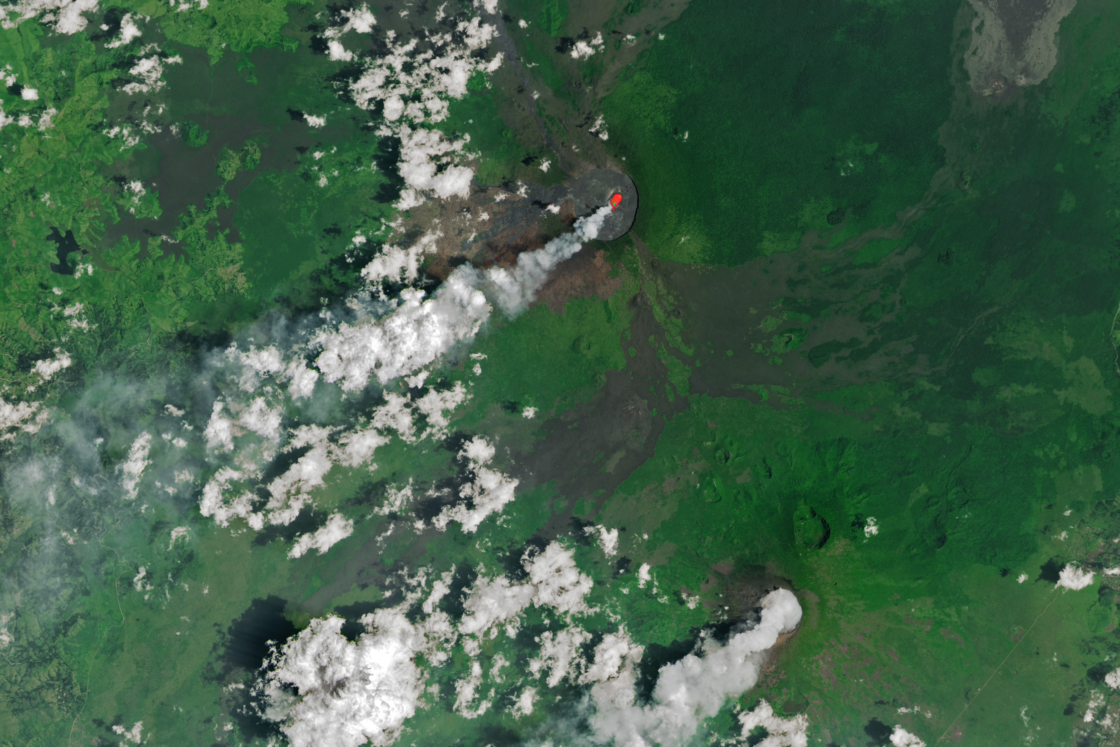
Space-based observations of Nyamulagira (or Nyamuragira), a massive basaltic shield volcano in the Democratic Republic of the Congo, are frequently foiled by cloud cover. But a relatively clear window in early 2025 allowed a glimpse of its ongoing eruption. The OLI (Operational Land Imager) on the Landsat 8 satellite acquired this image of the dynamic volcano on February 20. The natural-color scene is overlaid with an infrared signal to distinguish the lava’s heat signature.
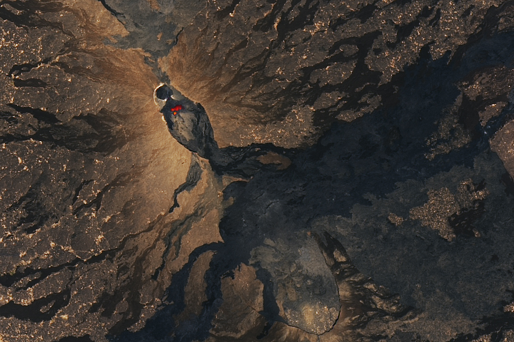
The youngest lava flows are darkest in appearance. Several branch to the west from the summit crater, while one runs to the northwest. Heat emanates from what may be a lava lake in the summit crater. A thermal signal also appears near the end of a southwest-trending lava flow, approximately 3.3 kilometers (2 miles) from the crater’s west rim.
Nyamulagira has erupted more than 40 times since the late 19th century. During a major eruption in 1938, a lava lake drained from the 2-kilometer-wide (1.2-mile-wide) crater. Lava can also spill from fissures on its broad flanks. Recent flows have reached Lake Kivu, one of the African Great Lakes, approximately 25 kilometers (15 miles) south of the summit. However, eruptions of neighboring Nyiragongo have historically caused more destruction to people and property. Among other events, a January 2002 eruption of Nyiragongo sent voluminous and fast-flowing lava through the city of Goma, affecting hundreds of thousands of people.
In the most recent eruptive period at Nyamulagira, satellite images from July 2024 revealed that activity had breached the crater and that lava was flowing down the mountain’s slopes. Effusive eruptions continued in the following months, and volcanic gas and ash emissions were significant at times. In late October 2024, the Volcanic Ash Advisory Center (VAAC) in Toulouse raised the aviation color code to red, the highest warning level. A plume was observed rising 4 kilometers into the air, according to news reports, and satellite sensors detected elevated sulfur dioxide concentrations extending hundreds of kilometers away from the volcano.
NASA Earth Observatory image by Wanmei Liang, using Landsat data from the U.S. Geological Survey. Story by Lindsey Doermann.
alert message