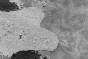

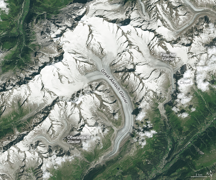
Spanning more than 1,000 kilometers across eight European countries, the Alps are among the planet’s largest and highest mountain ranges. The terrain is home to thousands of glaciers, including the range’s largest—the Great Aletsch Glacier (Grosser Aletschgletcher) in southwestern Switzerland. But like many glaciers in the Alps, the Aletsch is retreating and thinning.
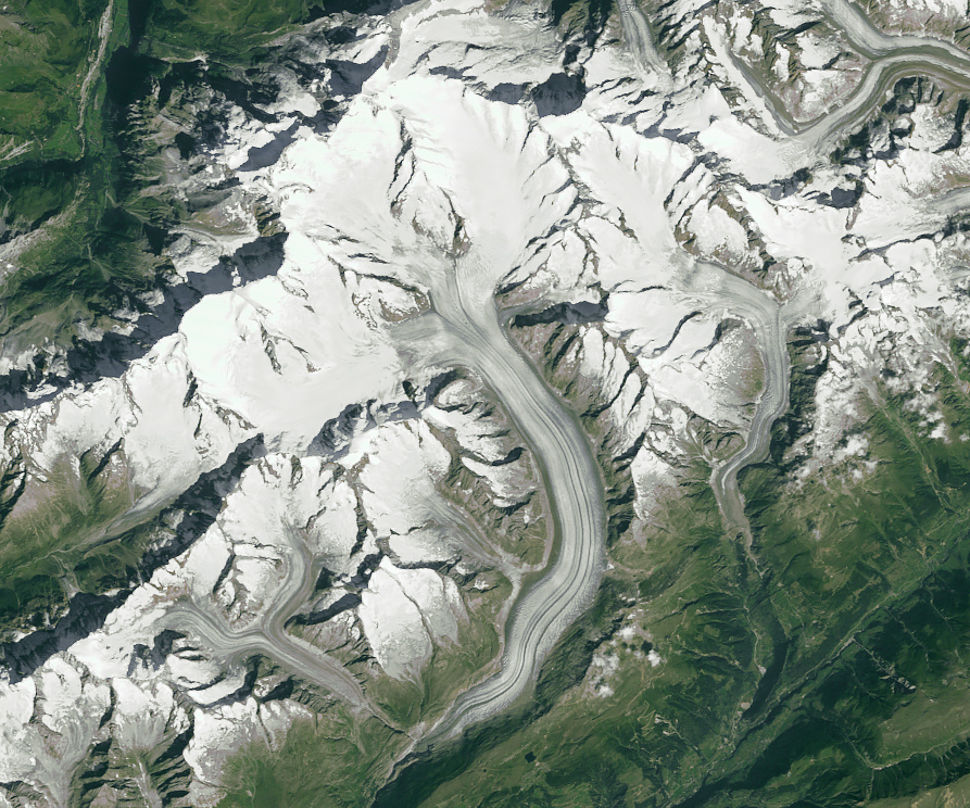
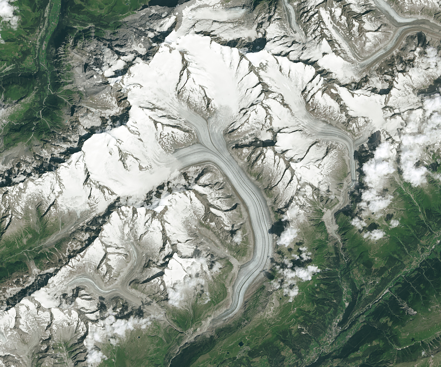
Change across the past four decades is visible in this image pair. The TM (Thematic Mapper) on Landsat 5 captured the left image in September 1984, and the OLI (Operational Land Imager) on the Landsat 8 captured the right image in August 2024.
As of March 2025, it was still too early in the year to acquire a new image without seasonal snow obscuring the glacier. Even in these late-summer scenes, minor differences might still be related to snow. Even so, changes to the length and width of the glaciers are clearly visible. (Note that clouds obscure some of the smaller glaciers toward the right side of the image.)
The shortening and narrowing of a glacier’s surface area—parameters visible in Landsat images—can indicate a net loss of ice mass. For example, imagine two equal-sized bowls filled with different amounts of water; the bowl with less water would display a lower surface height and smaller area. The same is generally true for glacial ice that flows along U-shaped valleys.
According to the Swiss Glacier Monitoring Network (GLAMOS), Aletsch has retreated more than 1,300 meters (4,300 feet) since 1984. It has also thinned, contributing to the glacier’s narrower appearance in the 2024 scene. In the span of four decades, GLAMOS data indicate that the glacier has lost 43 meters of water equivalent.
Aletsch’s neighbors also show decline, albeit more subtly. Since 1984, Oberaletsch Glacier to the left has retreated more than 240 meters, and Fiescher Glacier to the right has retreated more than 1,000 meters.
These images follow a particularly warm summer in 2024 that melted the abundant snowfall from the previous winter, according to news reports. Swiss glaciers that year lost 2.5 percent of their volume.
Glaciers in other parts of the world, such as Alaska in the United States, have contributed more in terms of total mass loss, according to a recent assessment of the glacier mass changes in regions across the planet between 2000 and 2023. However, the largest relative losses during that period occurred in areas with smaller glacial area. Central Europe, for example, which includes Switzerland, lost 39 percent of its glacial ice during that time.
NASA Earth Observatory images by Michala Garrison, using Landsat data from the U.S. Geological Survey. Story by Kathryn Hansen with image interpretation by Christopher Shuman, UMBC (retired).
alert message