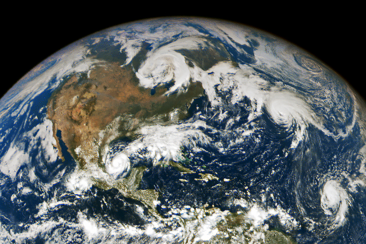
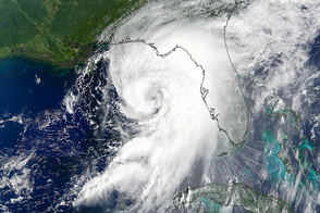
Hurricane Milton barreled into Florida’s west-central coast on the evening of October 9, 2024, making landfall south of Tampa as a major Category 3 storm. The hurricane lashed the region with heavy rainfall, damaging winds, and life-threatening storm surge, according to the National Hurricane Center.
This animation shows Milton in the days before, during, and after its devastating encounter with Florida. The false-color images depict infrared signals known as brightness temperature, which is useful for distinguishing cooler cloud structures (white and purple) from the warmer surface below (yellow and orange). Data for the animation were acquired by the MODIS (Moderate Resolution Imaging Spectroradiometer) and VIIRS (Visible Infrared Imaging Radiometer Suite) instruments on several NASA and NOAA satellites.
Since infrared data are based on temperatures rather than visible light, the data can be obtained day or night. This animation shows both daytime and nighttime images, beginning at 3:35 p.m. Eastern Time (19:35 Universal Time) on October 8 and ending at 3:08 a.m. Eastern Time (07:08 Universal Time) on October 10.
Shortly before the first image of this series, Milton was a Category 4 storm with sustained winds of 155 miles (250 kilometers) per hour. It soon grew to a Category 5 storm and then weakened to a still-potent Category 3 storm prior to making landfall on October 9. The storm maintained hurricane-strength intensity and fast, forward speed while crossing Florida, emerging over the western Atlantic as a Category 1 storm with sustained winds of 85 miles (140 kilometers) per hour at the end of this animation on October 10.

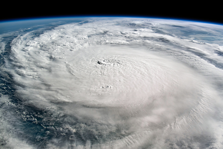
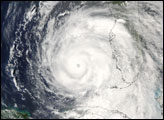
On the morning of October 8, 2024, an astronaut aboard the International Space Station took this photo of Hurricane Milton as it churned over the Gulf of Mexico as a Category 4 storm. Astronaut photos of the region are being made available to various agencies via the International Disasters Charter and NASA’s Disasters Response Coordination System (DRCS).
NASA’s DRCS has been activated to support agencies responding to the storm, including the Federal Emergency Management Agency (FEMA) and the Florida Geospatial Information Office. The team will be posting maps and data products on its open-access mapping portal as new information becomes available about flooding, power outages, precipitation totals, and other topics.
NASA Earth Observatory images by Michala Garrison, using MODIS and VIIRS data from NASA EOSDIS LANCE and GIBS/Worldview and the Joint Polar Satellite System (JPSS). Astronaut photograph ISS072-E-29325 was acquired on October 8, 2024, with a Nikon Z 9 digital camera using a 50 millimeter lens and is provided by the ISS Crew Earth Observations Facility and the Earth Science and Remote Sensing Unit, Johnson Space Center. The image was taken by a member of the Expedition 72 crew. The image has been cropped and enhanced to improve contrast, and lens artifacts have been removed. The International Space Station Program supports the laboratory as part of the ISS National Lab to help astronauts take pictures of Earth that will be of the greatest value to scientists and the public, and to make those images freely available on the Internet. Additional images taken by astronauts and cosmonauts can be viewed at the NASA/JSC Gateway to Astronaut Photography of Earth. Story by Kathryn Hansen.