The Earth Observatory has published its last Image of the Day on this website. Please join us on our new home at science.nasa.gov/earth/earth-observatory.
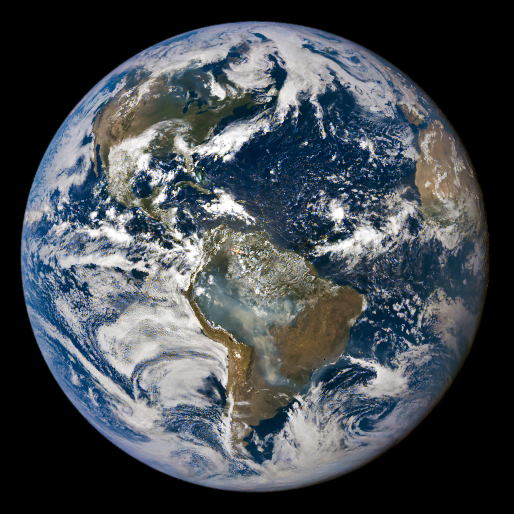
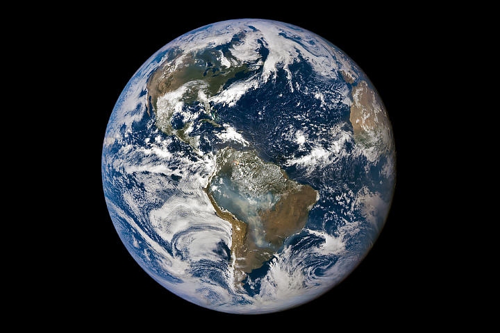
Intense fires burning in several South American countries draped large swaths of smoke across the continent throughout August and early September 2024. In Brazil and Bolivia, fire activity reached levels not seen since 2010 as a prolonged drought parched landscapes in both countries.
From about 1 million miles (1.6 million kilometers) away from Earth, NASA’s EPIC (Earth Polychromatic Imaging Camera) imager on the DSCOVR (Deep Space Climate Observatory) satellite captured this view of smoke billowing from the blazes on September 3, 2024.
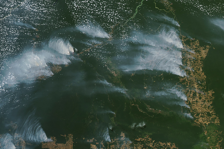
Smoke from fires in Brazil swept over the country’s capital city in mid-August and early September. For several days, São Paolo’s air was clouded with smog, and air quality was unhealthy for sensitive groups, according to AirNow. The smoke grounded flights and forced schools to close in the most populous city in Brazil, according to The Guardian.
The fire season in the southern Amazon, which generally ramps up in August and peaks in September and October, has been intense this year. According to the Copernicus Atmosphere Monitoring Service (CAMS), a component of the European Union’s space program, emissions from fires have been exceptionally high in Bolivia and the Brazilian states of Amazonas and Mato Grosso do Sul.
CAMS estimates near-real-time wildfire emissions using its Global Fire Assimilation System (GFAS), which aggregates observations made by the MODIS (Moderate Resolution Imaging Spectroradiometer) sensors on NASA’s Aqua and Terra satellites. Compared to the previous 21 years, these areas have registered their highest year-to-date total emissions, at 44, 22, and 13 million metric tons of carbon, respectively.
The Pantanal region—which straddles the Brazil-Bolivia border and is home to one of the world’s largest tropical wetlands—has been especially hard hit in 2024. Early and intense blazes spread over the wetlands in late May and continued into August. According to Brazil’s National Institute for Space Research (INPE), there were a record number of fire detections in the biome in June 2024, and fires have continued to burn at high levels since.

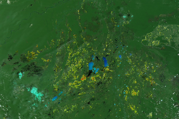
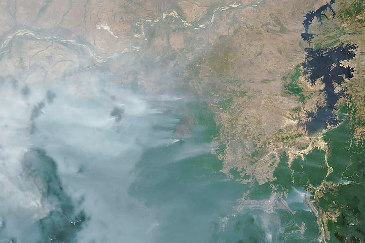
The false-color image above, acquired by the OLI (Operational Land Imager) on Landsat 8, shows fires near Ascensión de Guarayos, in the Bolivian state of Santa Cruz. The false-color image emphasizes the burn areas (brown) from several fires on September 3, 2024. Unburned vegetation is green. Near- and short-wave infrared bands help penetrate some of the smoke to reveal hot areas associated with active fires, which appear orange.
Through September 6, blazes tore through more than 10 million hectares of Bolivia, or roughly 9 percent of the country’s total area. Out of the 42 million metric tons of carbon emitted in Bolivia between May and August, 33 million metric tons came from fires in the state of Santa Cruz, according to Mark Parrington, CAMS senior scientist with the European Centre for Medium-Range Weather Forecasts (ECMWF).
Large parts of South America have seen significant rainfall deficits over the past three months. According to ECMWF, this has led to “exceptional drought” (the highest drought ranking) over much of the central and northern parts of the continent. Brazil’s Natural Disaster Monitoring and Alerts Center noted on September 5 that shifted rainfall patterns from El Niño, increased temperatures from climate change, and reduced humidity from deforestation have all contributed to the drought.
NASA Earth Observatory images by Michala Garrison, using data from DSCOVR EPIC and Landsat data from the U.S. Geological Survey. Story by Emily Cassidy.