The Earth Observatory has published its last Image of the Day on this website. Please join us on our new home at science.nasa.gov/earth/earth-observatory.
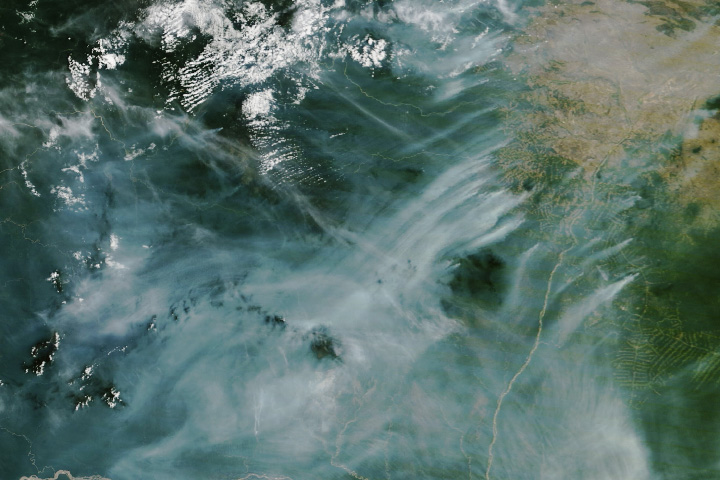
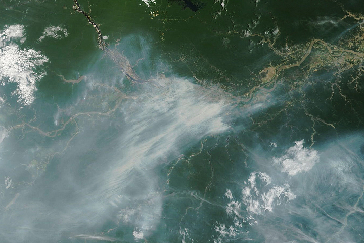
Fire season in Brazil got off to an early and active start in 2024. In February, NASA satellites observed unusually widespread and intense fire activity in the northern state of Roraima. In May and June, drought in the more southerly state of Mato Grosso do Sul helped spread intense, early-season blazes in the Pantanal, one of the world’s largest wetlands. In July, fires picked up to unusually high levels within rainforests in the Amazon River Basin.
Fires are more prevalent in Brazil in the driest months of the year—generally beginning in July and peaking in August and September. In some parts of the country, fire activity was already intense in July 2024. As of August 7, Brazil’s National Institute for Space Research (INPE) had detected via satellite almost twice as many active fires in the Brazilian Amazon compared to the same January-to-August time period in 2023.
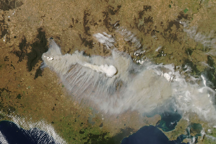
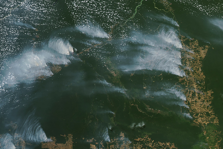
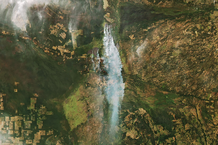
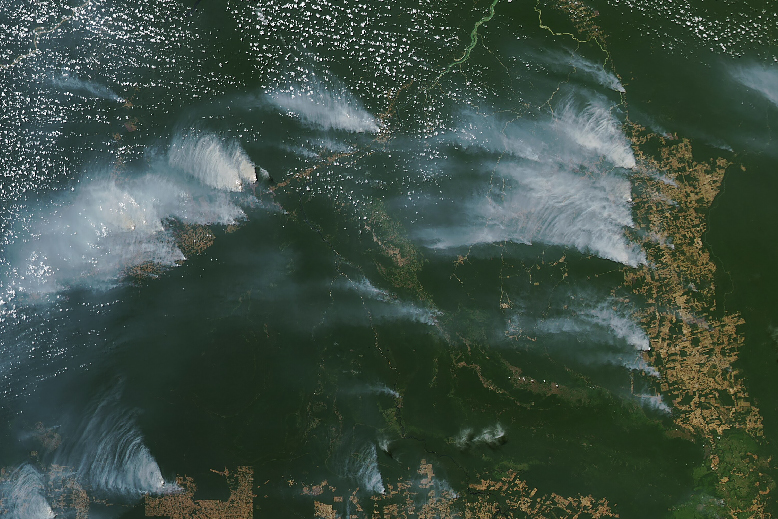
The MODIS (Moderate Resolution Imaging Spectroradiometer) instrument aboard NASA’s Aqua satellite captured this image of smoke from fires over the states of Amazonas and Pará on August 4, 2024. Dense smoke was present in the Apuí region of Amazonas and along the BR-163 highway in southern Pará. Triangular plumes streamed from areas of recent deforestation—often adjacent to side roads off the main highway that create a “fishbone pattern” of cleared land when viewed from above. Deforested land in this area is usually used for cattle ranching and crop production.
Using data from Aqua, INPE detected more fires in the state of Amazonas in July 2024 than any previous July in their record, which goes back to 1998. The satellite-powered SERVIR Amazon Fire Dashboard, which classifies active fire detections from the VIIRS (Visible Infrared Imaging Radiometer Suite) sensors based on their intensity, persistence, and the type of vegetation burned, indicated that most of the activity was linked to deforestation.
“The major fire activity in July was tied to deforestation along this ‘leading edge’ of the deforestation frontier,” said Doug Morton, an Earth system scientist in the Biospheric Sciences Laboratory at NASA’s Goddard Space Flight Center. People ignite deforestation fires during the dry season to remove drying trees, branches, and stumps, left over after using bulldozers and other equipment to clear land during the wetter months. It sometimes takes months or even years to burn off enough of the woody debris that land can be used for ranching or farming.
Severe drought has plagued the Amazon Basin since mid-2023, partly because El Niño, which heated up the eastern Pacific Ocean from May 2023 to May 2024, shifted rainfall away from this area. According to scientists at World Weather Attribution, drought is also severe because human-caused global warming has added extra heat to the region and helped create conditions where fires can flourish and spread rapidly.
Carbon emissions from blazes in the Brazilian Amazon and Pantanal biomes so far this year have been the highest since 2005, according to Mark Parrington, an atmospheric scientist with the European Centre for Medium-Range Weather Forecasts (ECMWF). Parrington tracks fires for the Copernicus Atmosphere Monitoring Service (CAMS) using a satellite-based data record that began in 2003. Emissions were especially high from Amazonas and Mato Grosso do Sul.
NASA Earth Observatory image by Michala Garrison, using MODIS data from NASA EOSDIS LANCE and GIBS/Worldview. Story by Emily Cassidy.