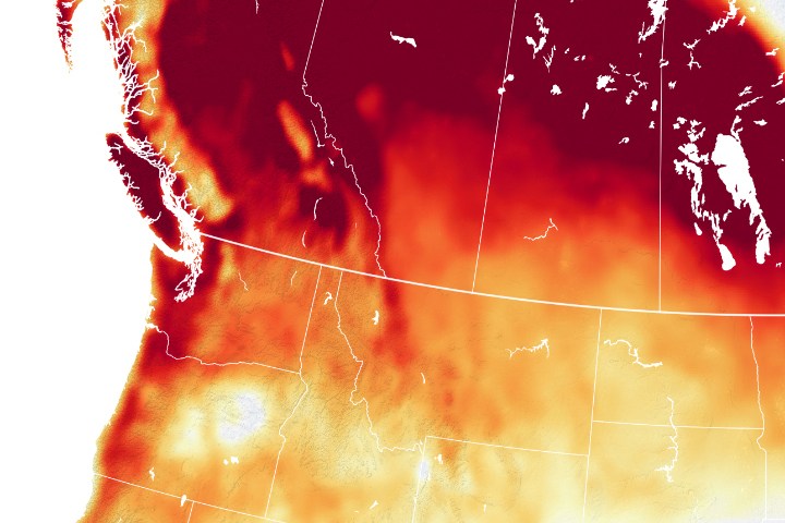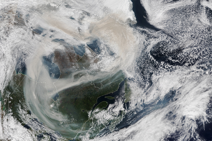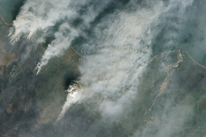
Raging fires filled the skies of southern Canada and the northern United States with smoke in mid-May 2023. The fires had scorched 478,000 hectares (1,800 square miles) in Alberta, British Columbia, and Saskatchewan, as of May 16, which is 10-times the average area burned for this time of year.
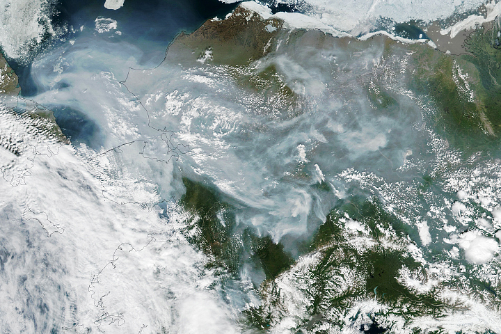
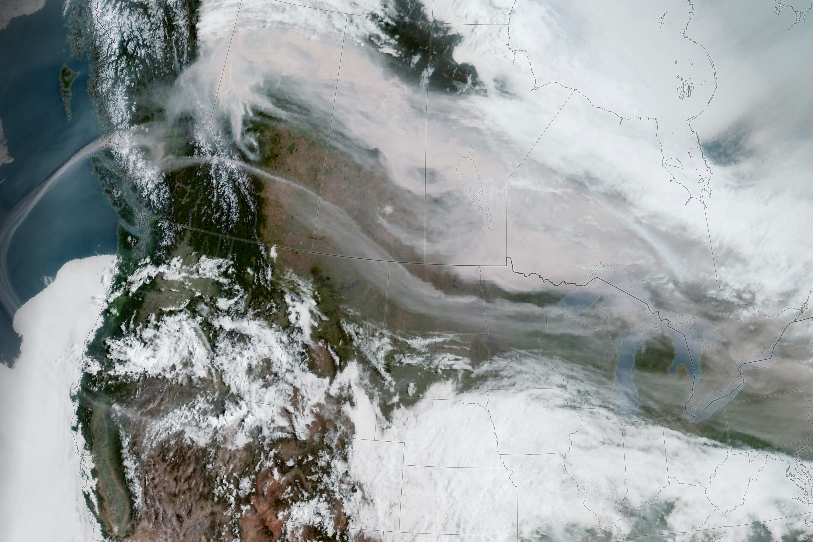
This image, from the Geostationary Operational Environmental Satellite 18 (GOES-18), shows smoke from the fires sweeping over southern Canada as well as North Dakota, Minnesota, and several other states on May 15, 2023. GOES-18 is operated by the National Oceanic and Atmospheric Administration (NOAA); NASA helps develop and launch the GOES series of satellites.
As of May 16, there were 87 wildland fires burning in Alberta, a quarter of which were classified as out of control, meaning the fires were expected to grow in size. A majority of the 478,000 hectares burned have been in Alberta, according to the Canadian Wildland Fire Information System, but several fires were classified as burning out of control on that day in British Columbia and Saskatchewan.
Smoke from the fires has caused poor air quality and reduced visibility in several cities. Wildfire smoke contains tiny particles called aerosols—some of which can degrade air quality and exacerbate respiratory and cardiovascular health problems. Air quality conditions on May 16 in some Alberta cities were ranked as “very high risk”—the highest ranking in Canada’s Air Quality Health Index.
Hazy skies were also observed by a global network of ground sensors called the Aerosols Robotic Network, or AERONET, which is comprised of more than 500 carefully calibrated Sun photometer instruments that measure aerosol optical depth (AOD) around the world. The instruments are pointed at the Sun and record the intensity of incoming light. Scientists use this information to deduce the amount and size of the aerosols in the atmospheric column by calculating the difference between the light received and what would be expected in cloud-free conditions.
“A perfectly clear blue sky would produce a very low AOD value, less than 0.05, in visible wavelengths,” said Pawan Gupta, an atmospheric scientist and co-lead of AERONET at NASA’s Goddard Space Flight Center. “An AOD reading of 3 would make it difficult even to see the Sun.”
Wind brought smoke from the fires down to Maryland on May 10, making the Sun look milky in the sky. The AERONET instrument at NASA Goddard in Greenbelt, Maryland, had an average AOD value of about 1 in visible wavelengths. On May 16, smoke contributed to hazy skies and hazardous air quality in North Dakota and northern Minnesota. An AERONET sensor at the University of North Dakota in Grand Forks measured an average AOD of 2.3 on that day, with peak values close to 3.
Unseasonably hot weather is expected to continue over the next few days in Western Canada. In British Columbia, temperatures are expected to reach 30° Celsius (86° Fahrenheit) through May 18, according to Environment Canada.
NASA Earth Observatory image by Lauren Dauphin, using GOES 18 imagery courtesy of NOAA and the National Environmental Satellite, Data, and Information Service (NESDIS). Story by Emily Cassidy.