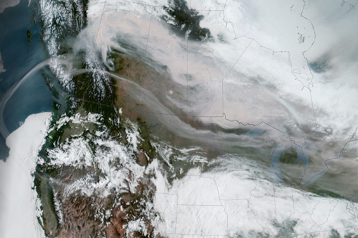
A springtime heatwave has made large swaths of western North America feel like the dog days of summer. In mid-May 2023, western Washington and Oregon, along with much of British Columbia and Alberta, Canada, were in the throes of a record-breaking streak of hot weather. While the most unseasonably warm weather subsided by May 16, above-average temperatures were projected to persist for several more days.
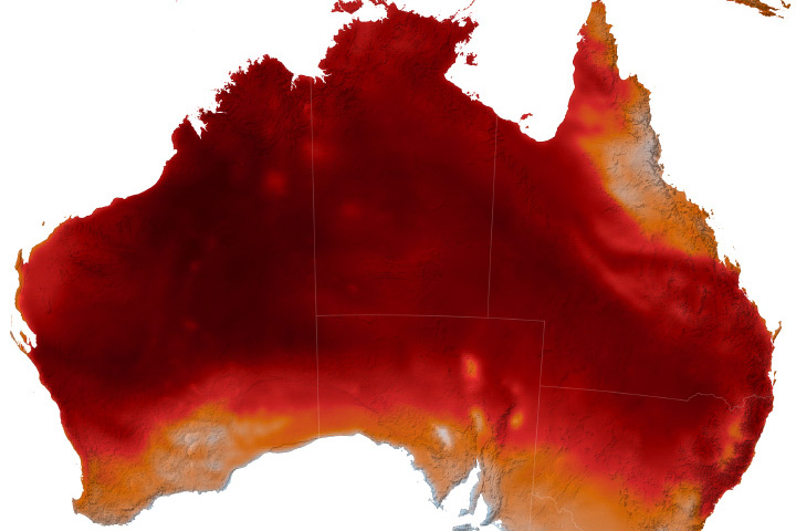
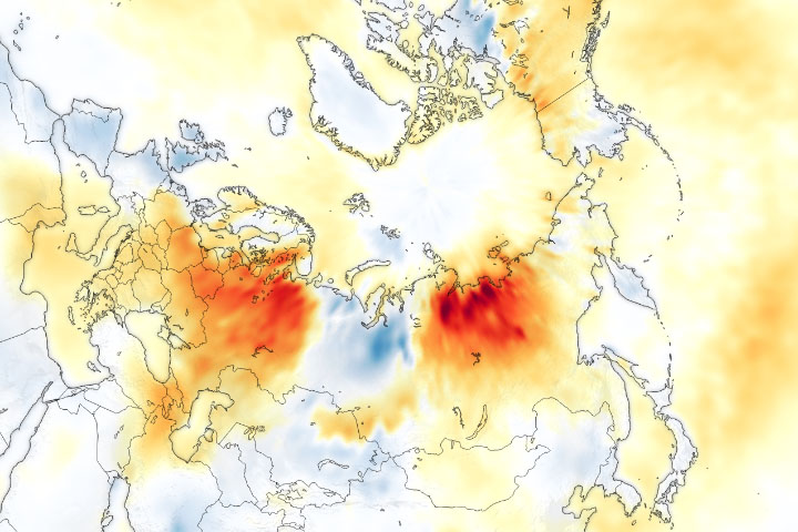
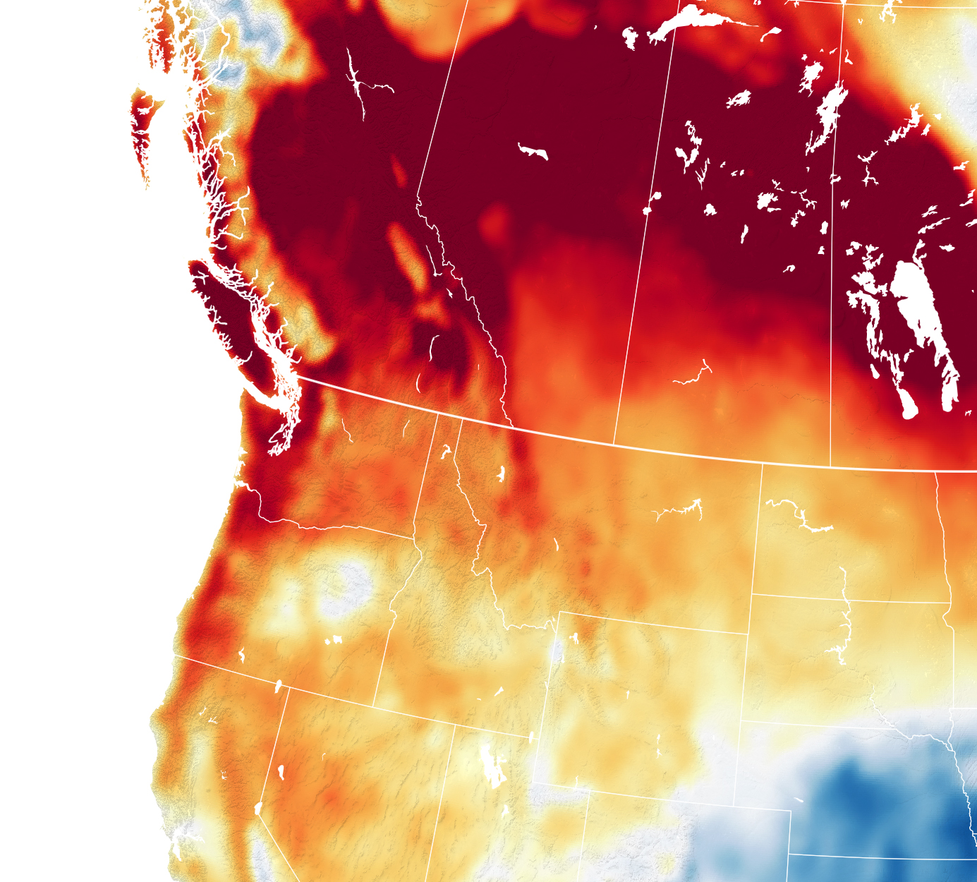
The map above shows the difference in air temperature between May 15, 2023—one of the hottest days in the heatwave—and the 2014-2022 mean for that date. The map is derived from the Goddard Earth Observing System (GEOS) model and depicts air temperatures at 2 meters (about 6.5 feet) above the ground. Dark red areas are where air temperatures reached more than 22°F (12°C) above the recent average.
Heat records were toppled across several Canadian provinces. In British Columbia, dozens of daily records fell for three days straight, according to local news reports. New monthly records were also broken, and temperatures exceeded 95°F (35°C) in some locations. Stateside, record books also got significant updates. Notably, May 15 marked the fourth straight day of record high daily temperatures in Seattle.
This event is reminiscent of the “heat dome” that parked over the Pacific Northwest in June 2021. During that dangerous stretch, temperatures in some places soared more than 27°F (15°C) over recent averages for the same date. The cities of Seattle and Portland set all-time-record highs of 108°F (42°C) and 116°F (47°C), respectively.
In the current spell, a strong high-pressure ridge developed over western Canada, which served to center the heat on Alberta as air sank, warmed, and dried out. Temperatures in May 2023 did not approach the extremes seen in the June 2021 event, in part because it occurred over a month earlier in the year.
The heat and accompanying low humidity may exacerbate the already active wildland fire season in Alberta and British Columbia. Alberta reported 91 active fires in the province on May 17, and smoke had degraded air quality in many cities. Members of the Canadian Armed Forces joined firefighters in their efforts to control blazes ahead of the heatwave.
Unseasonable warmth is expected to persist throughout the week. According to Environment Canada, parts of interior British Columbia will continue to see daytime highs of 18 to 27°F (10 to 15°C) above normal. The department also warns of local flooding as the melting snowpack increases stream flow.
NASA Earth Observatory image by Lauren Dauphin, using GEOS-5 data from the Global Modeling and Assimilation Office at NASA GSFC. Story by Lindsey Doermann.
alert message