After a relatively quiet start, the 2024 typhoon season in the Northwest Pacific Basin is picking up. About a week after Typhoon Shanshan struck southern Japan, a powerful storm is bearing down on southern China.
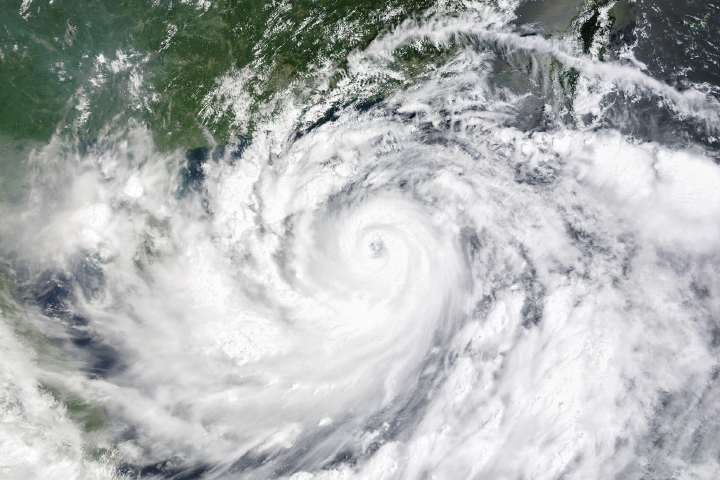
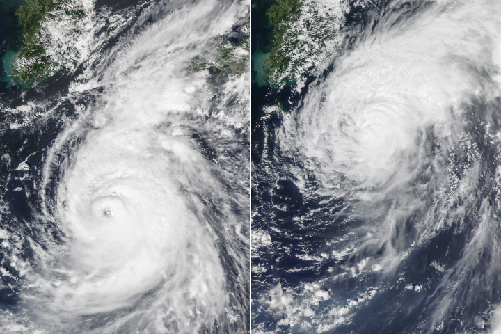
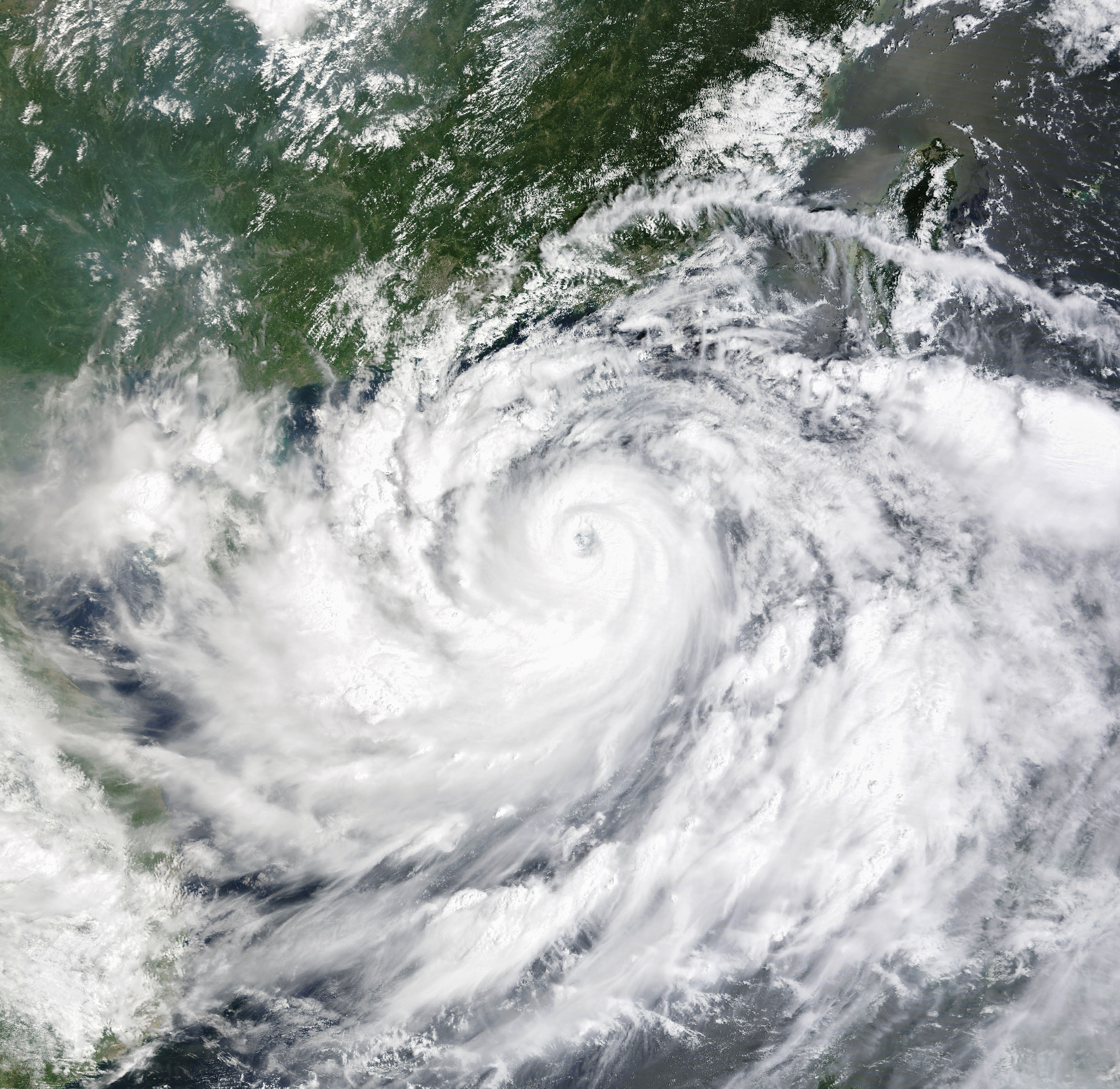
Typhoon Yagi first emerged northwest of Palau in late August and struck the island of Luzon in the Philippines as a tropical storm on September 2, causing destructive flash flooding and landslides. The island’s rugged terrain weakened Yagi temporarily, but the storm then strengthened rapidly as it moved over the South China Sea and encountered unusually warm water and favorable atmospheric conditions.
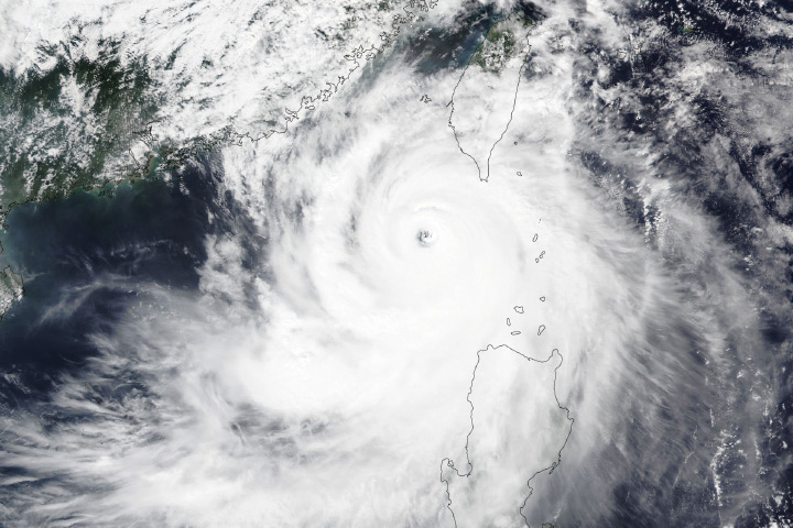
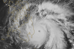
When the MODIS (Moderate Resolution Imaging Spectroradiometer) on NASA’s Terra satellite captured this image of Yagi at 10:12 a.m. local time (02:12 Universal Time) on September 5, the storm was tracking westward with maximum sustained winds of 225 kilometers (145 miles) per hour, making it the equivalent of a Category 4 hurricane and one of the strongest tropical cyclones yet in 2024.
Forecasters expect Yagi to continue moving westward, making landfall in Hainan or neighboring Guangdong province on the morning of September 6. Chinese officials bracing for the storm have closed schools, postponed flights, and closed offices, according to news reports.
NASA Earth Observatory image by Michala Garrison, using MODIS data from NASA EOSDIS LANCE and GIBS/Worldview. Story by Adam Voiland.