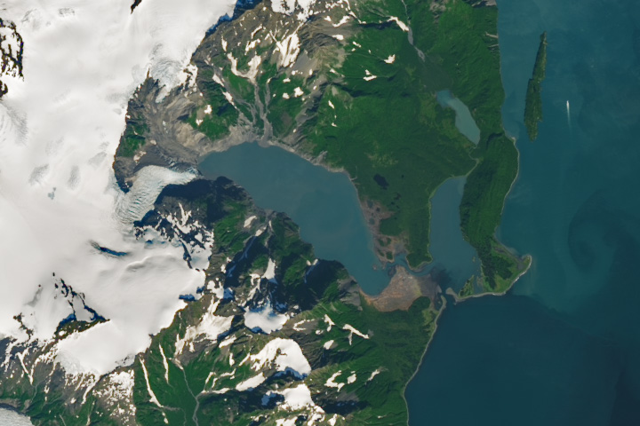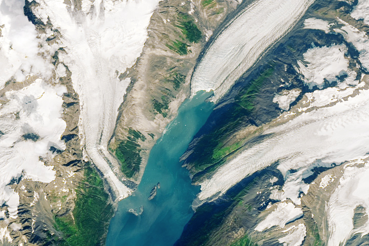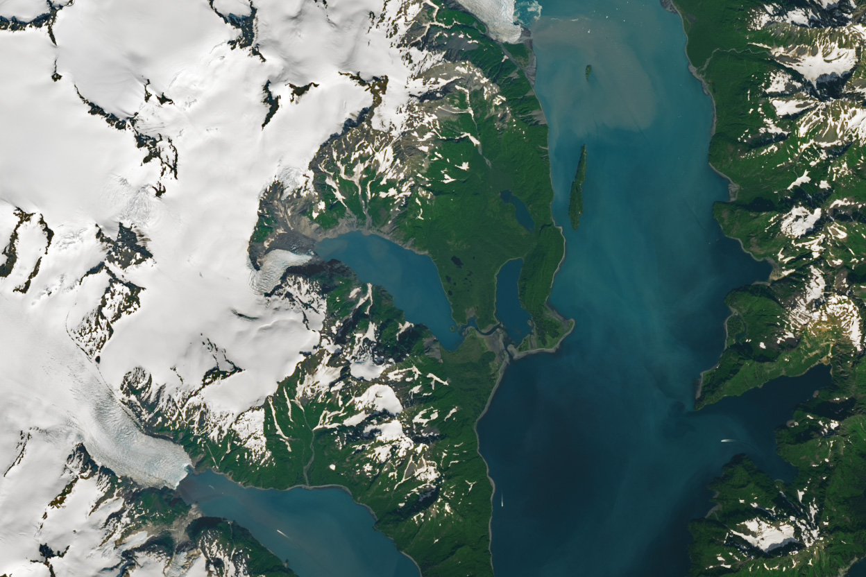

An atmospheric river brought intense rainfall to southern Alaska in early August 2024, triggering a large landslide and a tsunami in Pedersen Lagoon.
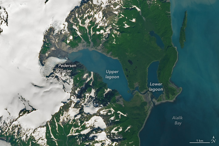
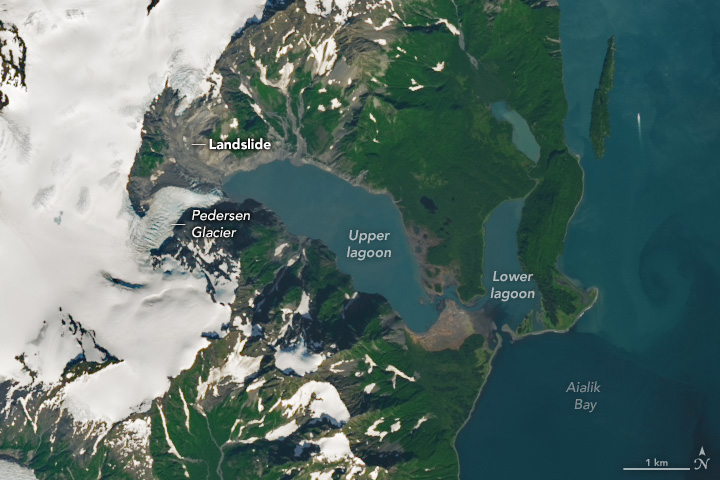
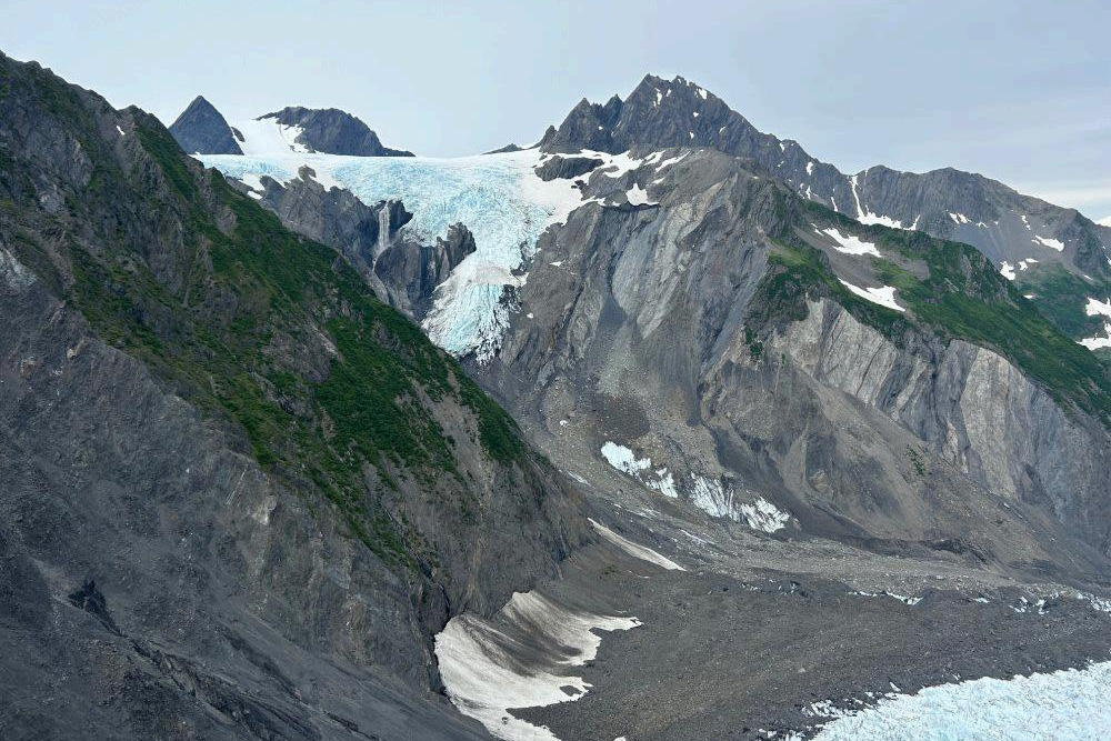
The series of events began unfolding early on August 7 on a slope on the northwest side of the upper Pedersen Lagoon, 20 miles southwest of Seward, Alaska. Landslide debris traveled alongside the Pedersen Glacier before crashing into the water. Preliminary estimates from the U.S. Geological Survey (USGS) indicate that the landslide moved about 2 million cubic meters of rocks and debris.
When the debris slid into the lagoon, it produced a tsunami about 56 feet (17 meters) high, according to the National Park Service. Some of the displaced water collided with hillslopes on the eastern side of the lagoon, and some traveled across the land between the upper and lower lagoons before dissipating on the eastern shore of the lower lagoon.
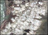
The image above (right), acquired on August 20 by the OLI-2 (Operational Land Imager-2) on Landsat 9, shows the aftermath of the landslide and tsunami. The wave damaged trees and flattened vegetation between the upper and lower portions of the Pedersen Lagoon. According to local reports, it also damaged a lodge’s boardwalk on the eastern side of the lower lagoon. The photograph below, provided by USGS, shows part of the landslide’s source area near Pedersen Glacier.
Glaciers can affect the stability of steep terrain, such as the cliffs lining the glacier-carved fjords of southern Alaska. As glaciers retreat, they leave slopes vulnerable to landslides. Pedersen Glacier is one of three lake-terminating glaciers in Kenai Fjords National Park that have seen significant retreat in the past 40 years. Analyzing Landsat images from 1984 to 2021, researchers found that Pedersen Glacier retreated by 2 miles (3.2 kilometers) during that period.
NASA Earth Observatory images by Wanmei Liang, using Landsat data from the U.S. Geological Survey. Story by Emily Cassidy.