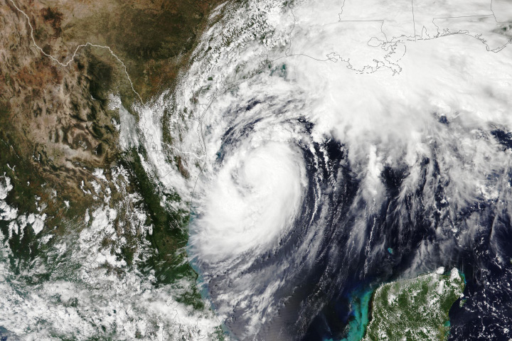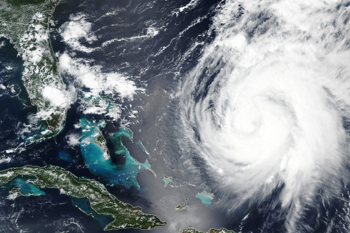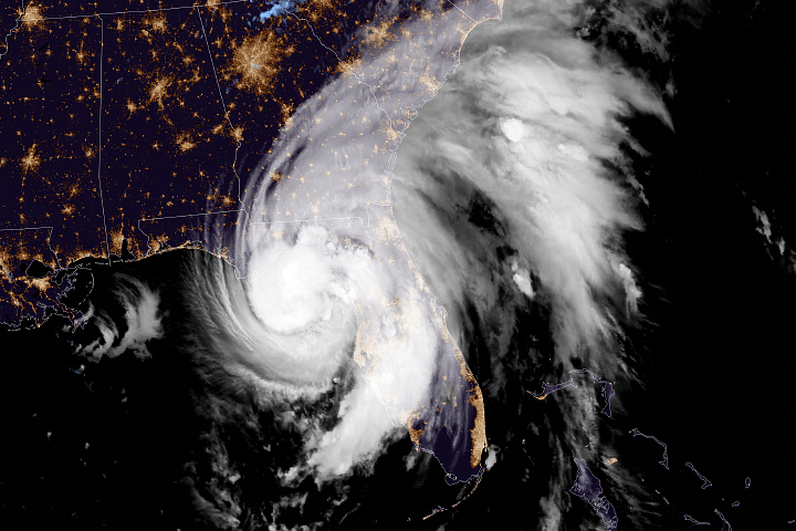
Tropical Storm Debby lashed the U.S. Southeast in the first week of August 2024, dropping copious amounts of rain. The storm first came ashore as a Category 1 hurricane in Florida’s Big Bend region on August 5 and then weakened to a tropical storm as its center moved inland. Skirting the Atlantic coast, it added to rainfall totals in Florida, Georgia, and the Carolinas.
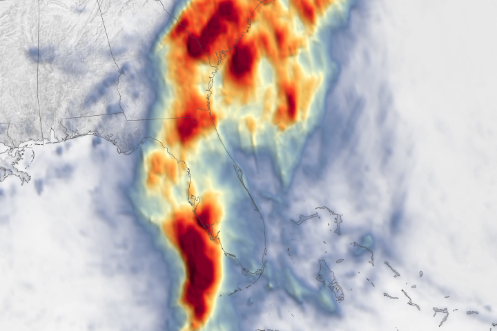
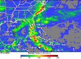
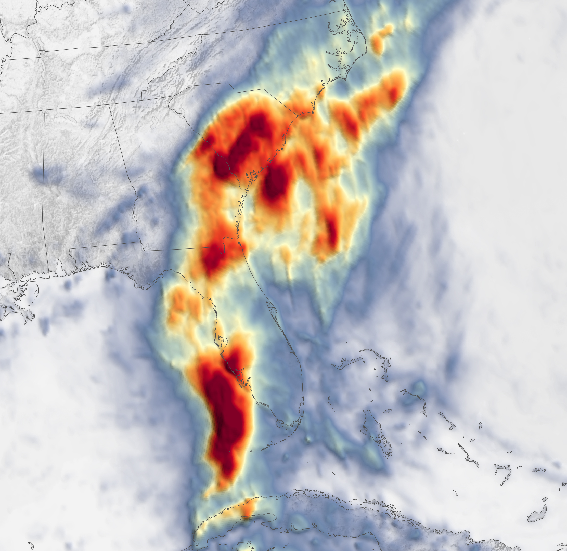
The map above shows rainfall accumulation over the five-day period ending at 7:59 p.m. Eastern Time (23:59 Universal Time) on August 7, 2024. These data are remotely sensed estimates that come from IMERG (the Integrated Multi-Satellite Retrievals for GPM), a product of the GPM (Global Precipitation Measurement) mission, and may differ from ground-based measurements. For instance, IMERG data are averaged across each pixel, meaning that rain-gauge measurements within a given pixel can be significantly higher or lower than the average.
During this five-day period, dozens of cities and towns across Florida, Georgia, and the Carolinas saw rainfall totals of more than a foot. In Florida, 17.78 inches (452 millimeters) fell in Sarasota and 19.67 inches (500 millimeters) fell in Lake City, according to the National Weather Service (NWS). In South Carolina, the town of Summerville saw 18.25 inches (464 millimeters).
The deluge continued as the storm made a second landfall, this time coming ashore northeast of Charleston, South Carolina, early on August 8. Having picked up more moisture during its stint over the Atlantic Ocean, Tropical Storm Debby continued dropping heavy rain on parts of the Carolinas.
As Debby continues northward as a tropical depression, forecasts call for heavy rain to move across the mid-Atlantic and Northeast on August 9–10. According to the NWS, flash flooding spurred by the heavy rainfall continued to be the storm’s biggest threat.
NASA’s Disasters program has been activated in response to Tropical Cyclone Debby, supporting stakeholders such as the Federal Emergency Management Agency (FEMA). As new information becomes available, the team will be posting maps and data products on its open-access mapping portal.
NASA Earth Observatory image by Lauren Dauphin, using IMERG data from the Global Precipitation Mission (GPM) at NASA/GSFC. Story by Kathryn Hansen.