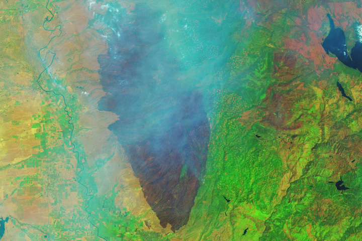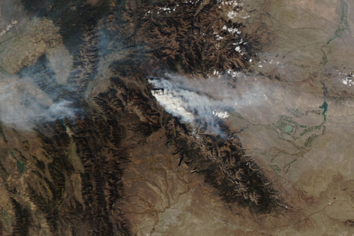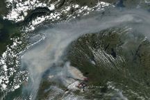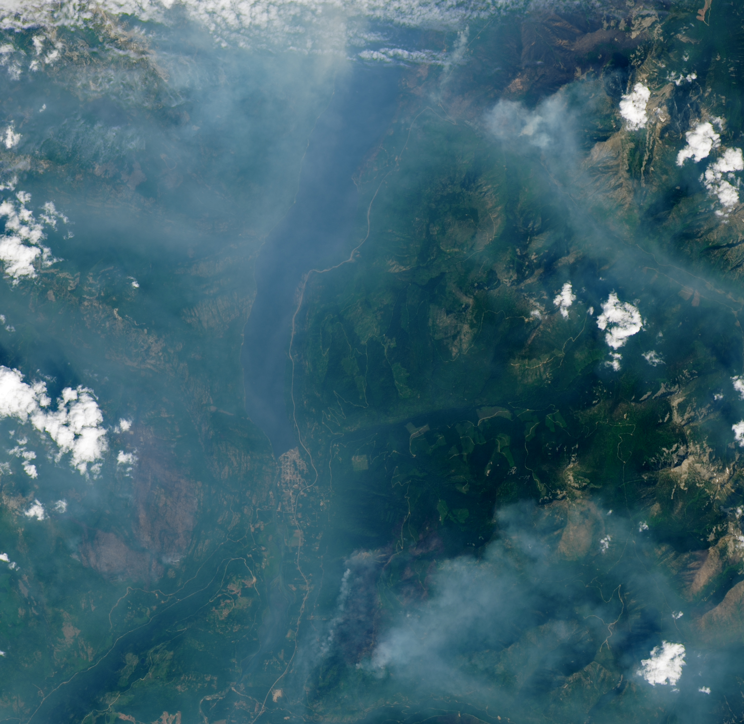
In the mountainous Kootenay region of southeast British Columbia, the Slocan Valley cradles the finger-like Slocan Lake, which is bordered by a village of the same name. In late July 2024, several wildland fires on both sides of Slocan Lake lofted smoke into the air and drove hundreds of residents to evacuate the area.
The OLI-2 (Operational Land Imager-2) on Landsat 9 acquired this image of the fires on July 27, 2024. At least six fires within the complex actively burned that day, including the Wilson Creek, Nemo Creek, Aylwin Creek, Komonko Creek, Mulvey Creek, and Ponderosa FSR fires.
The fires prompted officials to issue evacuation orders for lakeside areas, including the villages of Slocan (south end of the lake) and Silverton (north of this scene). Highway 6, which traces the lake’s eastern shore, was closed for a 40-kilometer (25-mile) stretch.
The image shows the valley—bounded by the Valhalla Range to the west and the Slocan Range to the east—filled with smoke. Layers of smoke, along with difficult terrain and dry vegetation, added to the challenges faced by crews working to contain the fires, according to an operational update from the BC Wildfire Service. News reports on July 30 noted that cooler and wetter weather has brought some relief, though wind and thunderstorms have remained a concern. On average (2012–2022), lightning ignites more than half of the province’s wildfires.
In 2024, fires across the Canadian province burned 874,191 hectares between April 1 and July 30, according to the BC Wildfire Service. That’s higher than the 20-year average (461,674 hectares) for that date range, but far below the 2,842,275 hectares that burned during the same period in 2023. The 2023 fire season ultimately became the province’s most destructive fire season on record.
NASA Earth Observatory image by Lauren Dauphin, using Landsat data from the U.S. Geological Survey. Story by Kathryn Hansen.