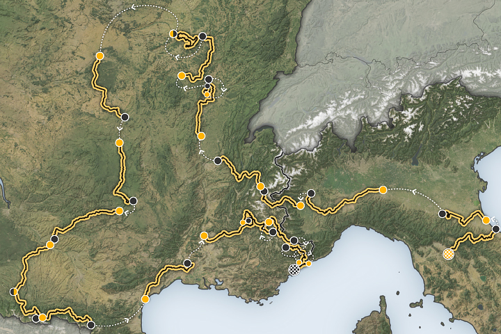
The Earth Observatory has published its last Image of the Day on this website. Please join us on our new home at science.nasa.gov/earth/earth-observatory.
The Arctic lowlands of the Russian Far East are a vast, typically frigid landscape undergirded with permafrost and peat, covered with tundra grasses, and speckled with lakes and meandering rivers. Wolves, foxes, and bears roam here, and semi-nomadic Indigenous communities have long raised reindeer and horses on this land. Increasingly, it’s also a place where wildland fires rage.
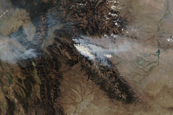
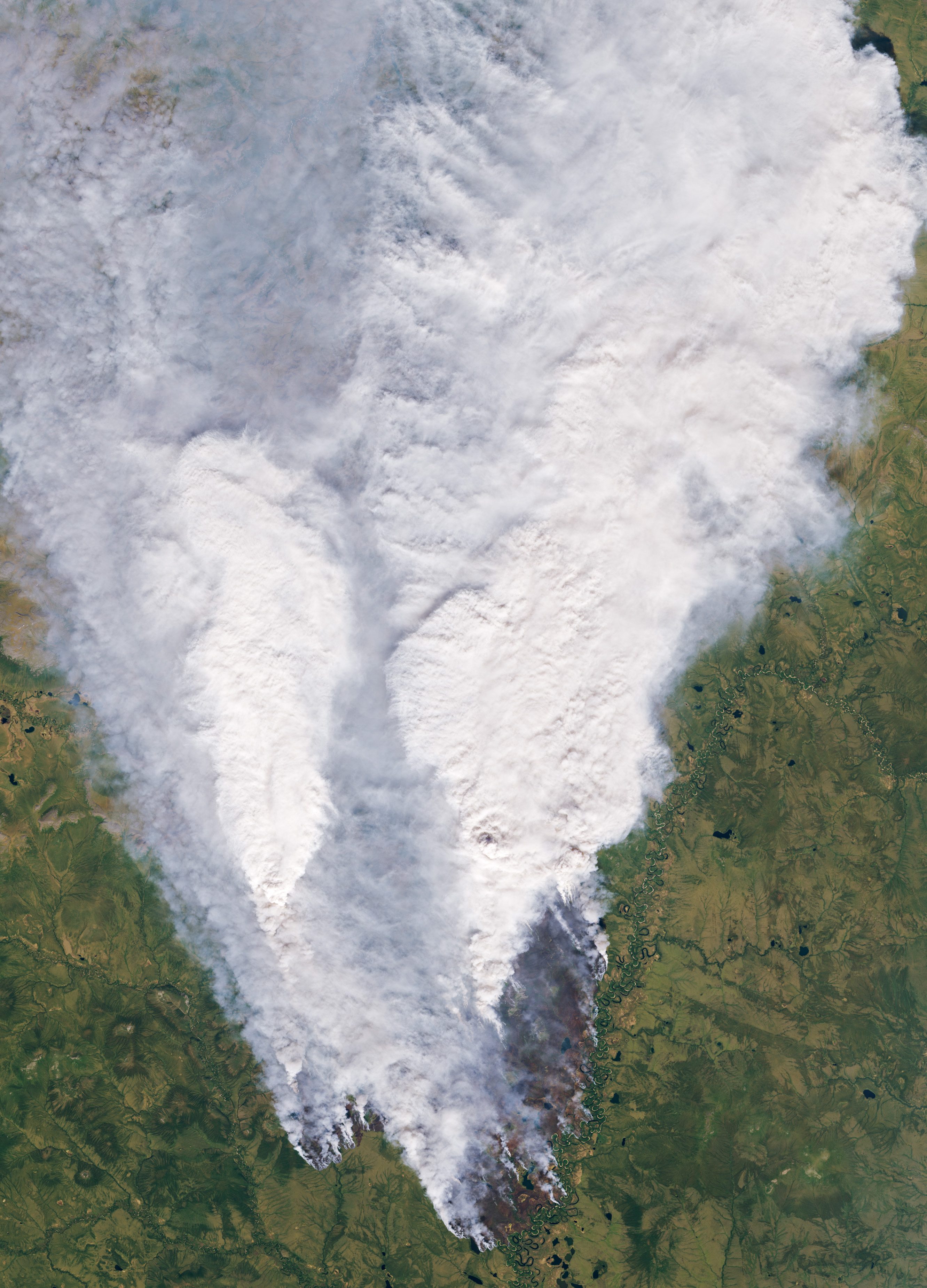
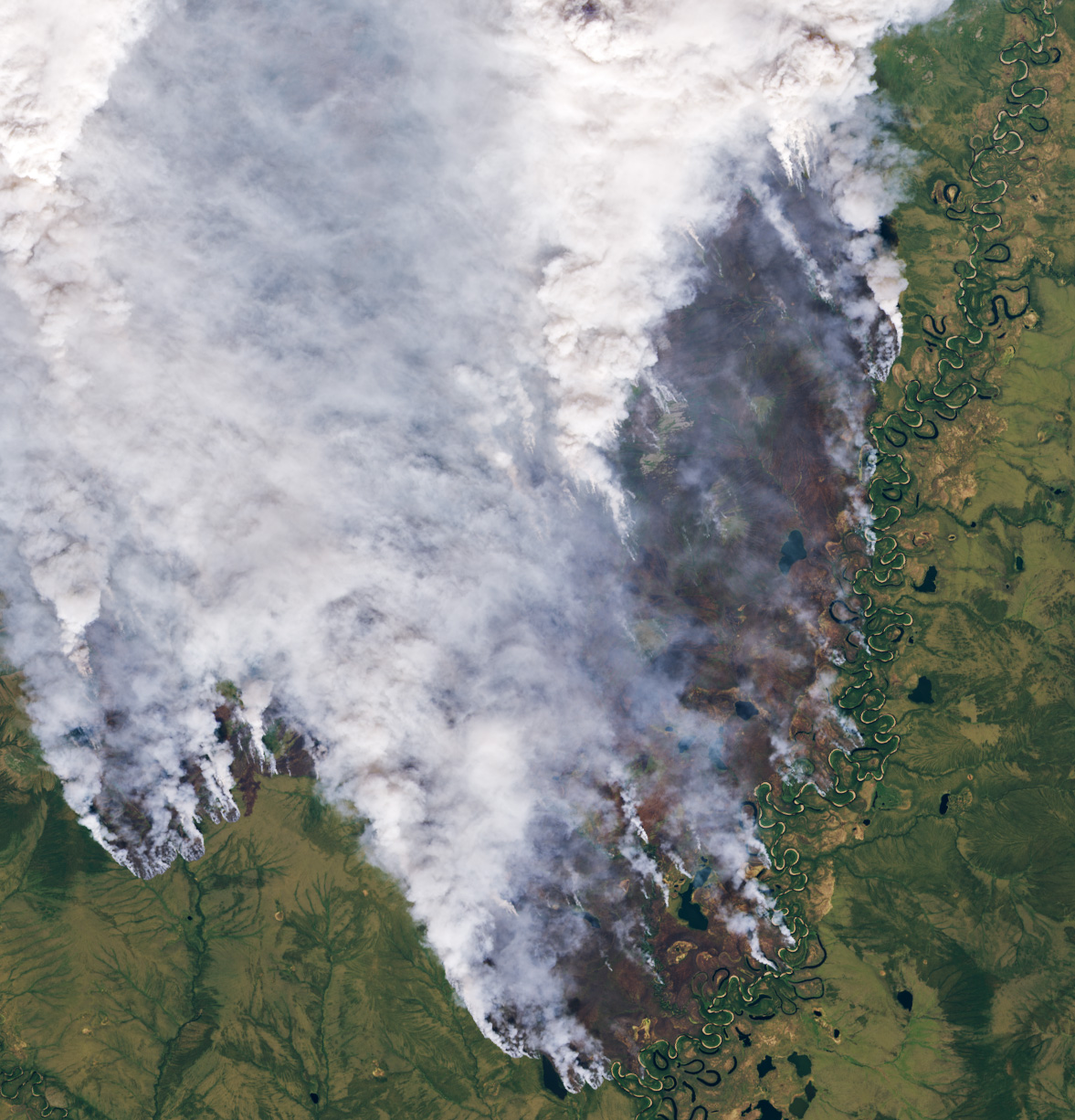
On July 10, 2024, the OLI (Operational Land Imager) on Landsat 8 captured these images of a large fire burning in the Abyysky district of Sakha, a region of northern Russia also known as Yakutia. The fire burned along the Khatyngnakh River in a remote area south of National Park Kytalyk, a UNESCO World Heritage site. Burned areas appear brown. Darker green areas are forested and likely include dwarf larch and birch. Tundra grasses, mosses, and lichen are dominant in the lighter green areas.
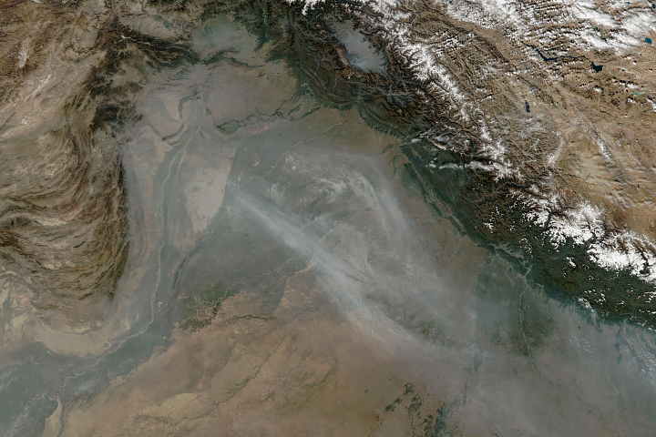
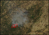
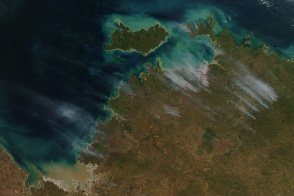
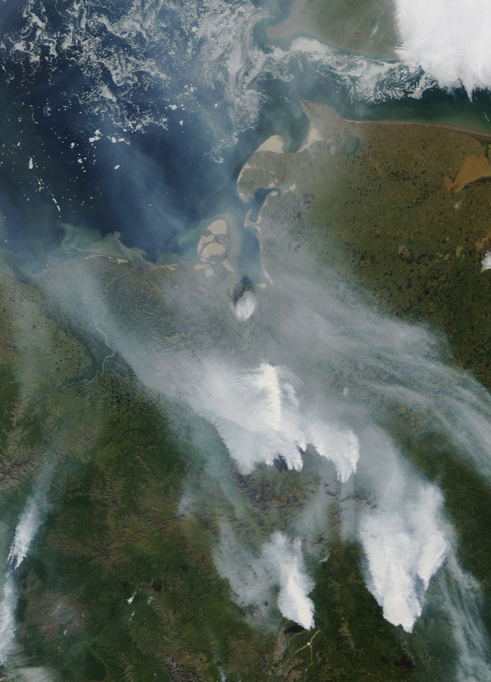
The broader view below was captured on July 15 with the MODIS (Moderate Resolution Imaging Spectroradiometer) on NASA’s Terra satellite. It shows several large fires from the same region burning on land, as bits of sea ice still float in the Laptev Sea to the north.
Seasonal freezing and thawing leaves the landscape littered with distinctive surface features common in areas with permafrost, such as thermokarst lakes, pillar-shaped baydzharakhs and accompanying alas depressions, and dome-shaped hills called pingos (bulgunnyakh in the Sakha language). Spring and summer typically leave the low-lying landscape swampy and water-logged, but meteorological data from ECMWF’s ERA5 and NASA’s MERRA-2 reanalysis models indicate that the area has been unusually warm and dry in recent months. These reanalysis tools combine past short-range weather forecasts from models with real-world observations from satellites, weather stations, aircraft, radiosondes, ships, and ocean buoys.
On July 18, 2024, Russia’s Federal Forestry Agency reported that 69 fires were burning across 276,983 hectares (1,069 square miles) in Sakha. More than 2,000 people were in the region, including hundreds of paratroopers providing firefighting assistance. Sakha is one of nine areas in Russia that have declared a state of emergency due to fires.
The region is mostly populated by the communities of Eveny, Evenki, and Sakha, Indigenous peoples who have lived in the region for hundreds of years. They live in small, dispersed, sometimes semi-nomadic communities where traditional activities include fishing, hunting, foraging, and reindeer herding, said Stanislav Saas Ksenofontov, a postdoctoral scholar at the University of Northern Iowa who studies how climate change is affecting Indigenous communities in the Siberian Arctic. “Devasting fires like this can cut off communities, damage hunting grounds and berry-picking areas, and disrupt reindeer migration routes,” he said.
Most fires in this region are ignited by dry lightning. “Fires are a natural part of boreal and high Arctic landscapes in Sakha and the broader Siberian Arctic,” said Kevin Smith, a U.S. Forest Service plant physiologist and co-author of a 2022 analysis of wildland fire activity in the Siberian Arctic. “However, the frequency, severity, and area encompassed by current wildfire conditions are truly striking.”
Smith and colleagues analyzed roughly two decades of fire detections captured by MODIS sensors and found a three-fold increase in the number of fires and more than a doubling in the total area burned between 2000–2010 and 2010–2020, with the largest changes occurring in the western and central Siberian regions.
Carbon emissions from fires within the Arctic Circle have been much higher so far in June and July 2024 than during this period over the past few decades, according to data shared by Mark Parrington, an atmospheric scientist with the European Centre for Medium-Range Weather Forecasts (ECMWF). Parrington tracks fires for the Copernicus Atmosphere Monitoring Service (CAMS) using a satellite-based data record that began in 2003. CAMS estimates near-real-time wildfire emissions using its Global Fire Assimilation System (GFAS), which aggregates observations of fires made by MODIS.
While Arctic fires result in an immediate release of carbon into the atmosphere, determining their long-term effects on the carbon cycle can be complicated. Tundra fires can disturb soils in ways that make it easier for trees to colonize areas that had previously been dominated by grasses and mosses—a process that draws boreal forests northward and can result in increased carbon storage, noted Smith.
“On the other hand, climate and associated vegetation shifts can result in whole new regimes that reduce the natural storage of carbon by peat bogs and lead to increases in the release of methane, a strong greenhouse gas,” Smith said. “To truly understand the ecological consequences of Arctic fires like these, it’s essential that we track fire activity and ecosystem responses with satellites but also that we follow up with on-the-ground research to better understand the implications.”
NASA Earth Observatory images by Wanmei Liang, using Landsat data from the U.S. Geological Survey and MODIS data from NASA EOSDIS LANCE and GIBS/Worldview. Story by Adam Voiland.