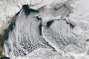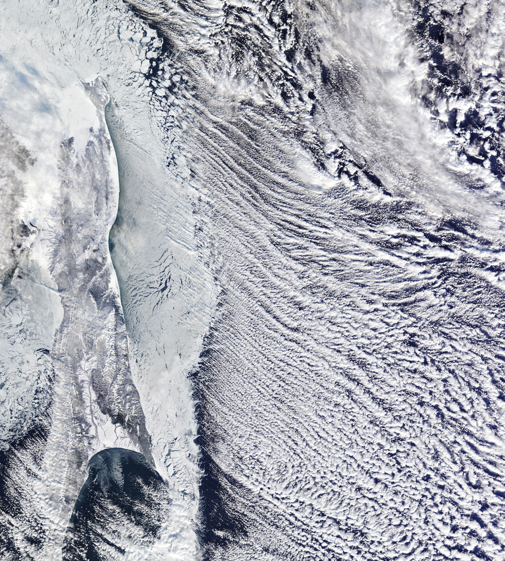
A wintry scene unfolded off the coast of eastern Russia in the waning days of 2023, when parallel lines of cumulus clouds known as “cloud streets” took shape over the Sea of Okhotsk.
The MODIS (Moderate Resolution Imaging Spectroradiometer) on NASA’s Terra satellite captured an image of this atmospheric phenomenon on December 28 at approximately noon local time (01:00 Universal Time). Also visible in this scene are the snow-covered Sakhalin Island and a mass of sea ice extending down its eastern shore.
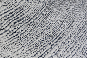
Cloud streets develop in the troposphere when cold, dry air from land moves over the comparatively warm ocean and gains moisture. Where the warm, moist air rises, water vapor condenses to form clouds. Where cooled air sinks adjacent to the clouds, skies are clear. Cloud streets, also known as horizontal convective rolls, are oriented in line with the direction of the wind.
The Sea of Okhotsk is noted for being a factory of clouds and ice, in part due to frigid northwesterly winds blowing from Siberia. Low temperatures in the town of Okha on Sakhalin Island drop to an average of -21 degrees Celsius (-6 degrees Fahrenheit) for the month of January, the coldest month there.
Around the time of this image, the atmosphere above the Arctic was producing clouds with bright iridescent colors found at higher altitudes, in the stratosphere. These ethereal polar stratospheric clouds develop in extremely cold conditions and were recently visible to observers at lower latitudes than usual. The Arctic stratosphere dipped to anomalously low temperatures at the time, according to the MERRA-2 weather reanalysis model maintained by NASA’s Global Modeling and Assimilation Office (GMAO).
NASA Earth Observatory image by Michala Garrison, using MODIS data from NASA EOSDIS LANCE and GIBS/Worldview. Story by Lindsey Doermann.
Parallel rows of cumulus clouds streamed from icy domains out over open water.
Image of the Day for January 3, 2024
View more Images of the Day:

alert message