This story was updated on August 28, 2023, to include new information about the fire.
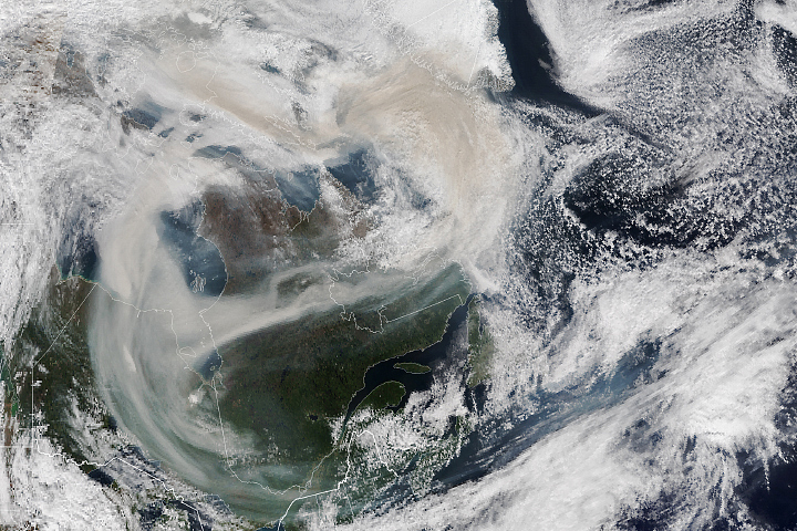
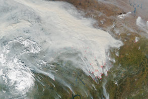
Since May 2023, large clusters of wildland fires burned in several parts of Canada. Months later, the extreme fire activity shows few signs of letting up. On August 28, 2023, the Canadian Interagency Forest Fire Centre (CIFFC) reported that 675 fires were out of control, with especially large numbers of fires burning in Yukon, British Columbia, and the Northwest Territories.
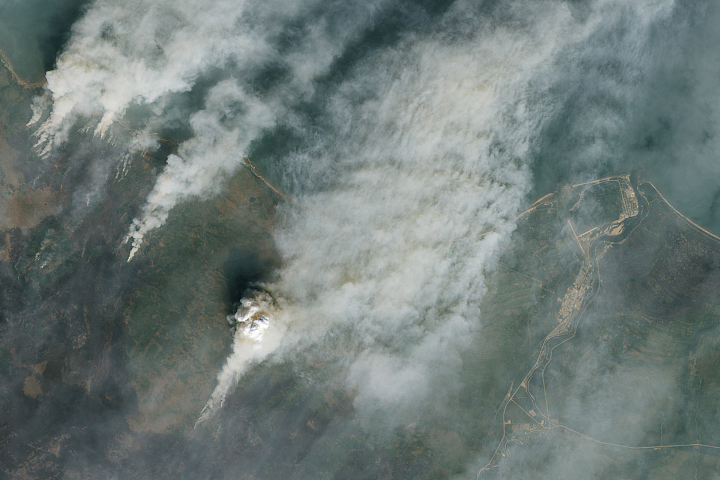
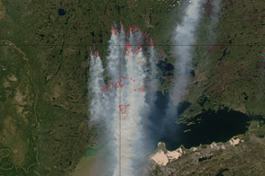
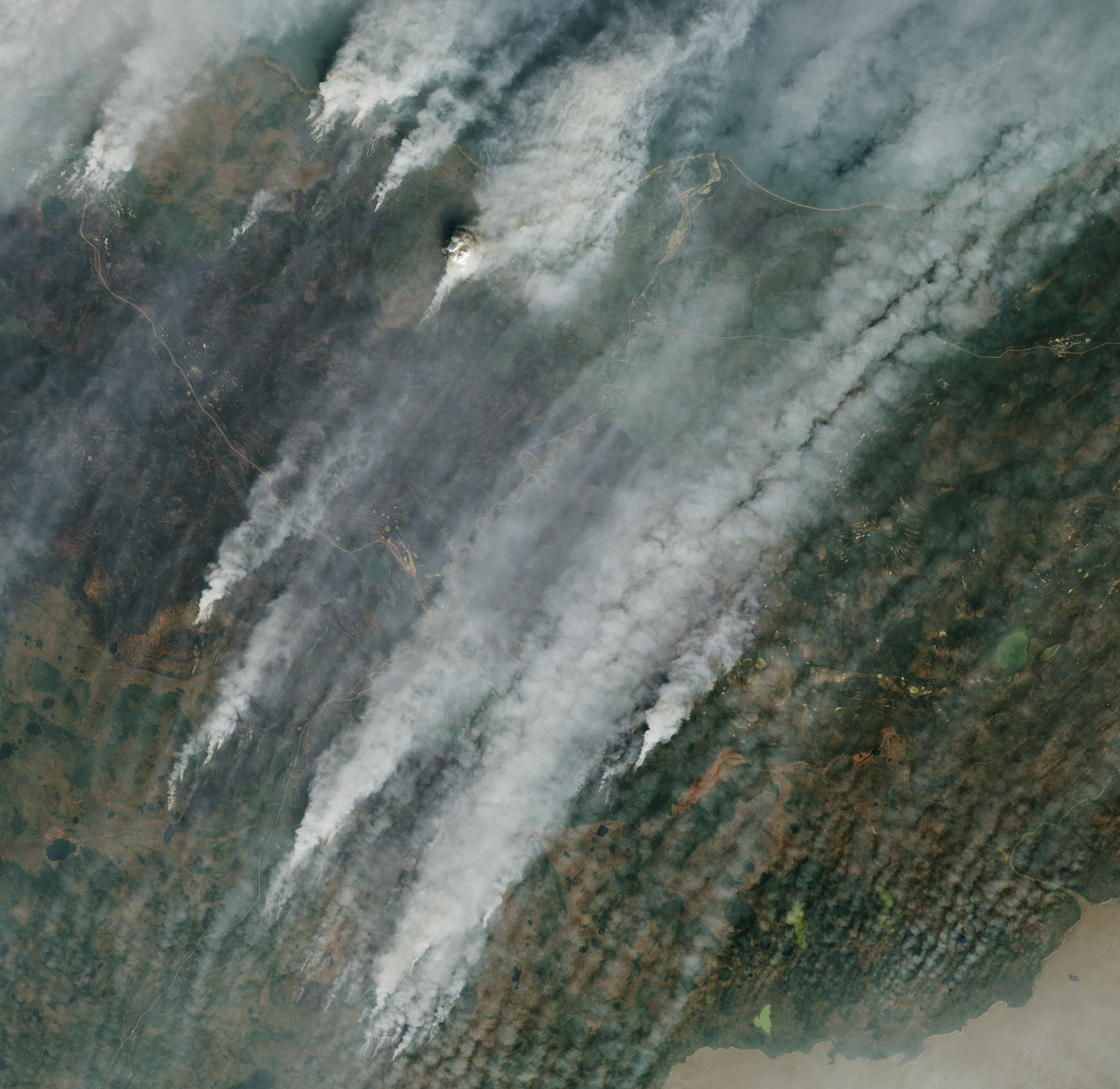
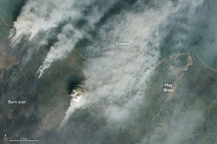
The Operational Land Imager-2 (OLI) on Landsat 9 captured this image of a large wildfire charring forests in the South Slave region of the Northwest Territories on August 24, 2023. At the time, the blaze was pushing northeast toward Hay River, a town of about 3,000 people along the south shore of Slave Lake. The same fire recently overran Enterprise, a small community in the area. The image below shows a more detailed view of part of the fire as it burned near Hay River on August 24.
Canadian authorities have issued evacuation orders for Enterprise, Hay River, Fort Smith, and the K’atlodeeche First Nation area. As of August 28, the fire had reached as close as 1 kilometer (0.6 miles) to Hay River’s airport and 1.5 kilometers west of the town center, according to local authorities. Firefighters have used controlled burns, bulldozers, helicopters, pumping equipment, and other tools to prevent the fire from reaching Hay River. However, buildings in small settlements to the south of the city, including Paradise Gardens and Patterson Road, were damaged when the fire flared up over the weekend in the midst of winds that reached 70 kilometers (45 miles) per hour at times, according to CTV News.
Daily satellite observations of the fires are available through NASA’s Worldview and Fire Information for Resource Management System (FIRMS) browsers. Both tools have daily maps that show the locations of hot areas associated with the fires as detected by the Moderate Resolution Imaging Spectroradiometer (MODIS) and Visible Infrared Imaging Radiometer Suite (VIIRS) sensors. The latest data show active fires just to the west of Hay River.
Canada is facing one of the worst fire years it has seen in decades, according to data published by the CIFFC. More than 15.1 million hectares (37.3 million acres) had burned as of August 25, seven times the 25-year average.
NASA Earth Observatory images by Lauren Dauphin, using Landsat data from the U.S. Geological Survey. Story by Adam Voiland.