

On July 10, 2023, lava began to spill from the Fagradalsfjall volcanic system in southwestern Iceland, marking the third consecutive summer of activity at the volcano. The latest eruption follows a months-long event in March 2021 and a weeks-long event in August 2022. Prior to that, the volcano had been quiet for 800 years.
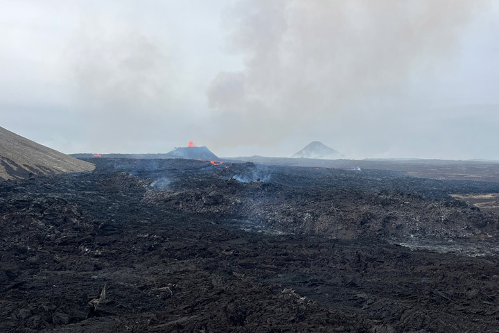
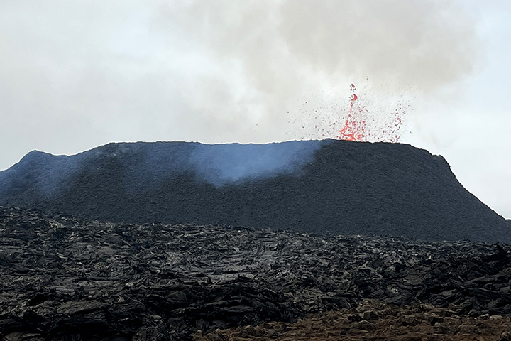
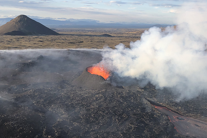
The current eruption is centered near Litli-Hrutur, a small 312-meter (1,024-foot) peak on the Reykjanes Peninsula several kilometers northwest of Fagradalsfjall’s two prior eruption locations. In the first hours of the 2023 eruption, the earth split open and fountains of lava spilled from new fissures as plumes of sulfur dioxide and other volcanic gases billowed kilometers above the ground. After this initial burst of activity, the eruption calmed. The length of the main fissure shrank from 800 meters to about 75 meters and much of the activity became limited to one spatter cone (seen in the photo below) along the northern edge of the fissure.
The false-color image of fresh lava flowing south (top of the page) was acquired on July 17, 2023, by the Operational Land Imager-2 (OLI-2) on Landsat 9. The image includes a combination of visible and infrared light (bands 6-5-3), which helps distinguish the heat signature of the lava. Warm areas—the new lava flows—appear bright yellow and orange. Cooled lava flows from previous eruptions appear black.
Scientists from the Institute of Earth Sciences at the University of Iceland calculated that the eruption was discharging about 12 cubic meters of lava per second on July 17. The rate is similar to what was seen in the two earlier eruptions.

Water vapor, carbon dioxide, and sulfur dioxide are the three most abundant gases found within volcanic plumes. Scientists closely watch sulfur dioxide because it can contribute to air quality problems and acid rain. “Based on satellite and ground-based data, emissions of sulfur dioxide from Fagradalsfjall are in the range of several thousands of tons per day—similar to the 2021 and 2022 eruption,” said Simon Carn, a volcanologist at Michigan Tech and member of a NASA team that monitors sulfur dioxide emissions.
Several satellite sensors, including the Tropospheric Monitoring Instrument (TROPOMI) and the Ozone Monitoring Instrument (OMI), monitor sulfur dioxide emissions from volcanoes around the globe. Winds have mostly pushed the plume southwest and over the Atlantic Ocean, though pollution has at times looped back and affected air quality in nearby Reykjavík.
One unusual aspect of the eruption has been the size and longevity of wildfires that have spread outward from the lava flow. The smoldering fires have crept along the land surface, charring Arctic moss that grows atop old lava flows and generating large amounts of white smoke near the surface. Evgenia Ilyinskaya, a volcanologist at the University of Leeds, described the smoke from the fires as “nasty,” “dense,” and “acrid” after spending several days on the ground taking air quality samples.

The photograph above, taken by a member of the University of Leeds team, shows one of their jeeps engulfed in wildfire smoke. The team also captured the drone image below, which shows a line of moss fires smoldering beyond the volcanic plume.
“Depending on the strength and direction of the wind, the volcanic plume is generally more discrete and rises much higher into the atmosphere than the smoke generated by the wildfires,” explained Laura Wainman, a graduate student with the University of Leeds team. “It’s much easier to see the volcanic plume from above with satellite imagery, whereas on the ground the experience is dominated by the wildfire smoke.”

The moss fires, primed to burn because of unusually dry weather in recent weeks, have charred more than 250 hectares. That makes them the largest moss fires Iceland has seen in modern records, according to the Icelandic Institute of Natural Science. Since moss lacks roots like some other vegetation that grows in the area, it will be particularly slow to recover. Other common plants that grow in this area include heather and grass willow.
As of July 31, fresh lava covered roughly 1.5 square kilometers—an area equivalent to about 280 American football fields. Data from the Institute of Earth Sciences at the University of Iceland shows that the discharge rate for lava declined from 18 cubic meters per second on the first day of the eruption to 5 cubic meters per second on July 31, a sign that the eruption may be slowing.
NASA Earth Observatory image by Wanmei Liang, using Landsat data from the U.S. Geological Survey. Photographs courtesy of Laura Wainman (University of Leeds) and Adam Voiland (NASA Earth Observatory). Story by Adam Voiland.