The melting of winter snowpack and breakup of river ice caused damaging floods along the Yukon, Tanana, Kuskokwim, and other Alaskan rivers over several weeks in May 2023. Alaska’s governor declared a state of emergency on May 13 in response to the widespread impacts on riverside communities.
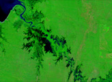
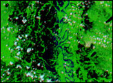
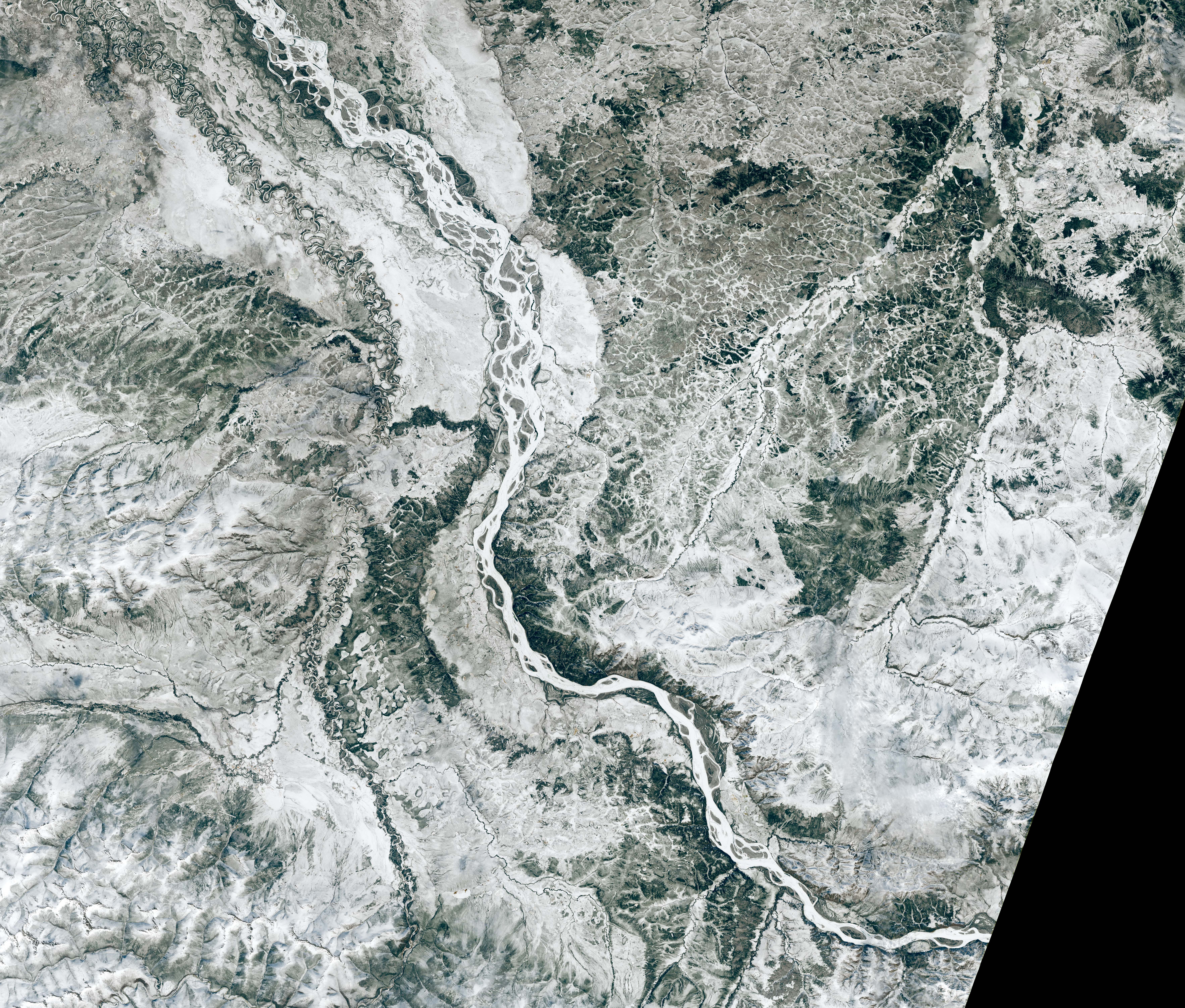
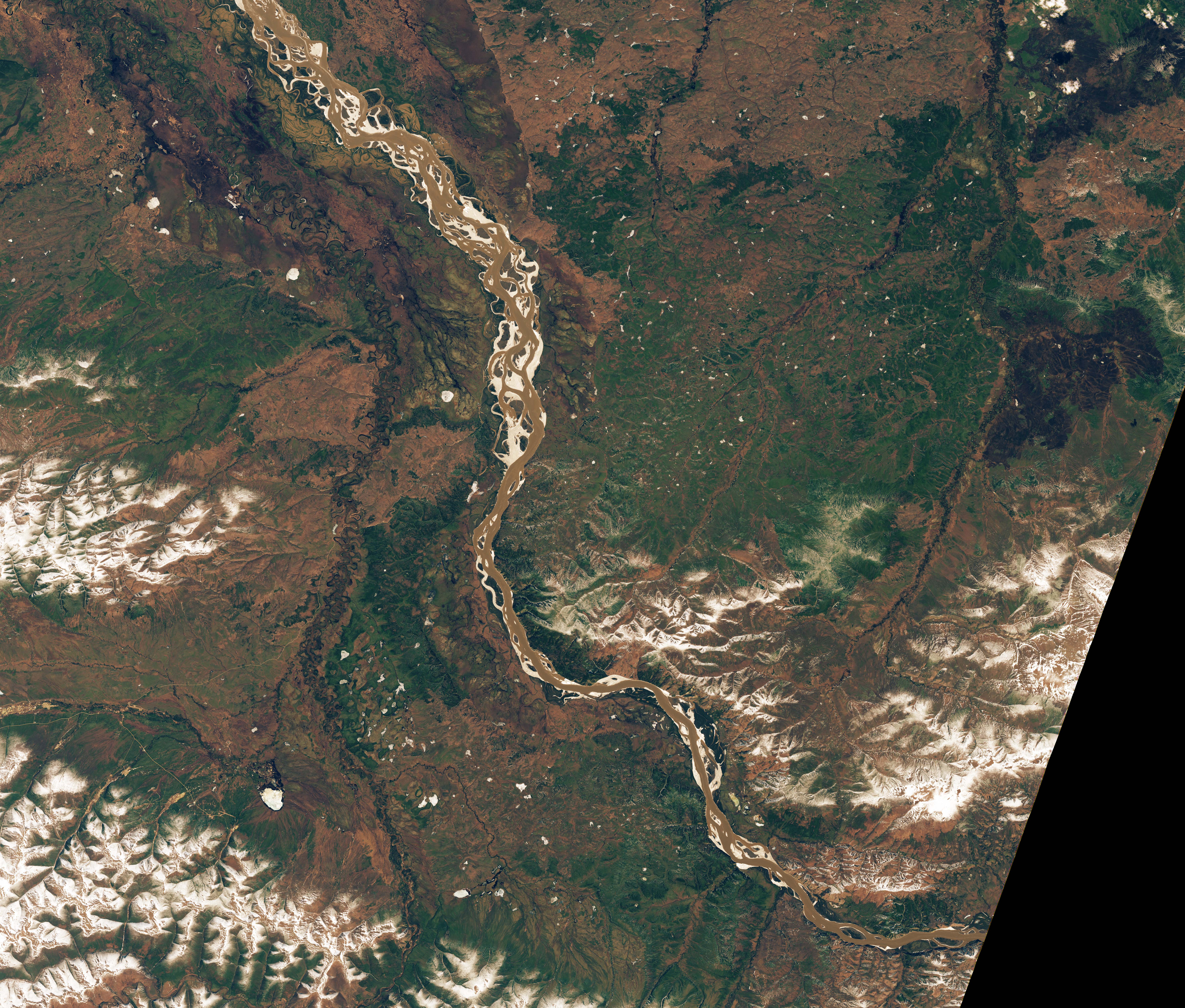
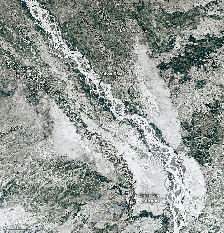
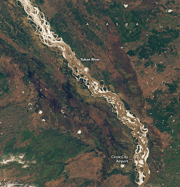
These images reveal a rapidly transformed landscape along the upper Yukon River. The earlier image (left), acquired on May 6, 2023, by the Operational Land Imager (OLI) on the Landsat 8 satellite, shows a frozen stretch of the Yukon River near the town of Circle, Alaska, cutting through the snow-covered landscape. The other image (right), acquired eight days later by the OLI-2 on Landsat 9, shows the land with almost no snow and the river flowing freer until approximately 25 miles (40 kilometers) downriver (northwest) of Circle, near the top of the image.
In the intervening time, the town of Circle underwent dramatic flooding as broken-up ice pushed down the river. Flooding in town started at about 5 p.m. on May 13. “It was reported that the water rose 10 feet in a 30-minute period shortly after that,” said meteorologist Jim Brader of the National Weather Service (NWS) forecast office in Fairbanks.
Ice jams—pieces of broken-up ice that obstruct the flow of a river—often contribute to flooding. The extent to which these jams were a factor in flooding in Circle is uncertain. NWS observers in the field did not find evidence of a single large ice stoppage. Instead, they speculated that flooding in the town could have been due to smaller jams, slower flow where the river becomes braided near Circle, and large amounts of water and debris released from ice jams upriver.
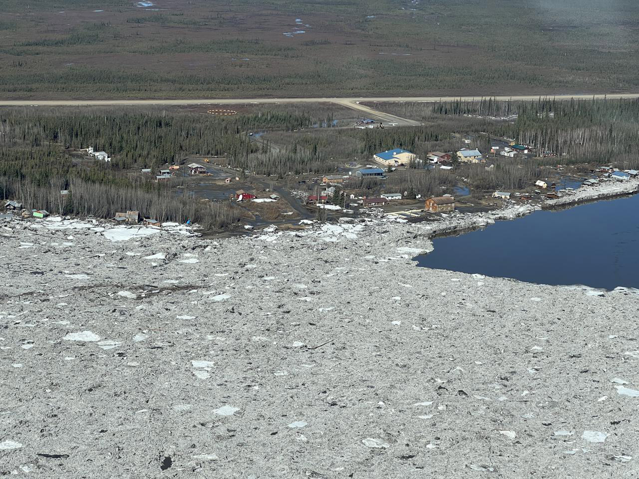
The floodwaters seemed to recede about as quickly as they rose, according to media reports. A pilot observed that the airport tarmac was dry by 10 a.m. the next morning, on May 14. However, buildings and infrastructure in town sustained significant damage, with several homes being knocked off of their foundations. The photograph above, from the NWS Alaska-Pacific River Forecast Center, shows an aerial view of Circle at 2:40 p.m. on May 14.
“Although ice jams happen every year, this year was much worse than average,” said Brader. Flooding to this extent may occur every 10 to 20 years in some locations, he said, but preliminary data indicate that the flood at Circle was near the record level of 1945.
Cooler-than-average temperatures in April followed by a delayed, rapid warm-up in May shoulder much of the blame. An above-average winter snowpack also contributed to the floods’ severity. Temperatures rose while much of the snow and ice was intact, setting off what is known as a dynamic breakup. In this scenario, river ice breaks into large chunks that are more likely to jam up as they move down the river. Runoff from snowmelt adds more water into the system, exacerbating floods. In contrast, a more gradual warm-up results in a thermal breakup, in which ice slowly rots in place and resists forming jams.
The spring breakup caused more flooding along the Yukon River in late May as broken river ice proceeded downstream in fits and starts. The National Weather Service continued to track the location of ice jams and floods.
NASA Earth Observatory images by Lauren Dauphin, using Landsat data from the U.S. Geological Survey. Photograph courtesy of the NWS Alaska-Pacific River Forecast Center. Story by Lindsey Doermann.