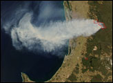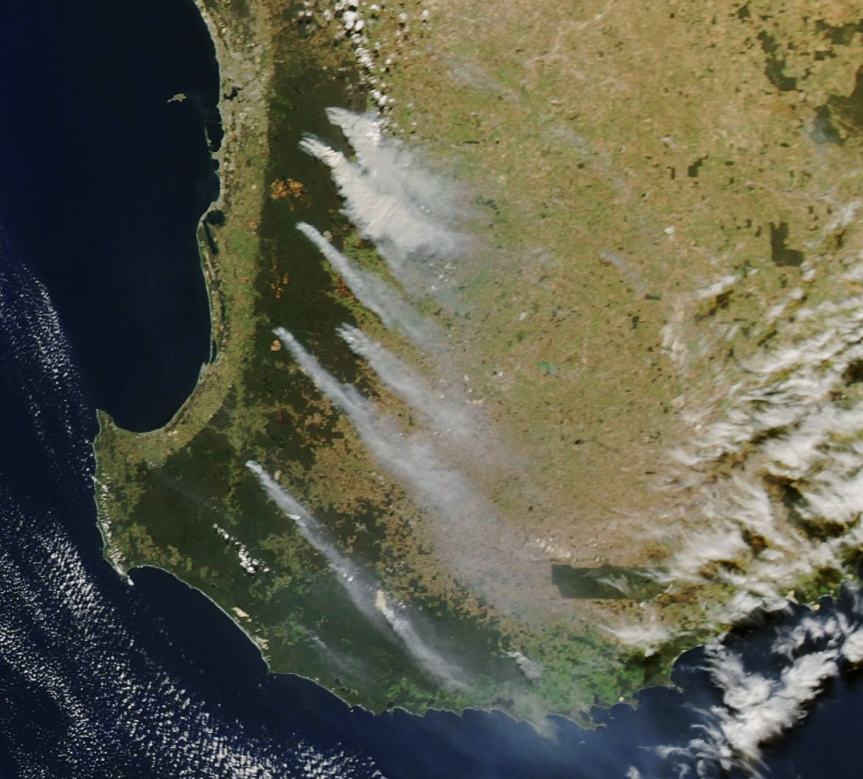
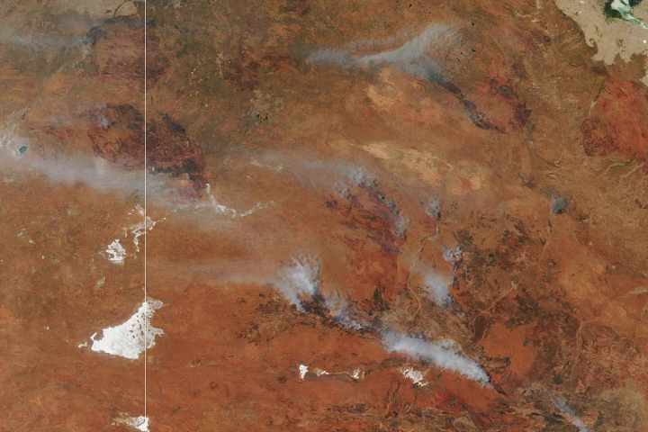
Bushfire season in southern Australia runs through summer and autumn. As the 2022–2023 fire season neared its end, smoke filled the skies south of Perth. Most of it, however, poured from fires that had been ignited intentionally.
The smoke is visible in this image, acquired on April 23, 2023, with the Moderate Resolution Imaging Spectroradiometer (MODIS) on NASA’s Aqua satellite. Most sources of smoke in the MODIS image matched the locations of prescribed burns listed on a map by Emergency WA.
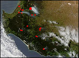
Summer and early autumn 2022–2023 were drier than usual, according to Western Australia’s Department of Biodiversity, Conservation and Attractions (DBCA). But in mid-autumn, plentiful rainfall set the stage for prescribed burning to begin. By the end of April, dozens of blazes were burning across the state’s southwest.
Prescribed burns are intended to reduce the build-up of flammable fuels and reduce the severity of bushfires, according to DBCA’s Parks and Wildlife Service. They can also be conducted with the intent to maintain biodiversity, or to rehabilitate vegetation after the land has been disturbed.
Though the fires were planned with meteorological conditions in mind, winds can still carry the smoke far from the source. In this view, winds moved the smoke plumes toward the southeast, and in some cases over the Indian Ocean.
Not every fire in this image was planned. Smoke from a fire burning near the Lake Muir Nature Reserve (toward the bottom of the image) is likely a bushfire, located just south of a prescribed burn. The Parks and Wildlife Service issued a smoke alert for the area warning of reduced visibility and potential health effects for people with respiratory or cardiovascular illnesses.
Stefan de Haan of DBCA said in a statement: “We thank the community for their understanding where smoke may impact populated areas at times over coming weeks and remind people to slow down, turn on headlights and drive carefully if smoke is affecting visibility on the roads.”
NASA Earth Observatory image by Lauren Dauphin, using MODIS data from NASA EOSDIS LANCE and GIBS/Worldview. Story by Kathryn Hansen.
Wet weather set the stage for prescribed burning to ramp up through April 2023 in the state’s southwest, near Perth.
Image of the Day for April 25, 2023
View more Images of the Day:
In northern Australia, peak bushfire season is during the dry period, which is generally in winter and spring. In southern Australia, the bushfire season peaks in summer and autumn.
alert message