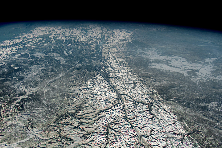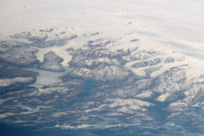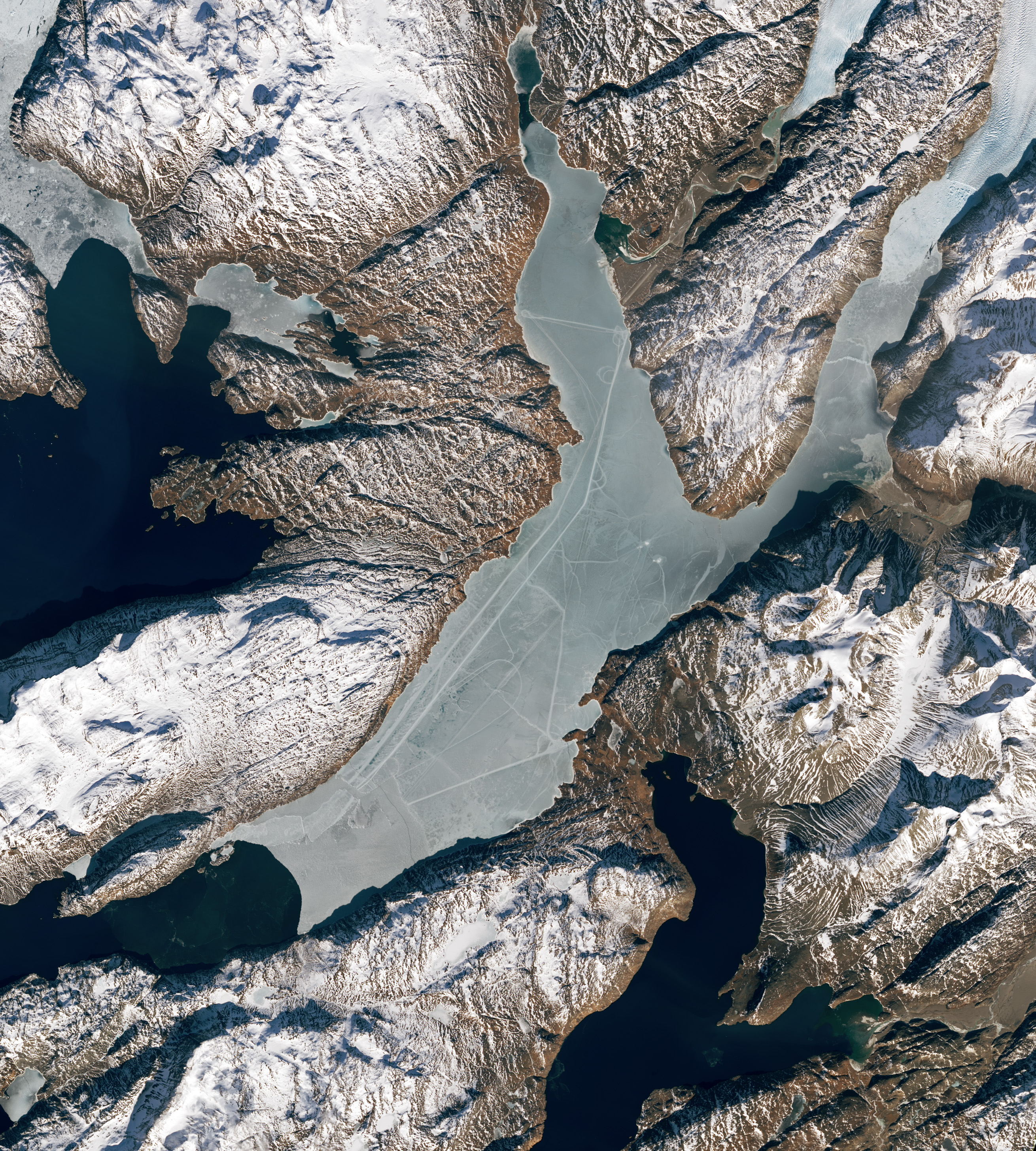
Greenland lacks an obvious human fingerprint when viewed from space. Instead of sprawling cities or geometrically organized agriculture, an enormous ice sheet spans much of the island. But there is a fjord along the island’s southern perimeter where seasonal ice has temporarily revealed the presence of people.
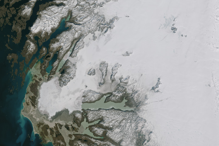
On March 13, 2023, the Operational Land Imager-2 (OLI-2) on Landsat 9 acquired these natural-color images of Tunulliarfik Fjord. The images have been pan-sharpened to bring out more detail.
At the time, the fjord’s waters were capped with a layer of sea ice. Atop the ice there are several long, straight lines connecting the towns of Narsarsuaq and Qassiarsuk, and running the length of the fjord. Though cracks and ridges can form naturally in the ice, there are indications that people were likely involved with producing some of the tracks pictured here.
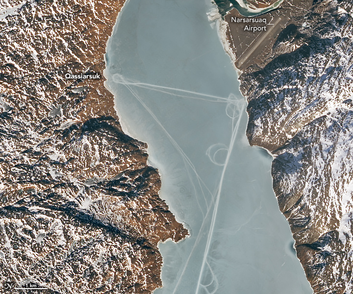
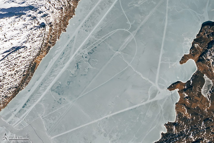
Nathan Kurtz and several other scientists in the Cryospheric Sciences Laboratory at NASA’s Goddard Space Flight Center reviewed the images. Their consensus was that many of the tracks, especially those that include loops, were likely produced by vehicles, such as snowmobiles. “It seems likely that residents from the town or nearby were out on the ice, possibly hunting or traveling,“ Kurtz said.
Traversing the frozen fjord with a vehicle would make sense given its size. The track that connects the small towns of Qassiarsuk and Narsarsuaq, visible in the first detailed image above, spans about 4 kilometers (2.5 miles). The track that runs the length of the fjord is at least 20 kilometers (12 miles) long.
Mixed amid the geometric shapes, some of the “lines” show more variation. They are particularly notable in the second detailed image above. “These look like natural ice deformation features, most likely cracks or ridging due to tidal motion,” Kurtz said.
As spring turns to summer, the snow and ice will loosen its grip on the region. The fjord’s waters are actually ice-free much of the year, except for floating icebergs that have broken off from the glacier to the north. And as snow melts from the land, white will be replaced with hints of green. Qassiarsuk is within the Kujataa World Heritage Site, which is recognized as the earliest Arctic landscape to have been farmed.
NASA Earth Observatory images by Lauren Dauphin, using Landsat data from the U.S. Geological Survey. Story by Kathryn Hansen.