The Earth Observatory has published its last Image of the Day on this website. Please join us on our new home at science.nasa.gov/earth/earth-observatory.
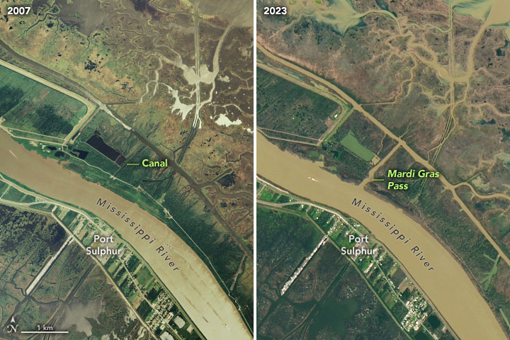
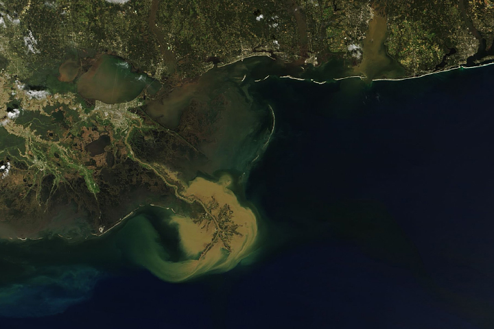
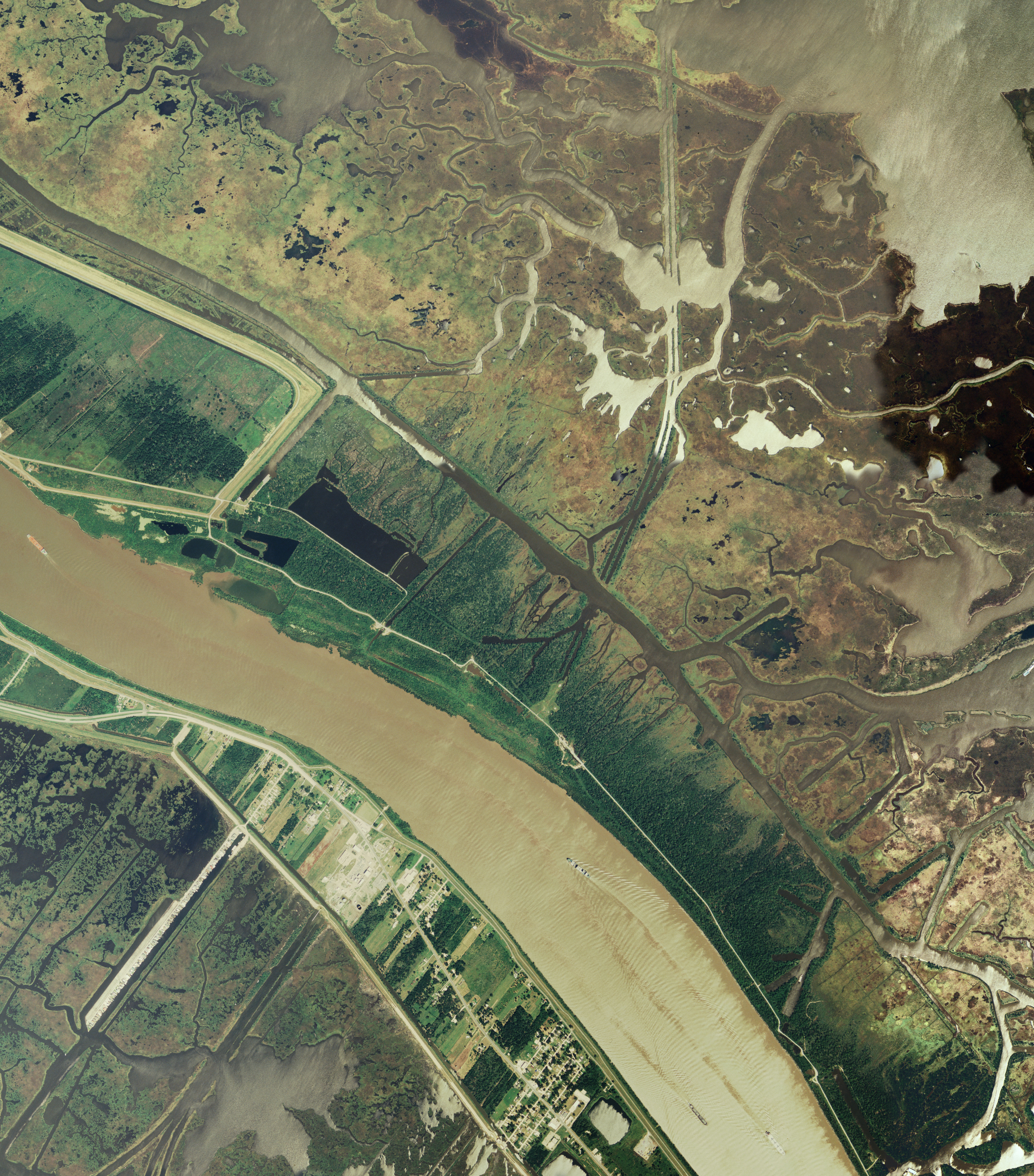
In February 2012, about 35 miles southeast of New Orleans, the Mississippi River broke through its eastern bank and created a new channel to the Gulf of Mexico. The 32-foot- wide and five-foot-deep breach occurred during Mardi Gras season, which prompted the Lake Pontchartrain Basin Foundation to name the channel Mardi Gras Pass. This small, free-flowing distributary began to contribute new sediment, freshwater, and nutrients to the wetlands of Louisiana.
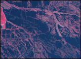
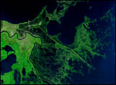
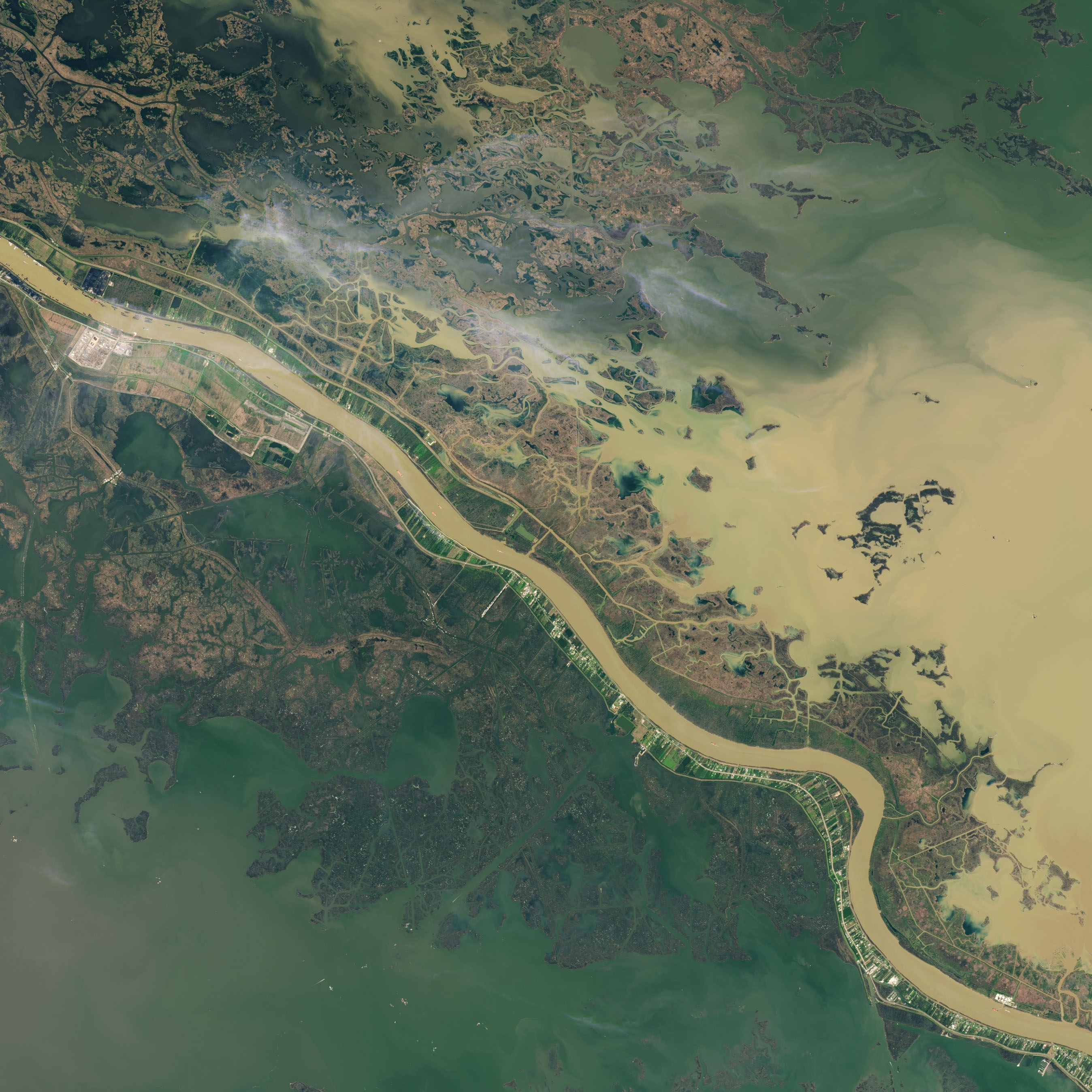
The right image, acquired by the Operational Land Imager (OLI) on Landsat 8, shows the pass in February 2023. The left image, acquired in September 2007 via aircraft for the National Agriculture Imagery Program (NAIP), shows the canal that predates the pass.
Mardi Gras Pass is located on the east bank of the Mississippi River in an area known as the Bohemia Spillway, which was created in 1926 with the removal of artificial levees. The spillway allows floodwater to spill over the bank of the river and relieve pressure on levees upstream. A few months after it was created, the catastrophic 1927 Mississippi River flood inundated parts of seven states, including Louisiana.
Outside of the levee system, the river is contained only by the buildup of sediment on the river’s banks. Mardi Gras Pass first began to develop during significant flooding along the Mississippi River in 2011, which spilled over the banks, washed away a section of road, and connected two existing canals (seen in the 2007 image). The channel continued to erode until it broke through the riverbank around the time of Mardi Gras, on February 21, 2012, creating a free-flowing distributary.
“Mardi Gras Pass is an example of the river moving to a wilder state,” said Alex Kolker, associate professor of coastal geology at the Louisiana Universities Marine Consortium.
Before the Mississippi was leveed, its floods would deposit sediment over the landscape, replenishing South Louisiana’s wetlands. The levees that bind the river to its current path prevent sediment from replenishing wetlands, which contributes to wetland loss in the state. (Subsidence, sea level rise, oil and gas exploration, and climate change also play a role.) Instead, the sediment flows to the end of the river—known as the bird’s foot—after which much of it is carried off the continental shelf.
Mardi Gras Pass allows the river to deposit sediment to wetlands closer inland, in shallower water, where it can build land effectively. And even though the pass wasn’t engineered, its formation allows researchers to better understand how man-made distributaries of the river—also known as sediment diversions—could benefit wetlands in the region.
Kolker and colleagues use Landsat and other satellites to estimate how sediment diversions impact wetland loss and gain in South Louisiana. In a 2017 paper, Kolker found that diversions can be useful in building new wetlands that aren’t easily eroded.
Although Mardi Gras Pass is a fairly small distributary, observations by the Lake Pontchartrain Basin Foundation indicate that its discharge is contributing to land building in Plaquemines Parish.
NASA Earth Observatory images by Joshua Stevens, using Landsat data from the U.S. Geological Survey and NAIP imagery from the U.S. Department of Agriculture. Story by Emily Cassidy.


