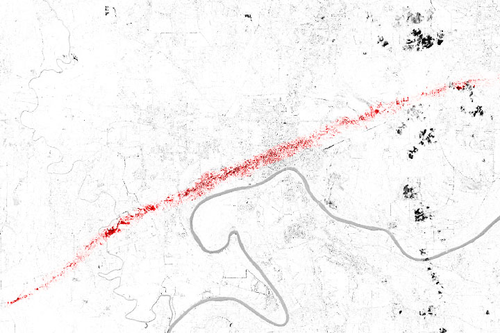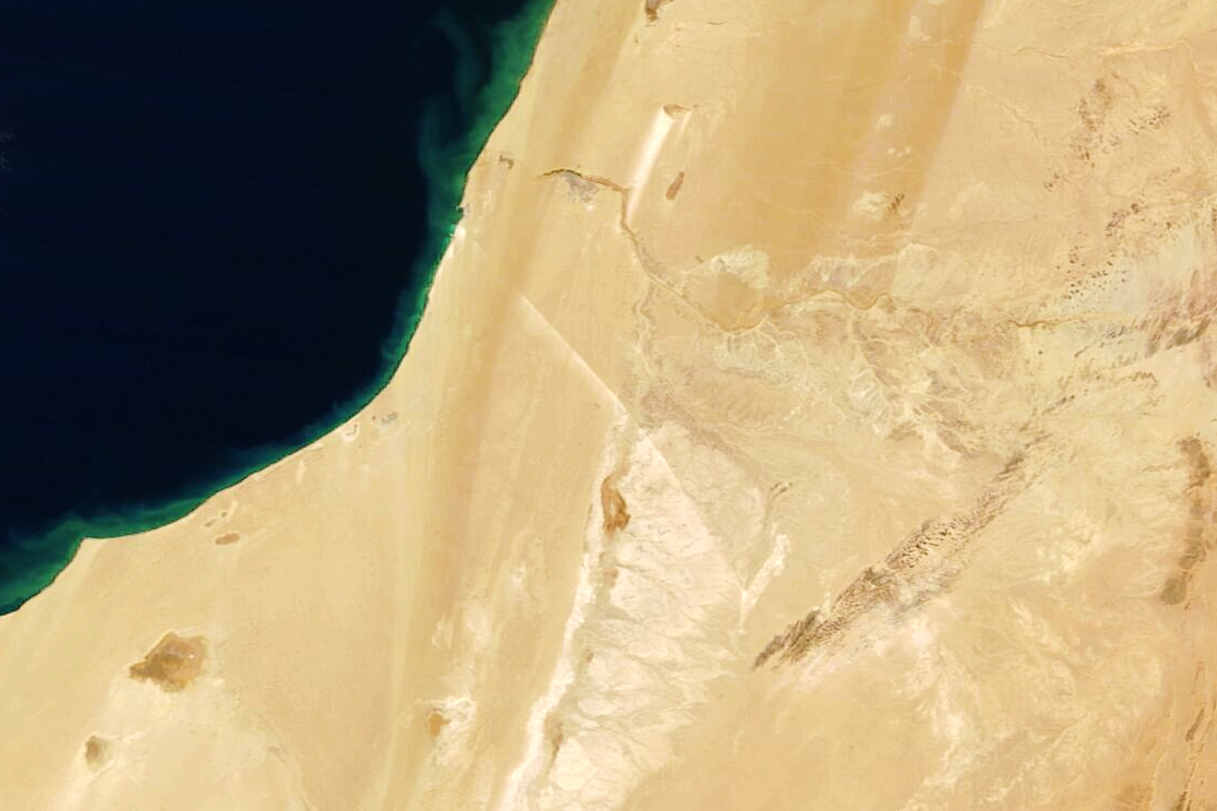
On the western edge of the Sahara Desert, a 61-mile-long white line cuts across the sand. This conspicuous line is the world’s longest conveyor belt system, which traverses Western Sahara’s desert from the Bou Craa phosphate mine to the coastal town of El Marsa near Laayoune. The conveyor belt helps transport a critical mineral from remote parts of northern Africa to farmlands across the world, including to the United States.
Phosphorous is a fundamental element to all living things and forms the backbone of our DNA. It is also one of three key nutrients used in commercial fertilizers. Most of the phosphorous in these fertilizers comes from phosphate rock, which is mined predominately is China, Western Sahara and Morocco, and the United States.
According to the U.S. Geological Survey (USGS), Morocco and Western Sahara produce about 38 million metric tons of phosphate rock a year, which was 17 percent of global production in 2021. USGS also estimates that this region contains 70 percent of all known phosphate rock reserves on the planet.
White dust from chalky phosphate rock can be seen blowing from the belt structure in the image above, acquired on December 14, 2022 by the Moderate Resolution Imaging Spectroradiometer (MODIS) on NASA’s Terra satellite. The white dust helps the belt stand out from the beige and brown desert landscape.
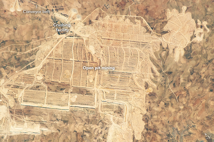
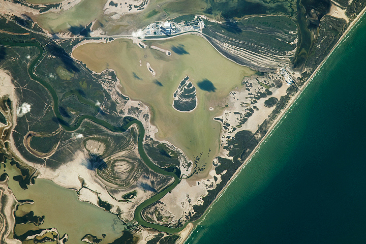
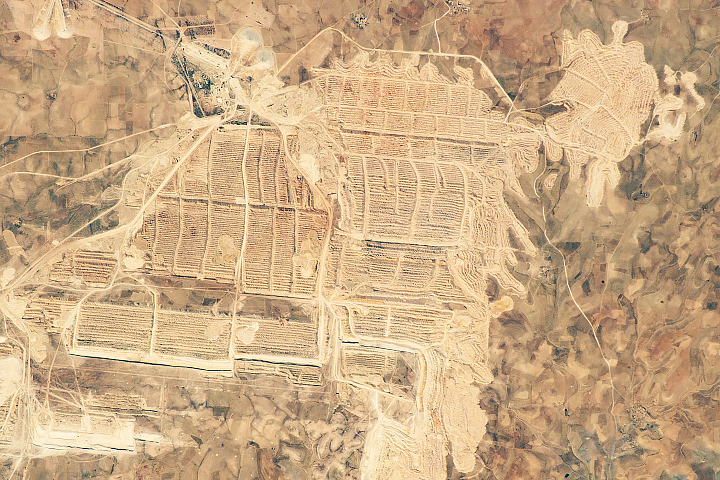
The open pit mine and its conveyor belt, which carries 2,000 tons of phosphate rock an hour, is so conspicuous in the Sahara Desert that it has attracted the attention of astronauts on the International Space Station. An astronaut took a photograph (second image above) of the mine in 2018.
NASA Earth Observatory image by Lauren Dauphin, using MODIS data from NASA EOSDIS LANCE and GIBS/Worldview. Astronaut photograph ISS056-E-32453 was acquired on June 16, 2018, with a Nikon D5 digital camera using a 1600 millimeter lens and is provided by the ISS Crew Earth Observations Facility and the Earth Science and Remote Sensing Unit, Johnson Space Center. The image was taken by a member of the Expedition 56 crew. The image has been cropped and enhanced to improve contrast, and lens artifacts have been removed. The International Space Station Program supports the laboratory as part of the ISS National Lab to help astronauts take pictures of Earth that will be of the greatest value to scientists and the public, and to make those images freely available on the Internet. Additional images taken by astronauts and cosmonauts can be viewed at the NASA/JSC Gateway to Astronaut Photography of Earth. Story by Emily Cassidy.