The Sahara Desert is renowned for its barren, arid landscapes that, in some areas, receive just a few inches (tens of millimeters) of rain per year. Still, when it rains in the world’s largest non-polar desert, it can most certainly pour.
The most recent example of this came in the form of an extratropical cyclone that pushed across the northwestern Sahara on September 7 and 8 and drenched large, treeless swaths of Morocco, Algeria, Tunisia, and Libya—areas that only rarely receive rain.
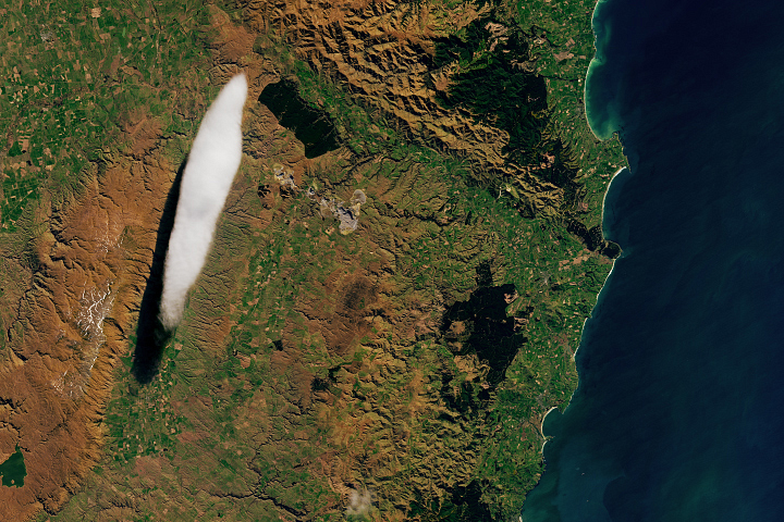
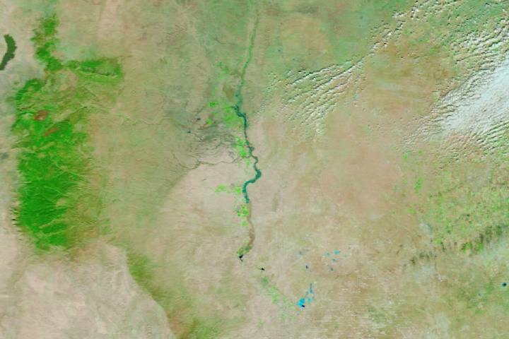
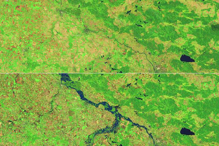
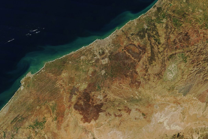
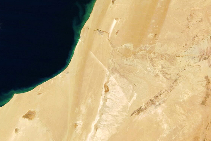
The MODIS (Moderate Resolution Imaging Spectroradiometer) on NASA’s Terra satellite captured this false-color image (right) of the resulting runoff and floodwater on September 10, 2024. The image on the left shows the same area on August 14, before the storm. With this combination of visible and infrared light (MODIS bands 7-2-1), areas covered by water appear dark and light blue. The shade of blue is influenced by the depth of the water and the amount of suspended sediment. Vegetation appears green.
While much of the rain fell in sparsely populated areas, news reports indicated that several villages in Morocco faced destructive flash floods, damaged roads, and disrupted electricity and water supplies.
“While some degree of rainfall in this region happens every summer, what’s unique this year is the involvement of an extratropical cyclone,” said Moshe Armon, a senior lecturer at the Institute of Earth Sciences and the Hebrew University of Jerusalem. The system formed over the Atlantic Ocean and extended far southward, pulling moisture from equatorial Africa into the northern Sahara.
Preliminary satellite analysis shows accumulations of many tens to more than 200 millimeters of rainfall in the areas affected—roughly equivalent to what the region receives in a year. The rainfall accumulation estimates are based on NASA’s IMERG (Integrated Multi-Satellite Retrievals for GPM) data, which is one of the only options for systematically assessing precipitation in the Sahara over broad areas because ground-based rain gauges and radar stations are so scarce.
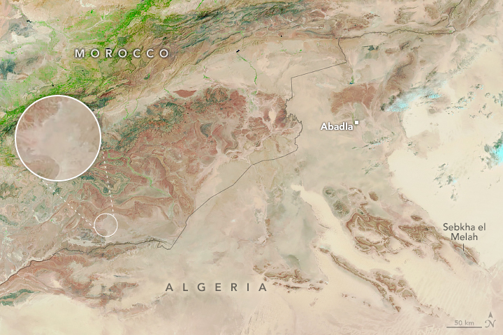
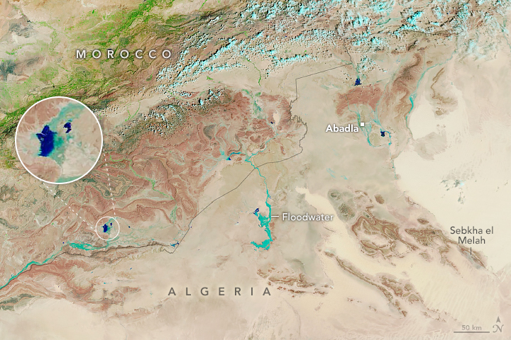
“What’s also fascinating is that normally dry lakes in the Sahara are filling due to this event,” Armon added. Several of these lakes are visible in the image as dark blue areas, including one in Morocco’s Iriqui National Park (shown in detail within the inset circle). One lake Armon is watching especially closely is Sebkha el Melah, a salt flat in central Algeria and the subject of one of his most recent studies.
Armon and colleagues analyzed two decades (2000–2021) of IMERG data to better understand the frequency of heavy precipitation events in this region. Of the hundreds of events that affected this area over that time span, they identified only six prior occurrences that led to the lake filling.
Overall, the researchers identified more than 38,000 heavy precipitation events over the Sahara and found that roughly 30 percent of those, like this event, occurred during the summer. Of these summer events, only a few were associated with an extratropical cyclone.
NASA Earth Observatory image by Michala Garrison, using MODIS data from NASA EOSDIS LANCE and GIBS/Worldview. Story by Adam Voiland.
alert message