The Earth Observatory has published its last Image of the Day on this website. Please join us on our new home at science.nasa.gov/earth/earth-observatory.
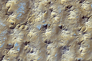
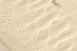
Sculpted by time and fierce Atlantic winds, the Namib sand sea has been on the move for a million years and counting. The fast-moving sands blanket a region of Africa’s southwestern coast where treasures—from diamonds and ghost towns to rare and endangered species—have long captured human imaginations.
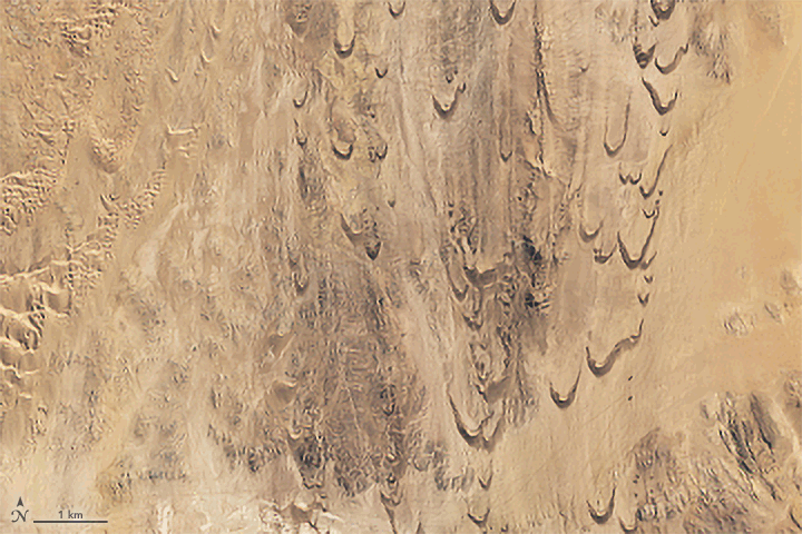
The rapid movement of the dunes is clear in this series of Landsat 8 and 9 images acquired between 2013 and 2022 (one scene per year). The images show a group of crescent-shaped barchan dunes and more linear transverse dunes located in the Sperrgebiet region of the southern Namib desert. The dunes have migrated northward by several kilometers in recent decades, driven primarily by the region’s persistent south-southwest winds.
Researchers from the Desert Research Institute and the Smithsonian Institution used satellite observations from the Advanced Spaceborne Thermal Emission and Reflection Radiometer (ASTER) on NASA’s Terra satellite to study the motion of the dunes over an eight-year period and found that the average rate at which the dunes in this area moved ranged from 7 to 32 meters (23 to 105 feet) per year.
Large dunes tended to preserve their shape, moving at an average of about 9 meters per year, according to the researchers. Some of the smaller dunes were much faster, with some moving as quickly as 83 meters (272 feet) per year. Unlike the larger dunes, the smaller dunes tended to appear and disappear. Tracking dunes with satellite images over years and decades reveals smaller dunes regularly popping up and passing larger crescent-shaped barchan dunes.
“This is a very high energy wind regime with strong southerly winds, especially in austral summer. It’s one of the windiest desert regions in the world,” said Nick Lancaster, a dune expert and emeritus research professor at the Desert Research Institute. “As a result, the Sperrgebiet dunes are among the fastest-moving dunes in the world.”
Small dunes migrate more rapidly than large ones because there is simply less material to move, Lancaster added, noting that migration occurs because sand is eroded from the upwind (stoss) side of dunes and deposited on the lee (slipface).
“Knowing how to track dune movement remotely is important because there are places in Peru, Egypt, Qatar, and other countries where migrating barchans can damage infrastructure and crops,” explained study coauthor Stephen Scheidt, now a researcher based at NASA’s Goddard Space Flight Center. “It’s also useful for developing and testing models of how the winds and the atmosphere work on both Mars and Earth.”
Over millennia, a variety of environmental factors have shaped Namibia’s dunes and controlled the rate of flowing sand. These include sea level, coastal geography, and changing wind patterns. “The topography is such that the dunes and winds are funneled through wind-eroded troughs in the bedrock,” said Lancaster. Then, as now, Namibia’s dunes are primarily fed from the ancient sands near the Orange River, which forms the southern edge of Namibia, in a semi-desert landscape dubbed the “forbidden area,” or Sperrgebiet, by German diamond miners in the early 20th century.
It was those prized diamond deposits that kept much of the area off-limits to the public for more than a century. Namibia’s ministry of environment and tourism has said that many of the relics of Sperrgebiet’s diamond rush—from abandoned dance halls to rusting railroad fragments—will be conserved “to stand as a haunting testament to mankind’s tenacity, greed and love of beauty until the shifting sands finally swallow them.”
NASA Earth Observatory image by Joshua Stevens, using Landsat data from the U.S. Geological Survey. Story by Sally Younger.