
Surrounded by mountains and volcanoes, the Valley of Mexico was once the catchment for a group of five connected lakes that served as the backdrop for ancient city-states and empires, including Teotihuacan (800 B.C.E. to 800 C.E.), the Toltec Empire (950 to 1150 C.E.), and the Aztec Empire (1300 to 1521 C.E.).
Among them was Lake Xochimilco, which became a flourishing site of a distinctive form of pre-Columbian chinampa agriculture. Farming in the chinampa style involved the construction of small stationary “floating” garden beds separated by canals in shallow lake water. The rectangular beds were typically built using strategically planted willow trees, layers of vegetation, soil, and mud.
Farmers fertilized these raised beds with nutrient-rich muck from adjacent canals, with the technique proving to be a viable way of raising a large amount of food in a small space. In Xochimilco, meaning “where the flowers grow” in the Aztec language of Nahuatl, chinampas were often also used to grow flowers, which played an important role in Aztec culture. During the Aztec era, crops grown in Xochimilco were often shipped to the nearby Aztec capital of Tenochtitlan.
After the Spanish conquered the Valley of Mexico in the 1500s, they started to drain the lakes and chinampas for dry land agriculture. What remained of the lakes was diverted and used up in the 1800s and 1900s. Most of the swampy wetlands and chinampas that remained were eventually covered over by the expansion of Mexico City, which is now home to nearly 22 million people.
Some vestiges of the region’s watery agricultural past have survived. On September 10, 2022, the Operational Land Imager-2 (OLI-2) on Landsat 9 acquired this image showing an intricate network of canals and chinampas in part of the area once occupied by Lake Xochimilco.

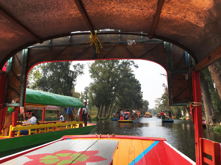
Due to water pollution and other challenges, farmers continue to raise crops on just 2.5 percent of the remaining chinampas in this area, according to reporting from National Geographic. Some canals have instead become tourism hubs, with many visitors exploring Xochimilco’s waterways in colorful boats called trajineras. Residential communities have spread to others. Though many chinampas stand empty and unused, some have been turned into soccer fields or wildlife preserves.
Even the memory of where chinampas were once located has faded in some areas as the fields were silted over and covered by growing cities. However, satellite observations and other forms of remote sensing have played a key role in rediscovering and mapping ancient chinampa areas in recent decades. Among them is a large pre-Aztec network of chinampas that flourished in Xaltocan, a pre-Columbian city-state to the north of Xochimilco. The fields there were covered with sediment and forgotten until archaeologists used aerial photography, Landsat imagery, and Quickbird imagery to produce detailed maps of them.
NASA Earth Observatory image by Lauren Dauphin, using Landsat data from the U.S. Geological Survey. Photograph by Lauren Dauphin. Story by Adam Voiland.