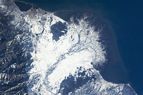
Dust storms are common in dry, sandy places like the Sahara, but they also happen beyond the planet’s desert regions. In autumn, plumes of silt and sand occasionally blow from the Copper River Delta and over the Gulf of Alaska.
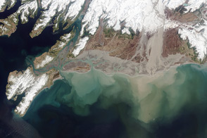
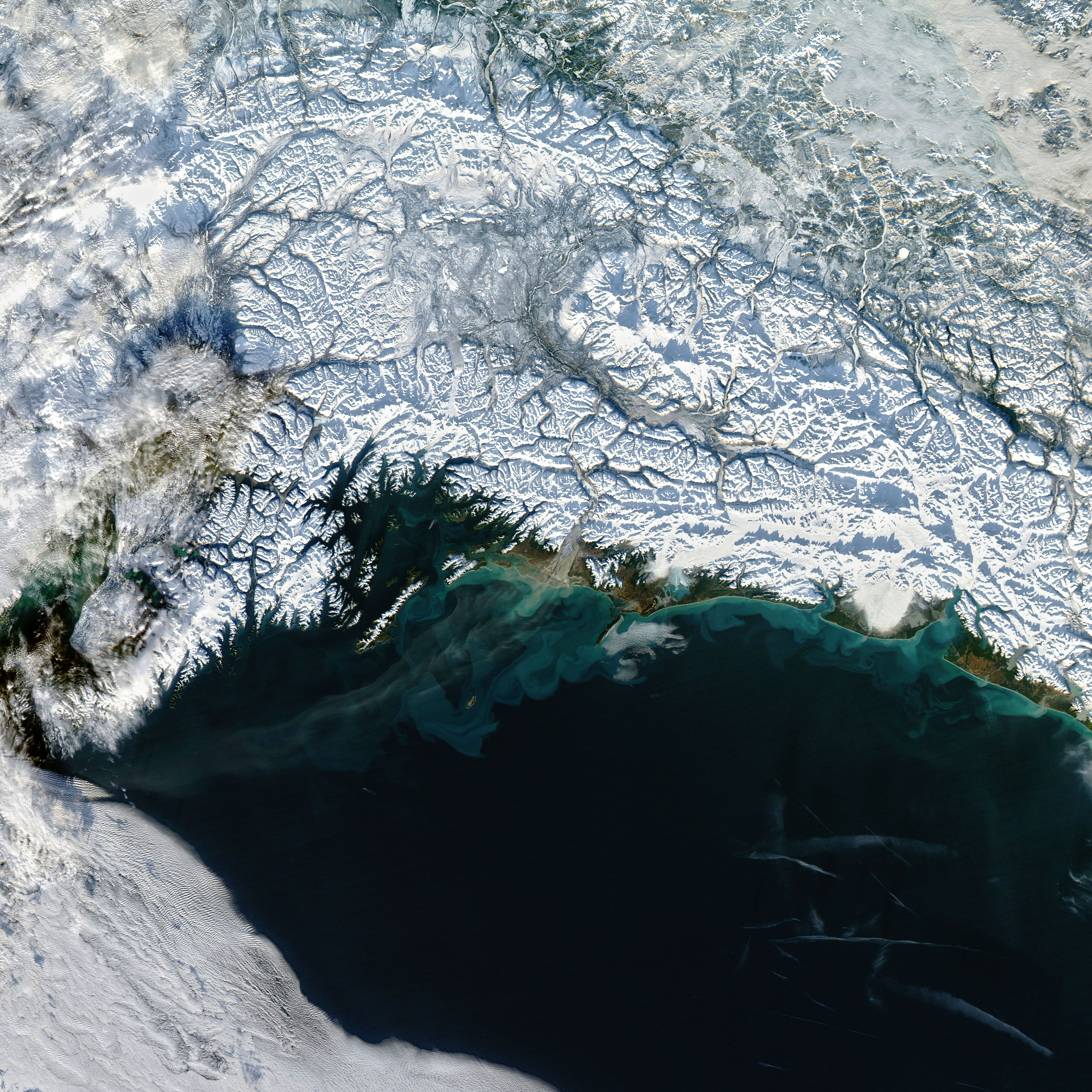
One of these Alaskan dust storms was in progress on November 17, 2022, when the Moderate Resolution Imaging Spectroradiometer (MODIS) on NASA’s Aqua satellite acquired this image. Plumes from the Copper River Delta—and farther upstream in the valley—are most common in autumn, when water levels are low, winds are strong, and snow has not yet blanketed the entire floodplain.
Winds are channeled through narrow mountain gaps and blow offshore. These strong “gap winds ” can quickly dry out the floodplain’s sediments and then loft the particles into the air. Most particles are likely fine-grained loess, which formed as glacial ice moved over the area and ground the underlying rock into a fine silt, or “glacial flour.”
At the time, the dust streamed toward the southwest. Most of it stayed north of Middleton Island, located about 70 miles (110 kilometers) southwest of the delta, where the airport reported clear weather and visibility of up to 10 miles. But the island is not always spared. A significant dust storm in autumn 2018 caused visibility at the airport to drop to 3 miles (5 kilometers).
Dust storms play an important role in delivering iron to the Gulf of Alaska. It is especially important for phytoplankton in the central part of the gulf, where the micronutrient tends to be in short supply.
NASA Earth Observatory image by Joshua Stevens, using MODIS data from NASA EOSDIS LANCE and GIBS/Worldview. Story by Kathryn Hansen.
alert message