
For most of 2022, the world’s ocean basins have been relatively quiet and free of tropical cyclones. This week, Typhoon Hinnamnor shattered the calm, spinning up quickly to category-5 strength in the Western Pacific Ocean. The path of the storm has been erratic and the potential for landfall is currently unclear.
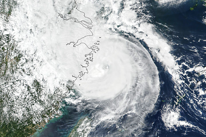
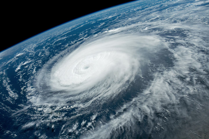
The photograph above was taken in the late morning on August 31, 2022, by an astronaut on the International Space Station. On September 1, 2022, the Moderate Resolution Imaging Spectroradiometer (MODIS) on NASA’s Aqua satellite acquired a natural-color image (below) of Hinnamnor. Though the typhoon appeared to be bearing down on Taiwan in the image, it had actually started to turn north and away from the island.
Around the time of the MODIS image, the U.S. Joint Typhoon Warning Center reported that Hinnamnor had sustained winds of 115 knots (140 miles/220 kilometers per hour), with gusts up to 140 knots. The storm was approximately 600 kilometers (330 nautical miles) south of Okinawa. By the evening of September 2, winds had slowed to 80 knots (90 miles/150 kilometers per hour), with gusts to 100 knots. The storm had only moved about 50 kilometers (30 miles).
On August 30, Hinnamnor became the first category-5 storm on Earth in 2022, as winds reached 260 kilometers (160 miles) per hour. As noted by Yale Climate Connections, it was pretty late in the year for the first storm of such intensity; an average of 5.3 category-5 storms form each year globally.
Forecasters are indicating that Hinnamnor might head for South Korea or southern Japan in the first week of September. Sea surface temperatures are several degrees above average, which could help sustain and strengthen the storm in coming days.
The Western Pacific typhoon season stretches across the entire year, but the majority of storms usually form between May and October. So far in 2022, 13 tropical storms or depressions have formed in the basin, of which four have become typhoons.
In the Atlantic Ocean, the month of August 2022 passed without a single hurricane, the first time that has happened since 1997.
NASA Earth Observatory image by Lauren Dauphin, using MODIS data from NASA EOSDIS LANCE and GIBS/Worldview. Astronaut photograph ISS067-E-302073 was acquired on August 31, 2022, with a Nikon D5 digital camera using an 30 millimeter lens and is provided by the ISS Crew Earth Observations Facility and the Earth Science and Remote Sensing Unit, Johnson Space Center. Story by Michael Carlowicz.
Image of the Day Atmosphere Severe Storms
On August 30, the storm became the first category 5 cyclone on Earth in 2022.
Image of the Day for September 4, 2022
An average of twenty tropical cyclones form each year amid some of the world’s warmest ocean waters.


