
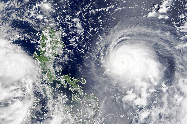
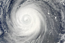
Typhoon Rai crossed the southern and central Philippines on December 16, 2021, having intensified to category 5 strength just hours before landfall. Locally named Odette, the storm was one of the strongest recorded on Earth this year and the sixth to reach category 5.
This natural-color image above was acquired in the early afternoon on December 16 by the Visible Infrared Imaging Radiometer Suite (VIIRS) on the Suomi-NPP satellite. Around the time of this image, the storm had sustained winds of 240 kilometers (150 miles) per hour, a category 4 super typhoon.
News and weather reports indicated that the storm first came ashore in Siargao, a popular island for tourism, with sustained winds around 195 kilometers (120 miles) per hour, before crossing over several other islands. About 100,000 people evacuated their homes before Rai arrived. An estimated 30 million people live in the central and southern islands of the Philippines.
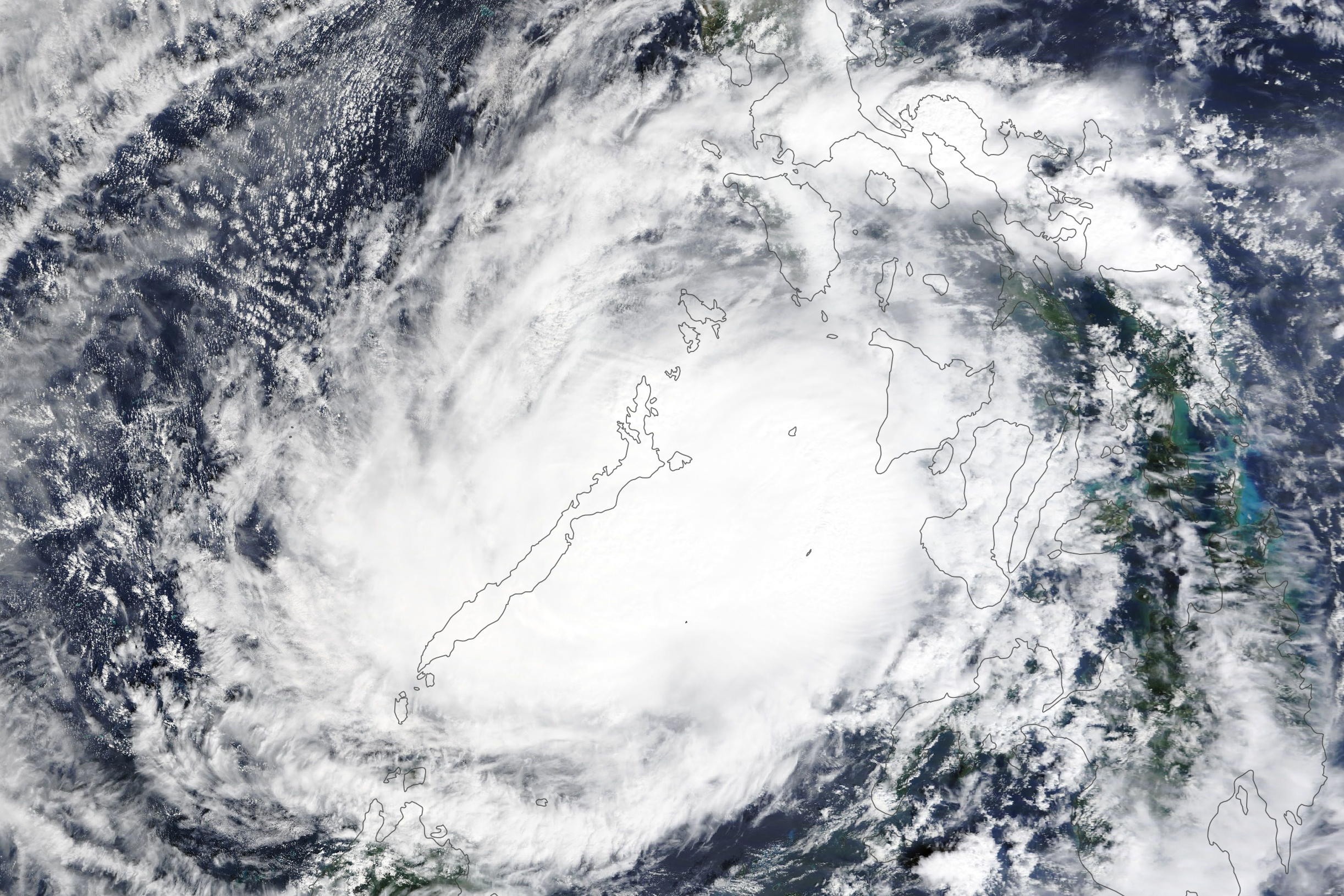
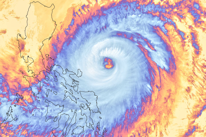
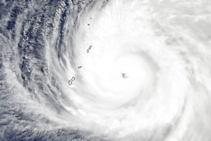
The second image, acquired in the late morning on December 17 by the Moderate Resolution Imaging Spectroradiometer (MODIS) on NASA’s Terra satellite, shows the storm on the western side of the Philippines as it started to track northwest. Sustained winds were still whipping at 180 kilometers (110 miles) per hour.
Forecasters from the U.S. Joint Typhoon Warning Center predicted that the storm would head toward Vietnam and southern China in the coming days.
Rai (Odette) is the 15th typhoon to pass through or close to the Philippines this year. The archipelago typically sees more landfalling storms annually than any other place on Earth.
NASA Earth Observatory image by Lauren Dauphin, using VIIRS data from NASA EOSDIS LANCE, GIBS/Worldview, and the Suomi National Polar-orbiting Partnership. Story by Michael Carlowicz.
alert message


