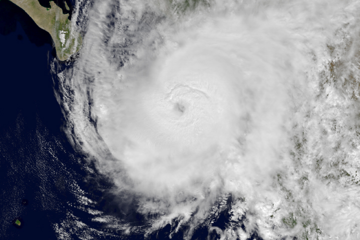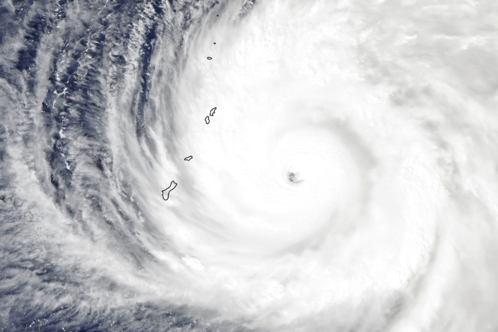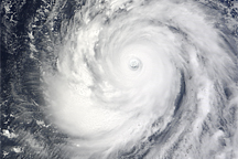
In just 30 hours from October 23-24, 2018, a tropical storm in the western Pacific Ocean exploded into a category 5 super typhoon. Now that storm has made a direct hit on Tinian and Saipan in the Northern Mariana Islands, a territory of the United States.
Super Typhoon Yutu has tied Super Typhoon Mangkhut as the strongest storm on Earth this year and is likely the strongest to make a direct hit on the Mariana Islands since modern record-keeping began. Yutu is the 31st cyclonic storm of the Pacific typhoon season and the tenth category 5 storm on Earth in 2018, the second most in any year. (In 1997, there were twelve category 5 storms.)
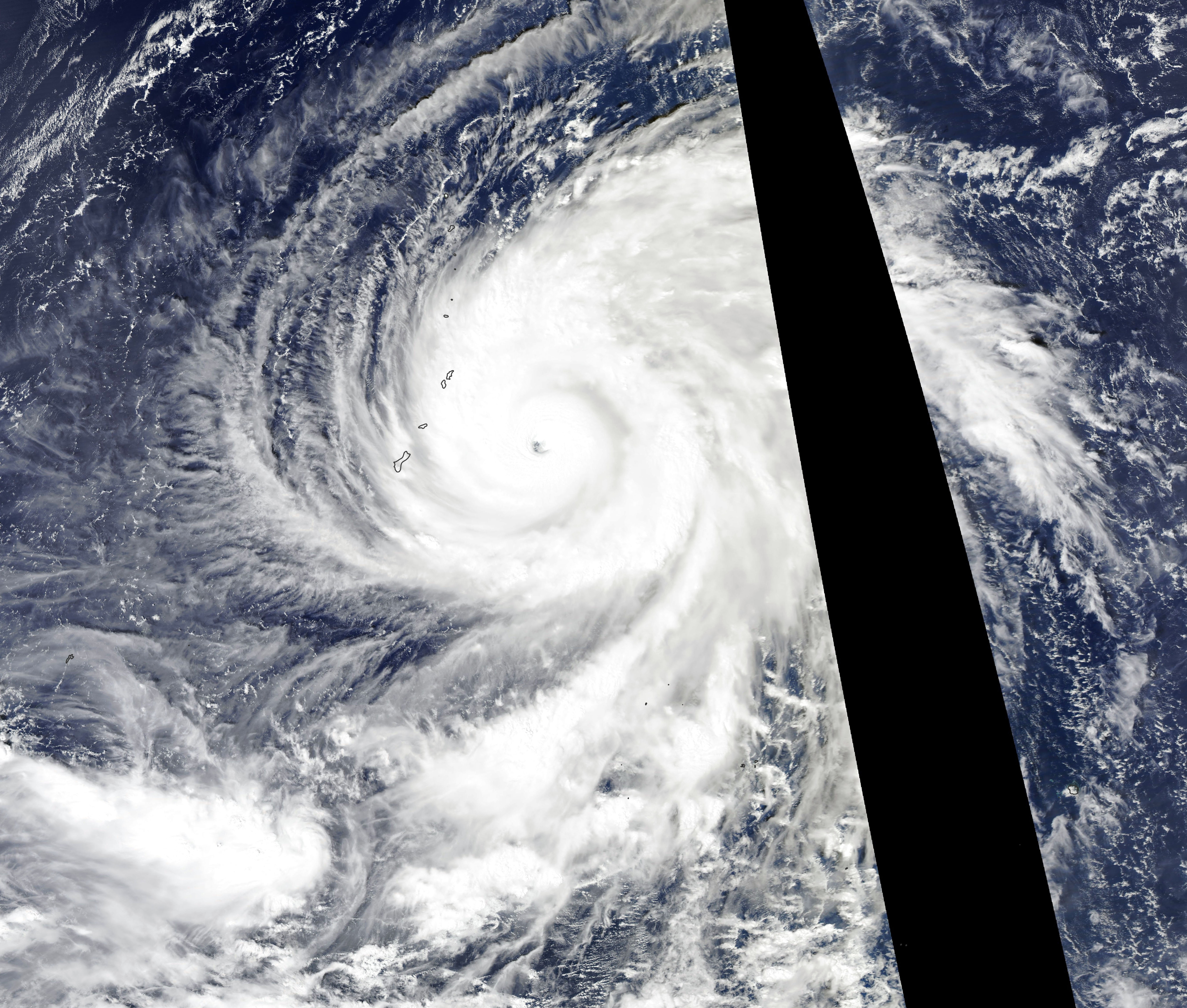
The natural-color image above was acquired in the early afternoon on October 24, 2018, by the Moderate Resolution Imaging Spectroradiometer (MODIS) on NASA’s Aqua satellite. Several hours later, the NOAA-20 polar-orbiting satellite acquired nighttime images of the storm around the time of landfall.
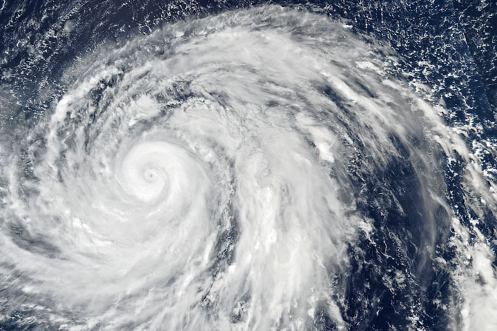
This animation shows the development of the storm’s wind field between October 21-24, 2018. The strongest winds appear red; lighter winds are white. Note the rapid intensification starting on October 23. The wind data comes from the Goddard Earth Observing System (GEOS) model, an experimental weather model that scientists at NASA use to analyze global weather phenomena. The GEOS model ingests wind data from more than 30 sources, including ships, buoys, radiosondes, dropsondes, aircraft, and satellites.
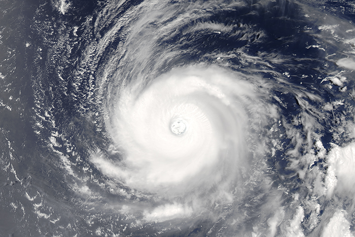
At 10 p.m. local time (12:00 Universal Time) on October 24, the U.S. Joint Typhoon Warning Center reported Yutu’s sustained wind speed was 155 knots (180 miles/255 kilometers per hour), with gusts to 190 knots. Typhoon-force winds extended out to 85 miles (140 kilometers) from the eye, with tropical storm-force winds stretching to 240 miles (390 kilometers). Maximum significant wave height in the open ocean was estimated at 52 feet (16 meters), and forecasters were concerned about signficant storm surges on the Northern Mariana islands.
In forecasts made just before Yutu made landfall, meteorologists predicted widespread areas of 4-8 inches (100-200 millimeters) of rain, with some areas seeing 10 inches (250 mm). Flooding and landslides were serious concerns, but the strongest warnings were related to the fierce winds. The U.S. National Weather Service office in Tiyan, Guam, declared: “Most homes will sustain severe damage, with potential for complete roof failure and wall collapse. Most industrial buildings will be destroyed.”
NASA Earth Observatory images by Joshua Stevens, using MODIS data from NASA EOSDIS/LANCE and GIBS/Worldview and GEOS-5 data from the Global Modeling and Assimilation Office at NASA GSFC. Story by Mike Carlowicz.