The Earth Observatory has published its last Image of the Day on this website. Please join us on our new home at science.nasa.gov/earth/earth-observatory.
On the night of December 10, 2021, a potent storm front brought tornadoes, intense thunderstorms, and bursts of straight-line wind to the Midwestern United States. Though tornadoes can occur in any time of year—with roughly a dozen every December—the event was rare for how long it lasted and how far north it occurred in meteorological winter.
With unseasonably warm and humid weather in place in the mid-section of the U.S. and a cool weather front approaching from the west, the National Weather Service (NWS) predicted early on December 10 that severe weather was imminent: “A few strong tornadoes, damaging gusts, and large hail are all expected beginning this evening across Arkansas and Missouri, with the greatest tornado threat close to the confluence of the Mississippi and Ohio Rivers.”
A few hours later, as many as 70 tornado-like events were reported across the Midwest, killing at least 100 people and injuring hundreds more in Arkansas, Kentucky, Illinois, and Missouri. Preliminary reports suggest it was the deadliest tornado event in the U.S. since a tornado hit Joplin, Missouri, in 2011.
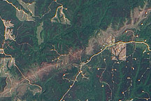
The worst damage came along what may be a historically long track for a tornadic storm that started in Arkansas and crossed through Missouri, Tennessee, and Kentucky for several hours. NWS reported winds ranging from 158 to 206 miles (254 to 332 kilometers) per hour, damage of at least an EF-3 rating on the Enhanced Fujita (EF) scale, and a ground track that may have blown across 200 miles (300 kilometers) and spanned 0.75 miles (1.2 kilometers) at its widest.
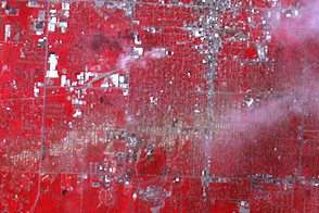
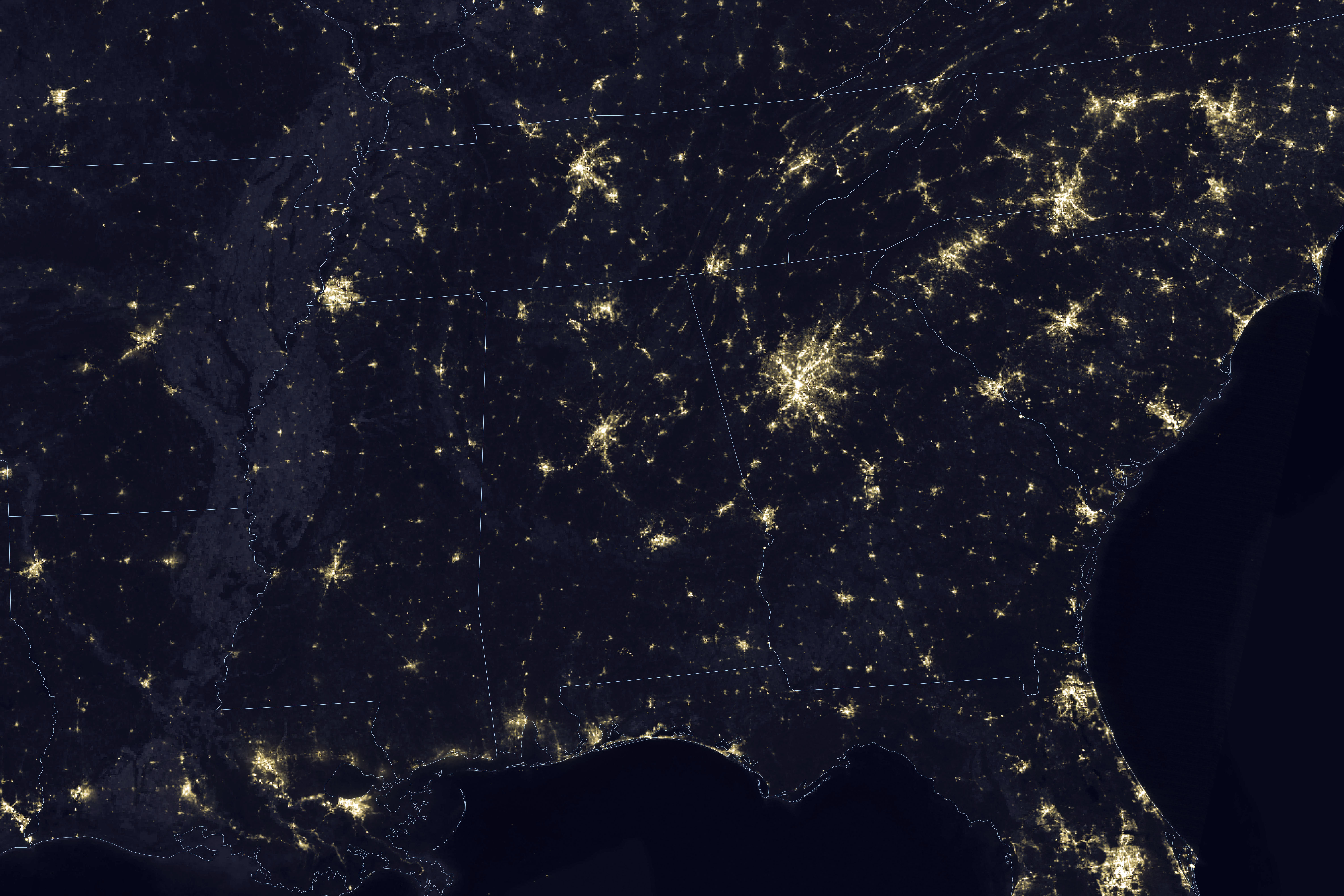
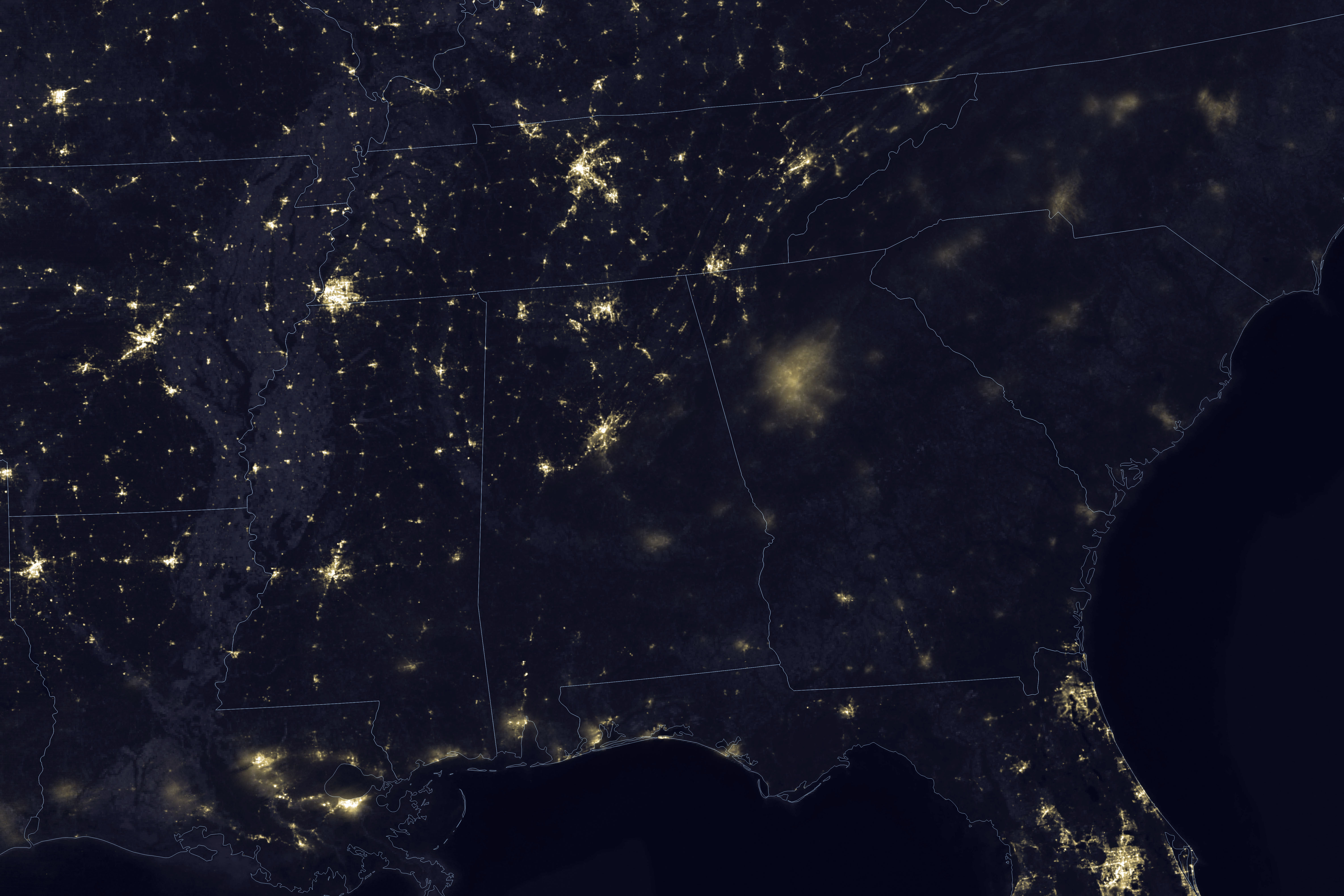
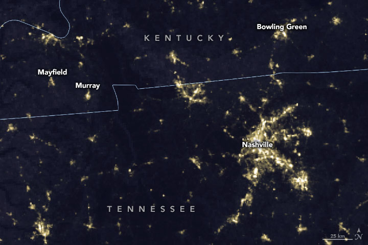
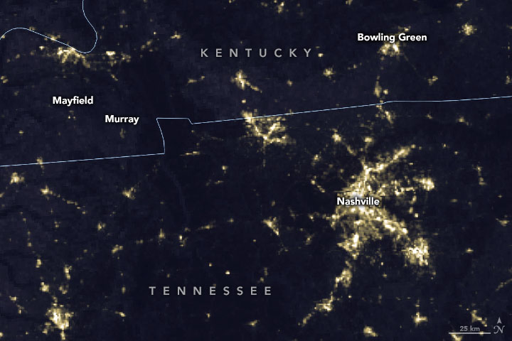
The images above were acquired on December 3 and December 12, 2021, with the day-night band (DNB) of the Visible Infrared Imaging Radiometer Suite (VIIRS) on the Suomi-NPP satellite. The image pair captures storm-induced power outages in areas around Mayfield, Murray, and Bowling Green, Kentucky. The DNB detects light in a range of wavelengths from green to near-infrared and uses filtering techniques to observe signals such electric lights in cities and towns.
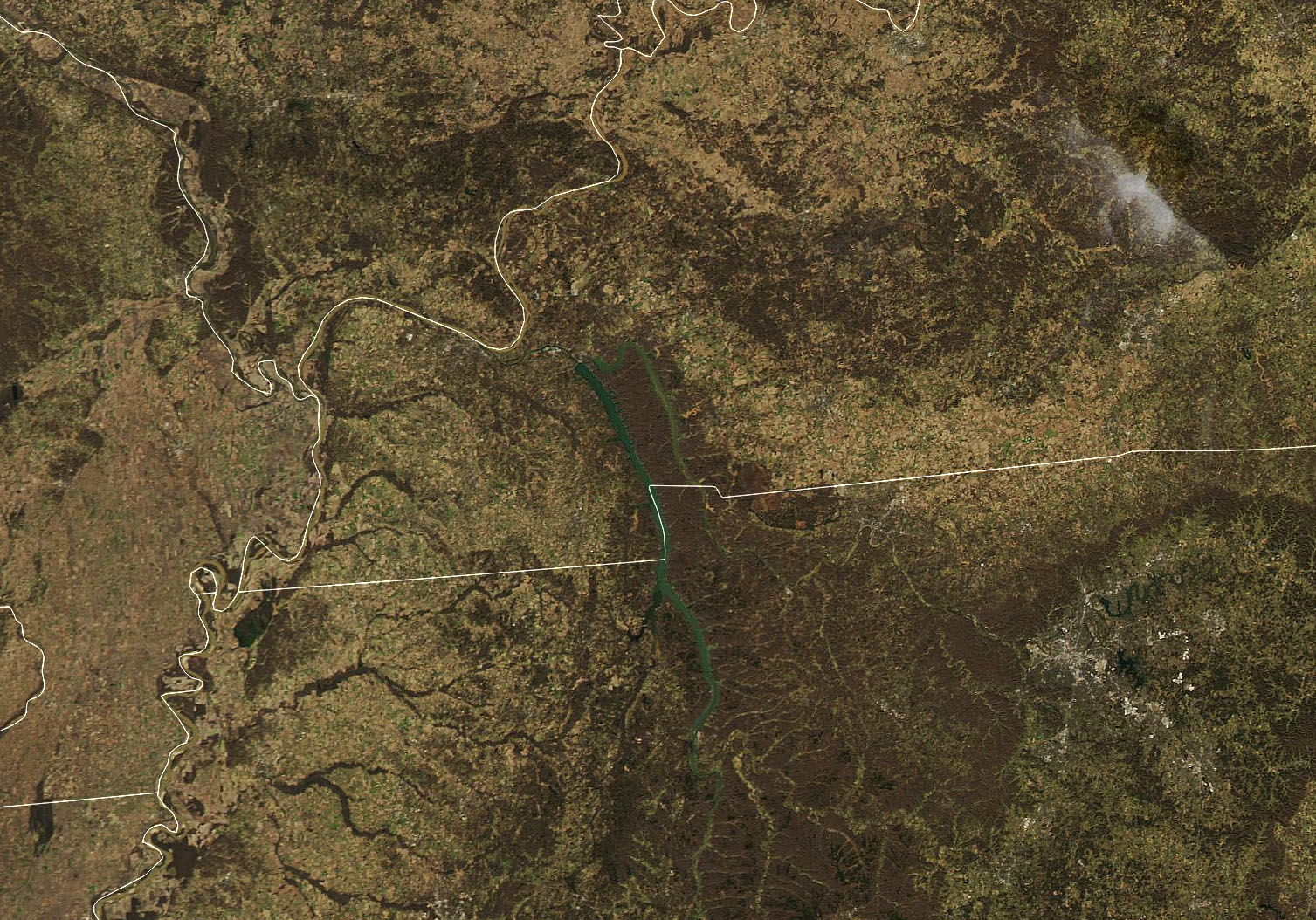
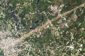
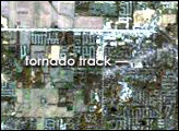
On December 12, 2021, the Moderate Resolution Imaging Spectroradiometer (MODIS) on NASA’s Aqua satellite acquired this natural-color image of the tornado track across western Kentucky near Mayfield. This area endured some of the worst damage of the fierce storm front.
According to meteorologist Bob Henson: “No U.S. tornado is known to have killed more than 80 people outside the core tornado season from March to June.” He added that until last weekend, the death toll for tornadoes in the U.S. in 2021 had been only 14, the third lowest since 1875.
Several researchers reported on social media that plumes from some of the supercell thunderstorms may breached the lower edge of the stratosphere. A NASA team has been working with satellite imagery—particularly GOES weather satellites—to find signatures of tornadoes and extreme thunderstorms in such lofty plumes.
In the most recent report from the Intergovernmental Panel on Climate Change, scientists drew an unequivocal link between human activity and global warming. The authors of that report noted that tropical cyclones, severe storms, and dust storms are expected to become more extreme in North and Central America as the world continues to warm.
NASA Earth Observatory images by Joshua Stevens, using VIIRS day-night band data from the Suomi National Polar-orbiting Partnership and MODIS data from NASA EOSDIS LANCE and GIBS/Worldview. Story by Michael Carlowicz.