The Earth Observatory has published its last Image of the Day on this website. Please join us on our new home at science.nasa.gov/earth/earth-observatory.
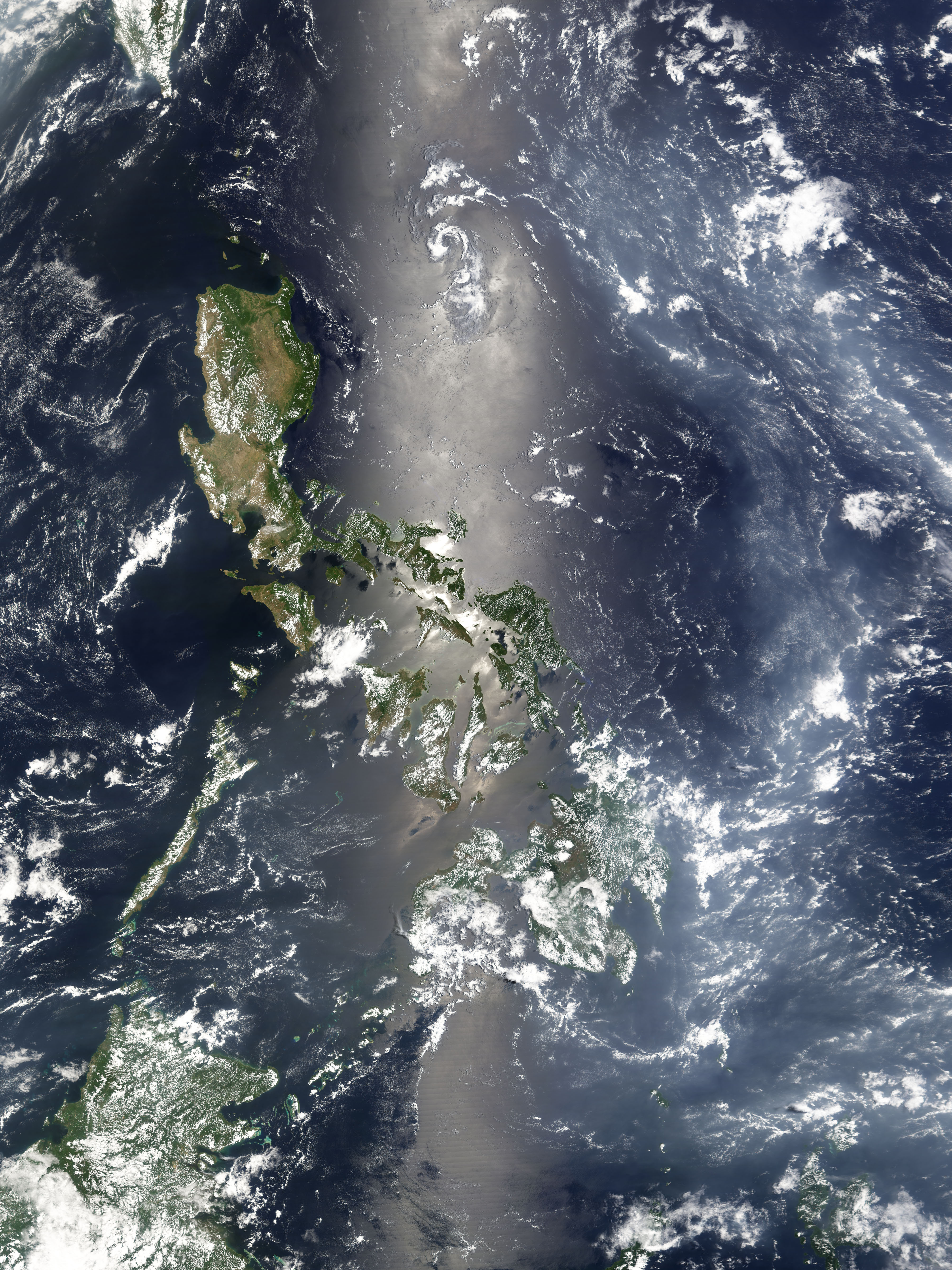
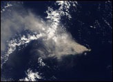
The Anatahan Volcano has extended its reach over 2,220 kilometers (1,380 miles) west to blanket the Philippine Sea with a river of white haze. The volcano erupted explosively on April 6, 2005, sending as much as 50 million cubic meters of ash into the atmosphere—its largest eruption in recorded history. The haze seen here is not a product of ash however; it is a soupy fog made from tiny drops of sulfuric acid suspended in the atmosphere. This volcanic fog, called “vog,” forms when sulfur dioxide emitted during the eruption combines with water molecules in the atmosphere to create sulfuric acid. It is not yet known how much sulfur dioxide exploded from Anatahan on April 6, or how much leaked from the volcano before and after that eruption, but the haze of sulfuric acid has now traveled to the Philippine Sea.
In addition to causing eye and respiratory irritation, vog can have a big impact on climate. As this image shows, the haze is bright and reflects sunlight back into space. This decreases the amount of energy that reaches the Earth’s surface, which lowers temperatures. Large volcanic eruptions such as Pinatubo in 1991, Krakatau in 1883, or Mt. Tambora in 1815 can send enough sulfur dioxide into the atmosphere to lower temperatures around the globe, and since the tiny acid droplets remain in the atmosphere for an extended period of time, the effect can last as long as a year or two.
This image of the vog over the Philippine Sea was acquired by the Moderate Resolution Imaging Spectroradiometer (MODIS) on NASA’s Terra satellite on April 20, 2005. A river of haze flows from the east in the lower right corner of the image, then snakes its way north over the water. The Philippines is immediately west of the haze, though Mindanao, the southern island of the country, appears to be covered with vog.
To the left of the haze, the sun is reflecting from the smooth surface of the ocean. The effect is a silvery mirror called sunglint that extends down a narrow strip of the image where the sun’s angle was just right to reflect light directly into the sensor. The large image provided above has a resolution of 500 meters per pixel.
NASA image created by Jesse Allen, Earth Observatory, using data obtained from the MODIS Rapid Response team.