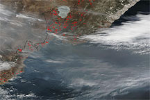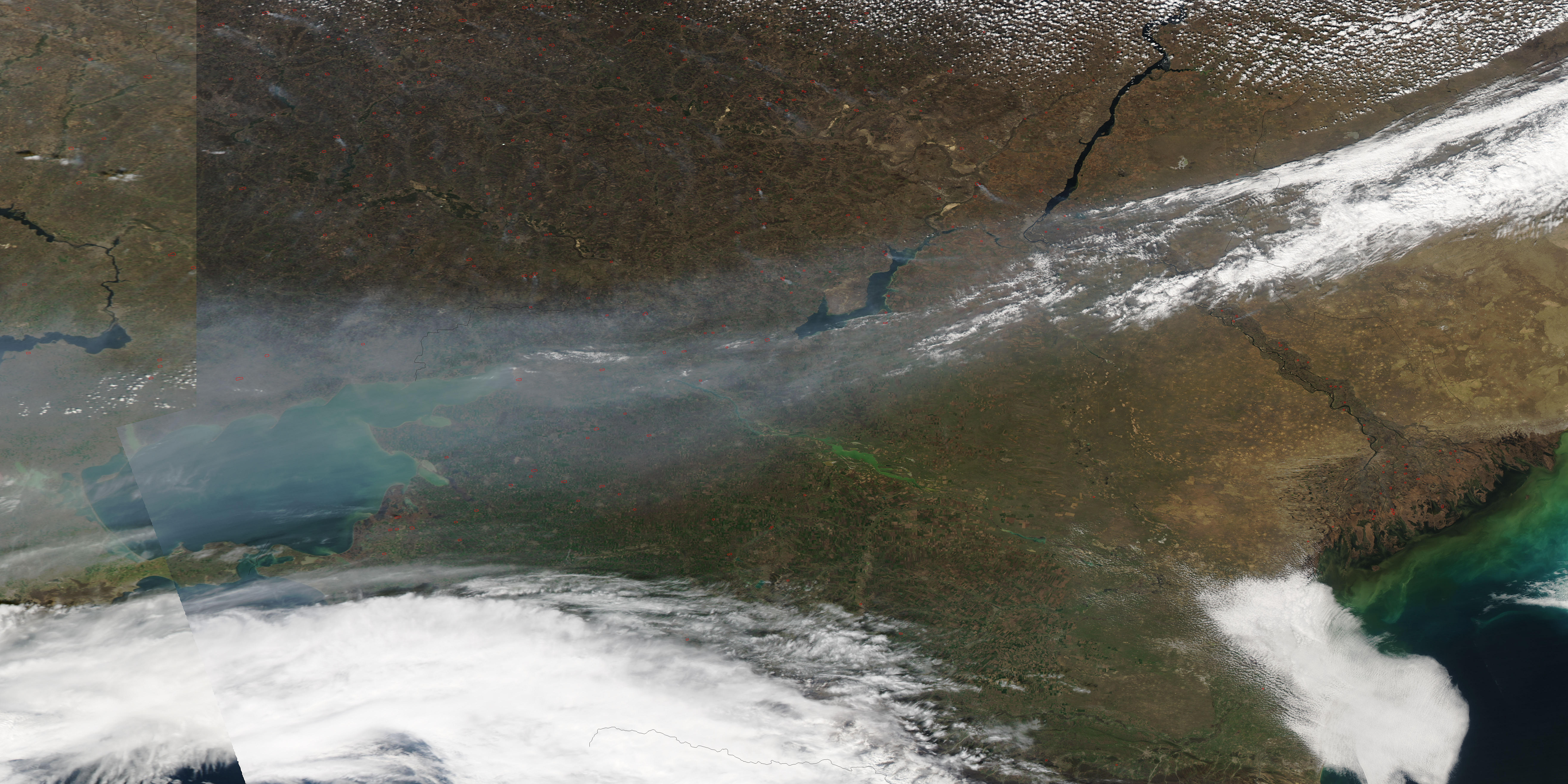
A narrow band of haze formed over the Sea of Azov on April 7, 2009. The Moderate Resolution Imaging Spectroradiometer (MODIS) on NASA’s Aqua satellite took this picture the same day. The haze appears especially thick over the Sea of Azov, and seems to thin toward the east. The thick-looking haze in the west, however, might result in part from that area’s location near the edge of the satellite swath, where the sensor had to look through a thicker layer (longer path) of atmosphere.
Throughout this image, red dots indicate hotspots where MODIS detected unusually warm surface temperatures, likely resulting from agricultural fires and/or wildfires. The fires likely contribute to the haze, and one example is a fire on the western shore of Tsimlyanskoye Vodokhranilishcho, which sends its smoke eastward. Given the broad distribution of the fires and the narrow band of haze, however, air currents probably play a role in channeling the haze into a fairly narrow east-west band.
NASA image courtesy MODIS Rapid Response Team, Goddard Space Flight Center. Caption by Michon Scott.
alert message