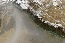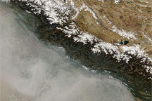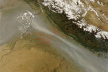

Haze hugged the Himalaya in late October 2008. The Moderate Resolution Imaging Spectroradiometer (MODIS) on NASA’s Terra satellite captured this image of the region on October 30, 2008. In this image, the haze obscures the satellite’s view of the ground surface along the southwestern face of the mountain range. An especially thick band of haze appears near the India-Pakistan border. A thick cluster of fires—indicated by red dots—occurs in the same area, although the band of haze passes over them.
The haze in this image probably results from a combination of agricultural fires and urban pollution. The pale beige color of the haze near the India-Pakistan border suggests that some of the haze might also result from dust blown into the region from the west.
NASA image courtesy MODIS Rapid Response, NASA Goddard Space Flight Center. Caption by Michon Scott.
Haze hugged the Himalaya in late October 2008. The haze probably resulted from a combination of agricultural fires and urban pollution, and may have contained some airborne dust.


